
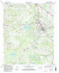
~ Crossville TN topo map, 1:24000 scale, 7.5 X 7.5 Minute, Historical, 1982, updated 1983
Crossville, Tennessee, USGS topographic map dated 1982.
Includes geographic coordinates (latitude and longitude). This topographic map is suitable for hiking, camping, and exploring, or framing it as a wall map.
Printed on-demand using high resolution imagery, on heavy weight and acid free paper, or alternatively on a variety of synthetic materials.
Topos available on paper, Waterproof, Poly, or Tyvek. Usually shipping rolled, unless combined with other folded maps in one order.
- Product Number: USGS-5333702
- Free digital map download (high-resolution, GeoPDF): Crossville, Tennessee (file size: 11 MB)
- Map Size: please refer to the dimensions of the GeoPDF map above
- Weight (paper map): ca. 55 grams
- Map Type: POD USGS Topographic Map
- Map Series: HTMC
- Map Verison: Historical
- Cell ID: 10839
- Scan ID: 149644
- Imprint Year: 1983
- Woodland Tint: Yes
- Visual Version Number: 2
- Aerial Photo Year: 1979
- Edit Year: 1982
- Field Check Year: 1980
- Datum: NAD27
- Map Projection: Polyconic
- Map published by Tennessee Valley Authority
- Map Language: English
- Scanner Resolution: 600 dpi
- Map Cell Name: Crossville
- Grid size: 7.5 X 7.5 Minute
- Date on map: 1982
- Map Scale: 1:24000
- Geographical region: Tennessee, United States
Neighboring Maps:
All neighboring USGS topo maps are available for sale online at a variety of scales.
Spatial coverage:
Topo map Crossville, Tennessee, covers the geographical area associated the following places:
- Sunset Terrace - Heritage Estates - Sherwood Farm - Shiloh - Oaklyn - Lantana - Parkway Estates - Storie - Hide-A-Way Hills - Crossville Estates - Volunteer Heights - Wild Plum - Livesay - Dunrovin Estates - Middle Brook Place - Lynwood Acres - Hiawatha Subdivision - Crossville - Greenbriar Village - Sparta Heights - Legget (historical) - Comanche Subdivision - Lake Genesis Country - Meadowview - Obed River Estates - Dykes Crossroads - Howard Springs - Mitchel Heights - Harrison Addition - Maplewood Estates - Cumberland Heights - Holiday Hills - Port Haven - Lake Tansi Village - Woodlawn - Jan Mor Acres - Shangrala - Timberland Estates - Pomona - Phillps Subdivision - South Hills - Foxfire - Lanatana Estates - Glendale - Woodstock Estates - Rolling Hills - Grassland Addition - Fairyland - Hillcrest - Baker Crossroads - Camelot - Hale - Parkview - Brookhaven - Oak Hill - Town Branch Estates
- Map Area ID: AREA3635.875-85.125-85
- Northwest corner Lat/Long code: USGSNW36-85.125
- Northeast corner Lat/Long code: USGSNE36-85
- Southwest corner Lat/Long code: USGSSW35.875-85.125
- Southeast corner Lat/Long code: USGSSE35.875-85
- Northern map edge Latitude: 36
- Southern map edge Latitude: 35.875
- Western map edge Longitude: -85.125
- Eastern map edge Longitude: -85


