
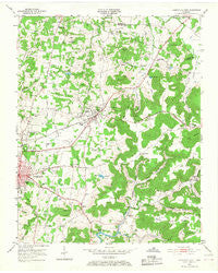
~ Cookeville East TN topo map, 1:24000 scale, 7.5 X 7.5 Minute, Historical, 1953, updated 1968
Cookeville East, Tennessee, USGS topographic map dated 1953.
Includes geographic coordinates (latitude and longitude). This topographic map is suitable for hiking, camping, and exploring, or framing it as a wall map.
Printed on-demand using high resolution imagery, on heavy weight and acid free paper, or alternatively on a variety of synthetic materials.
Topos available on paper, Waterproof, Poly, or Tyvek. Usually shipping rolled, unless combined with other folded maps in one order.
- Product Number: USGS-5333624
- Free digital map download (high-resolution, GeoPDF): Cookeville East, Tennessee (file size: 11 MB)
- Map Size: please refer to the dimensions of the GeoPDF map above
- Weight (paper map): ca. 55 grams
- Map Type: POD USGS Topographic Map
- Map Series: HTMC
- Map Verison: Historical
- Cell ID: 9943
- Scan ID: 149605
- Imprint Year: 1968
- Woodland Tint: Yes
- Aerial Photo Year: 1950
- Field Check Year: 1953
- Datum: NAD27
- Map Projection: Polyconic
- Map published by United States Geological Survey
- Map Language: English
- Scanner Resolution: 600 dpi
- Map Cell Name: Cookeville East
- Grid size: 7.5 X 7.5 Minute
- Date on map: 1953
- Map Scale: 1:24000
- Geographical region: Tennessee, United States
Neighboring Maps:
All neighboring USGS topo maps are available for sale online at a variety of scales.
Spatial coverage:
Topo map Cookeville East, Tennessee, covers the geographical area associated the following places:
- Bilbrey Park - Poplar Grove - Selby (historical) - Jeremiah - Country Club Estates - Countryside Estates - Terry Subdivision - Post Oak Estates - Rocky Point - Brotherton - Eastwood - White Plains - Parragon - Darwin Park - Mountain Meadows - Netherlands (historical) - Indian Hills - Ridgecrest - Briargate - Laurel Park - Buck Lake Estates - Village Green - Shennon Village - Lake Valley - Marchbanks (historical) - Capshaw Woods - Post Oak - Park Village - Poinsettia Subdivision - Winona - Pleasant View - Grandview - Garmar Subdivision - Oak Park Estates - Burton Estates - Candyland Estates - Shenandoah Estates - Bangham - Algood - Deberry Subdivision - Suntree Subdivision - Oaklawn - Poplar Estates - The Lowlands - Beverly Hills - Buck Mountain Estates - Ridgewood Estates
- Map Area ID: AREA36.2536.125-85.5-85.375
- Northwest corner Lat/Long code: USGSNW36.25-85.5
- Northeast corner Lat/Long code: USGSNE36.25-85.375
- Southwest corner Lat/Long code: USGSSW36.125-85.5
- Southeast corner Lat/Long code: USGSSE36.125-85.375
- Northern map edge Latitude: 36.25
- Southern map edge Latitude: 36.125
- Western map edge Longitude: -85.5
- Eastern map edge Longitude: -85.375


