
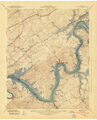
~ Concord TN topo map, 1:24000 scale, 7.5 X 7.5 Minute, Historical, 1940
Concord, Tennessee, USGS topographic map dated 1940.
Includes geographic coordinates (latitude and longitude). This topographic map is suitable for hiking, camping, and exploring, or framing it as a wall map.
Printed on-demand using high resolution imagery, on heavy weight and acid free paper, or alternatively on a variety of synthetic materials.
Topos available on paper, Waterproof, Poly, or Tyvek. Usually shipping rolled, unless combined with other folded maps in one order.
- Product Number: USGS-5333604
- Free digital map download (high-resolution, GeoPDF): Concord, Tennessee (file size: 13 MB)
- Map Size: please refer to the dimensions of the GeoPDF map above
- Weight (paper map): ca. 55 grams
- Map Type: POD USGS Topographic Map
- Map Series: HTMC
- Map Verison: Historical
- Cell ID: 9818
- Scan ID: 149595
- Field Check Year: 1940
- Datum: NAD27
- Map Projection: Polyconic
- Map published by Tennessee Valley Authority
- Map Language: English
- Scanner Resolution: 600 dpi
- Map Cell Name: Concord
- Grid size: 7.5 X 7.5 Minute
- Date on map: 1940
- Map Scale: 1:24000
- Geographical region: Tennessee, United States
Neighboring Maps:
All neighboring USGS topo maps are available for sale online at a variety of scales.
Spatial coverage:
Topo map Concord, Tennessee, covers the geographical area associated the following places:
- Boyd - Busselltown - Virtue - Hardin Estates - Choto Estates - Martel - Belle-Aire - Ford - Coulter Shoals - Rio Vista - Cedar Hills - Fort Loudon Estates - Dixie Lee Junction - Choto Hills - Scenic Point Estates - Shady Grove - Point Harbor - Forest Heights - Sequoyah Heights - Gravelly Hills - Fox Den - Audubon Hills - Concords Woods - Waterhaven - Highland Hills - Disco - Watershaw - Cusick - Concord - Friendsville - Martel Estates - Kingsgate - Antioch - Martel Estates East
- Map Area ID: AREA35.87535.75-84.25-84.125
- Northwest corner Lat/Long code: USGSNW35.875-84.25
- Northeast corner Lat/Long code: USGSNE35.875-84.125
- Southwest corner Lat/Long code: USGSSW35.75-84.25
- Southeast corner Lat/Long code: USGSSE35.75-84.125
- Northern map edge Latitude: 35.875
- Southern map edge Latitude: 35.75
- Western map edge Longitude: -84.25
- Eastern map edge Longitude: -84.125


