
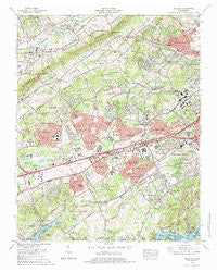
~ Bearden TN topo map, 1:24000 scale, 7.5 X 7.5 Minute, Historical, 1978, updated 1979
Bearden, Tennessee, USGS topographic map dated 1978.
Includes geographic coordinates (latitude and longitude). This topographic map is suitable for hiking, camping, and exploring, or framing it as a wall map.
Printed on-demand using high resolution imagery, on heavy weight and acid free paper, or alternatively on a variety of synthetic materials.
Topos available on paper, Waterproof, Poly, or Tyvek. Usually shipping rolled, unless combined with other folded maps in one order.
- Product Number: USGS-5332544
- Free digital map download (high-resolution, GeoPDF): Bearden, Tennessee (file size: 15 MB)
- Map Size: please refer to the dimensions of the GeoPDF map above
- Weight (paper map): ca. 55 grams
- Map Type: POD USGS Topographic Map
- Map Series: HTMC
- Map Verison: Historical
- Cell ID: 2861
- Scan ID: 143704
- Imprint Year: 1979
- Woodland Tint: Yes
- Visual Version Number: 2
- Aerial Photo Year: 1975
- Edit Year: 1978
- Datum: NAD27
- Map Projection: Polyconic
- Map published by United States Geological Survey
- Map Language: English
- Scanner Resolution: 600 dpi
- Map Cell Name: Bearden
- Grid size: 7.5 X 7.5 Minute
- Date on map: 1978
- Map Scale: 1:24000
- Geographical region: Tennessee, United States
Neighboring Maps:
All neighboring USGS topo maps are available for sale online at a variety of scales.
Spatial coverage:
Topo map Bearden, Tennessee, covers the geographical area associated the following places:
- Kingston Woods - Rennbore - Westlyn - Imperial Estates - Golden Meadows - Country Estates Mobile Home Park - Tan Rara Oesta - Oxmore Hills - West Forest - Meadowbrook - Cumberland Estates - Wooded Acres - Montvue - Wedgewood Hills - Westavia Woods - Karns - Bonneville Estates - Greenwood Heights - Westmoreland Heights - Cedar Springs - Pine Springs - Canby Hills - Amherst - Tekoa - Holiday Hills - Northshore Woods - Westborough - Glen Arden - Trails End - Kensington - Crestwood Hills - Eagles Landing Mobile Home Park - Green Valley - Belmont West - Middlebrook Acres - Oak Grove Heights - Hidden Hills - Stonebrook - Rocky Hill - Aldenwood Park - Hickory Hills - Berkshire Wood - Byington - Suburban Hills - Bearden - Fox Fire - Rothwood - Sevenoaks - Camelot - Galewood - Cedar Bluff - Piney Grove Mobile Home Park - Heather Heights - Brentwood - Trails West - Deane Hill - Edington (historical) - Hunting Hills West - Concord Trailer Park - Kingston Hills - Pleasant Ridge - Karns Mobile Home Kort - West Knoxville Mobile Park - West Emory - Echo Valley - Hidden Valley - Countryside - Ball Camp - Kinkaid (historical) - Gulfwood - King Arthur Court - Farrington - Timbercrest - Ebenezer - Landmark - Pleasant Hills - West Hills - Gulf Park - Ridgedale - Spanish Trails - Ashley Oaks - Fair Oaks - Windsor Park - Ten Mile - Third Creek - Woodland Acres
- Map Area ID: AREA3635.875-84.125-84
- Northwest corner Lat/Long code: USGSNW36-84.125
- Northeast corner Lat/Long code: USGSNE36-84
- Southwest corner Lat/Long code: USGSSW35.875-84.125
- Southeast corner Lat/Long code: USGSSE35.875-84
- Northern map edge Latitude: 36
- Southern map edge Latitude: 35.875
- Western map edge Longitude: -84.125
- Eastern map edge Longitude: -84


