
~ Bacon Gap TN topo map, 1:24000 scale, 7.5 X 7.5 Minute, Historical, 1968, updated 1981
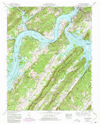
Bacon Gap, Tennessee, USGS topographic map dated 1968.
Includes geographic coordinates (latitude and longitude). This topographic map is suitable for hiking, camping, and exploring, or framing it as a wall map.
Printed on-demand using high resolution imagery, on heavy weight and acid free paper, or alternatively on a variety of synthetic materials.
Topos available on paper, Waterproof, Poly, or Tyvek. Usually shipping rolled, unless combined with other folded maps in one order.
- Product Number: USGS-5332458
- Free digital map download (high-resolution, GeoPDF): Bacon Gap, Tennessee (file size: 15 MB)
- Map Size: please refer to the dimensions of the GeoPDF map above
- Weight (paper map): ca. 55 grams
- Map Type: POD USGS Topographic Map
- Map Series: HTMC
- Map Verison: Historical
- Cell ID: 2058
- Scan ID: 143652
- Imprint Year: 1981
- Woodland Tint: Yes
- Visual Version Number: 1
- Photo Revision Year: 1980
- Aerial Photo Year: 1976
- Edit Year: 1980
- Datum: NAD27
- Map Projection: Polyconic
- Map published by Tennessee Valley Authority
- Map Language: English
- Scanner Resolution: 600 dpi
- Map Cell Name: Bacon Gap
- Grid size: 7.5 X 7.5 Minute
- Date on map: 1968
- Map Scale: 1:24000
- Geographical region: Tennessee, United States
Neighboring Maps:
All neighboring USGS topo maps are available for sale online at a variety of scales.
Spatial coverage:
Topo map Bacon Gap, Tennessee, covers the geographical area associated the following places:
- Stowe Station - Westshore Estates - Lake Shadow - Montcrest - Brown Ellis - Iron Divide (historical) - Midway - Sequoyah Shores - Green Acres - Circle M - Cherokee Hills - Fairview Acres - Suburban Shores - Lakeharbor - Lakeview - Barnardsville - Fairview - Laurel Bluff - Holiday Hills - Chapman Grove - Ponders - Crestwood - Idle Oaks - Anglers Cove
- Map Area ID: AREA35.87535.75-84.625-84.5
- Northwest corner Lat/Long code: USGSNW35.875-84.625
- Northeast corner Lat/Long code: USGSNE35.875-84.5
- Southwest corner Lat/Long code: USGSSW35.75-84.625
- Southeast corner Lat/Long code: USGSSE35.75-84.5
- Northern map edge Latitude: 35.875
- Southern map edge Latitude: 35.75
- Western map edge Longitude: -84.625
- Eastern map edge Longitude: -84.5


