
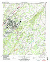
~ Athens TN topo map, 1:24000 scale, 7.5 X 7.5 Minute, Historical, 1964, updated 1996
Athens, Tennessee, USGS topographic map dated 1964.
Includes geographic coordinates (latitude and longitude). This topographic map is suitable for hiking, camping, and exploring, or framing it as a wall map.
Printed on-demand using high resolution imagery, on heavy weight and acid free paper, or alternatively on a variety of synthetic materials.
Topos available on paper, Waterproof, Poly, or Tyvek. Usually shipping rolled, unless combined with other folded maps in one order.
- Product Number: USGS-5332380
- Free digital map download (high-resolution, GeoPDF): Athens, Tennessee (file size: 12 MB)
- Map Size: please refer to the dimensions of the GeoPDF map above
- Weight (paper map): ca. 55 grams
- Map Type: POD USGS Topographic Map
- Map Series: HTMC
- Map Verison: Historical
- Cell ID: 1748
- Scan ID: 143609
- Imprint Year: 1996
- Woodland Tint: Yes
- Photo Inspection Year: 1990
- Aerial Photo Year: 1990
- Edit Year: 1991
- Field Check Year: 1964
- Datum: NAD27
- Map Projection: Universal Transverse Mercator
- Map published by Tennessee Valley Authority
- Map Language: English
- Scanner Resolution: 600 dpi
- Map Cell Name: Athens
- Grid size: 7.5 X 7.5 Minute
- Date on map: 1964
- Map Scale: 1:24000
- Geographical region: Tennessee, United States
Neighboring Maps:
All neighboring USGS topo maps are available for sale online at a variety of scales.
Spatial coverage:
Topo map Athens, Tennessee, covers the geographical area associated the following places:
- Ridgeway - Mashburn - Knox Park - Athens - Addison - Mount Cumberland - Sunset View - Morningside - Hutsell - Housley Addition - Avalon Heights - Alta Vista - Westwood Heights - Mount Verd - Bethsalem - Zion Hill - Cedar Springs - Tellico Hills - Forrest Hills - Bryson - Bohannon Addition - Ingleside Hill - Clem Jones Heights - North Liberty - Lockmiller Addition - Brewer Addition - Fairview - Heritage Park
- Map Area ID: AREA35.535.375-84.625-84.5
- Northwest corner Lat/Long code: USGSNW35.5-84.625
- Northeast corner Lat/Long code: USGSNE35.5-84.5
- Southwest corner Lat/Long code: USGSSW35.375-84.625
- Southeast corner Lat/Long code: USGSSE35.375-84.5
- Northern map edge Latitude: 35.5
- Southern map edge Latitude: 35.375
- Western map edge Longitude: -84.625
- Eastern map edge Longitude: -84.5


