
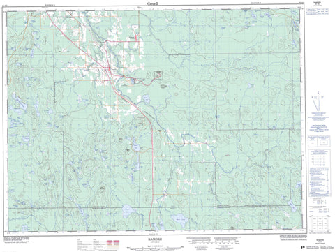
042A08 Ramore Canada topo map, 1:50,000 scale
042A08 Ramore NRCAN topographic map.
Includes UTM and GPS geographic coordinates (latitude and longitude). This 50k scale map is suitable for hiking, camping, and exploring, or you could frame it as a wall map.
Printed on-demand using high resolution, on heavy weight and acid free paper, or as an upgrade on a variety of synthetic materials.
Topos available on paper, Waterproof, Poly, or Tyvek. Usually shipping rolled, unless combined with other folded maps in one order.
- Product Number: NRCAN-042A08
- Parent Topo: TOPO-042A
- Map ID also known as: 042A08, 42A8, 42A08
- Unfolded Size: Approximately 26" high by 36" wide
- Weight (paper map): ca. 55 grams
- Map Type: POD NRCAN Topographic Map
- Map Scale: 1:50,000
- Geographical region: Ontario, Canada
Neighboring Maps:
All neighboring Canadian topo maps are available for sale online at 1:50,000 scale.
Purchase the smaller scale map covering this area: Topo-042A
Spatial coverage:
Topo map sheet 042A08 Ramore covers the following places:
- High Falls - Barnet - Benoit - Bernhardt - Bisley - Black - Bowman - Cochrane - Cook - Garrison - Guibord - Hislop - Lee - Maisonville - McCann - Melba - Michaud - Morrisette - Playfair - Terry - Thackeray - Timiskaming - Tolstoi - Andrew Lake - Arras Lake - Arthur Lake - Barnet Lake - Beaucoup Lakes - Benoit Lake - Berndt Lake - Big Finlander Lake - Binch Lake - Boisvert Lake - Bolton Lake - Borgford Lake - Bougie Lake - Burl Lakes - Butler Lake - Cariad Lake - Carlson Lake - Cauley Lake - Chatson Lake - Cherry Lake - Chummy Lake - Clermont Lake - Colvin Lake - Crescent Lake - De Courcey Lake - Dell Lake - Demarco Lake - Devereaux Lake - Dewar Lake - Dewhirst Lake - Dogue Lake - Douglas Lake - Duxfield Lake - Eade Lake - Emens Lake - Emms Lake - Errett Lake - Ferguson Lake - Fitter Lake - Foy Lake - Francesca Lake - Froude Lake - Gegear Lake - Gervais Lake - Girard Lake - Greenland Lake - Grenier Lake - Grove Lake - Halfway Lake - Hattatt Lake - Henrick Lake - Heslip Lake - Hewitt Lake - Hornby Lake - Ivan Lake - Jenner Lake - Kellett Lake - Kitchen Lake - Knight Lake - Lalonde Lake - Larrett Lake - Lauramay Lake - Lavallee Lake - Leece Lake - Legault Lake - Little Finlander Lake - Little Twin Lakes - Little Wright Lake - Lower Crescent Lake - Lower Hewitt Lake - Lower Twin Lake - Ludgate Lake - Malloch Lake - McGarry Lake - McMillan Lake - McVittie Lake - Melville Lake - Meyers Lake - Minson Lake - Mobbs Lake - Mooreland Lake - Neelands Lake - Nicolson Lake - Oslund Lake - Pike Lake - Pike Lake - Poe Lake - Pothole Lakes - Purdy Lake - Rawson Lake - Ray Lake - Renecker Lake - Rocks Lake - Rouleau Lake - Sabourin Lake - Scanlon Lake - Schell Lake - Schiller Lake - Shuker Lake - Sunstrum Lake - Talbock Lake - Terry Lake - Todhunter Lake - Tolstoi Lake - Tomwool Lake - Turkey Lake - Turner Lake - Turtle Lake - Upper Twin Lake - Verona Lake - Victor Lake - Wagg Lake - Warrell Lake - Wasnick Lake - West Lawlar Lake - Westaway Lake - Wildgoose Lake - Wolf Lake - Wright Lake - Youdell Lake - Blue Mountain - Defiance Peak - Gipsy Mountain - Guibord Hill - Lavaflow Mountain - Mount Kempis - Mount Stringer - Black River-Matheson - Kingham - Playfair - Wildgoose Outwash Deposit Provincial Park - Barnet Creek - Benoit Creek - Black River - Cochenour Creek - Emens Creek - Kellett Creek - Little Black River - Little Pike River - Little Wildgoose Creek - Malloch Creek - McVittie Creek - Melba Creek - Pike River - Sarsfield Creek - Tolstoi Creek - Tomwool Creek - Whiteclay River - Wildgoose Creek - Wolf Creek - Woollings Creek - Kirkland Lake - Bourkes - Holtyre - Ramore - Vimy Ridge - Wavell


