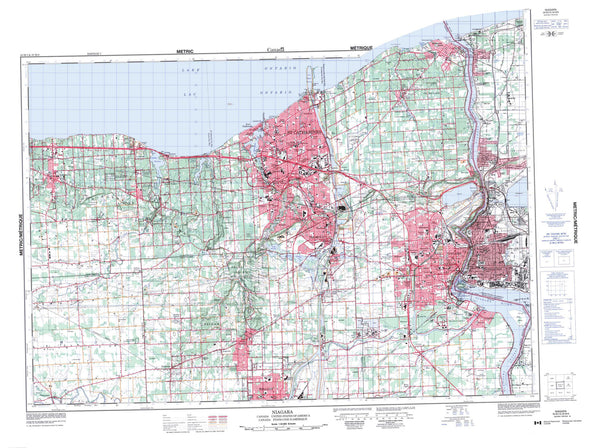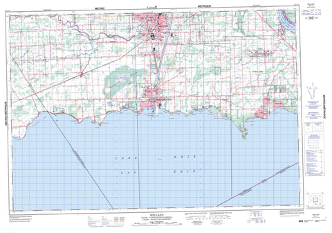
030L14 Welland Canada topo map, 1:50,000 scale
030L14 Welland NRCAN topographic map.
Includes UTM and GPS geographic coordinates (latitude and longitude). This 50k scale map is suitable for hiking, camping, and exploring, or you could frame it as a wall map.
Printed on-demand using high resolution, on heavy weight and acid free paper, or as an upgrade on a variety of synthetic materials.
Topos available on paper, Waterproof, Poly, or Tyvek. Usually shipping rolled, unless combined with other folded maps in one order.
- Product Number: NRCAN-030L14
- Parent Topo: TOPO-030L
- Map ID also known as: 030L14, 30L14
- Unfolded Size: Approximately 26" high by 36" wide
- Weight (paper map): ca. 55 grams
- Map Type: POD NRCAN Topographic Map
- Map Scale: 1:50,000
- Geographical region: Ontario, Canada
Neighboring Maps:
All neighboring Canadian topo maps are available for sale online at 1:50,000 scale.
Purchase the smaller scale map covering this area: Topo-030L
Spatial coverage:
Topo map sheet 030L14 Welland covers the following places:
- Abino Bay - Cedar Bay - Gravel Bay - Gravelly Bay - Lorraine Bay - Mohawk Bay - Moulton Bay - Reebs Bay - Silver Bay - Sunset Bay - Thunder Bay - Willow Bay - Bay Beach - Empire Beach - Nickel Beach - Pleasant Beach - Sherkston Beaches - Beard Point - Cassaday Point - Grabell Point - Mohawk Point - Morgans Point - Near Point - Niagara Peninsula - Pine Crest Point - Point Abino - Ramey's Bend - Rathfon Point - Shisler Point - Sugar Loaf Point - West Point - Whitemans Point - Windmill Point - Haldimand - Haldimand County - Nanticoke - Port Colborne - Welland - Bertie - Crowland - Gainsborough - Humberstone - Lincoln - Moulton - Pelham - Sherbrooke - Wainfleet - Welland - Willoughby - East Kelly Drain - Ellsworth Drain - North Forks Drain - South Forks Drain - West Kelly Drain - Wolfe Creek Drain - Rock Island - The Island - Biederman Pond - Lac Érié - Lake Erie - Quarry Ponds - The Clay Pits - Canal Welland - New Welland Canal - Welland Canal - Welland Ship Canal - Abino Hills - Sugarloaf Hill - The Sugar Loaf - Haldimand-Norfolk - Lincoln - Niagara - Welland - Canborough - Crowland - Dunn - Humberstone - Humberstone - Moulton - North Cayuga - Oneida - Rainham - Seneca - Sherbrooke - South Cayuga - Thorold - Thorold - Wainfleet - Walpole - West Lincoln - Battle of Cook's Mills National Historic Site of Canada - Lieu historique national du Canada de la Bataille-de-Cook's Mills - Lieu historique national du Canada du Champ-de-Bataille-de-Ridgeway - Ridgeway Battlefield National Historic Site of Canada - Wainfleet Bog Conservation Reserve - Ontario - Baker Creek - Bayers Creek - Beaver Creek - Black Creek - Boyer's Creek - Bridgewater Creek - Chippawa Channel - Forks Creek - Frenchman Creek - Frenchman's Creek - Hoover Creek - Indian Creek - Indian Creek - Little Forks Creek - Lyons Creek - Mill Race Creek - Niagara River - North Forks Creek - Rivière Niagara - Rivière Welland - South Forks Creek - Tea Creek - Tee Creek - Usshers Creek - Welland River - Big Forks Creek - Cassaday Reef - Port Maitland Bank - Dunnville - Haldimand - Bay Beach - Bay Beach Park - Becketts Bridge - Belleview Beach - Bethel - Black Creek - Brookfield - Burnaby - Camelot Beach - Cedar Bay - Chambers Corners - Cooks Mills - Coyle - Crowland - Crystal Beach - Dain City - Dainsville - Douglastown - Elco Beach - Feeder - Forks Road - Gasline - Hewitt - Humberstone - Long Beach - Lorraine - Lowbanks - Maple Park - Marshville - Montague - Morgans Point - Mulgrave - Netherby - Oakhill Forest - O'Reilly's Bridge - Ostryhon Corners - Perry - Pine Crest Point - Pleasant Beach - Point Abino - Point Abino - Ridgemount - Ridgeway - Ridgewood - River Bend - Robbins - Sherks - Sherkston - Shisler Point - Silver Bay - Silver Bay Park - Snyder - South Pelham - Stevensville - Thunder Bay - Wainfleet - Wainfleet - Wavecrest - Welland Junction - Welland South - Wildwood - Willow Bay - Windmill Point - Windmill Point - Winger - Humberstone Marsh - McCallum Swamp - Wainfleet Marsh