
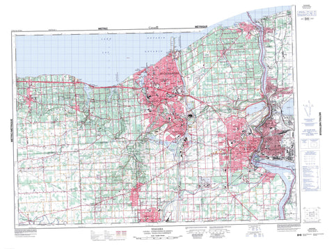
030M03 Niagara Canada topo map, 1:50,000 scale
030M03 Niagara NRCAN topographic map.
Includes UTM and GPS geographic coordinates (latitude and longitude). This 50k scale map is suitable for hiking, camping, and exploring, or you could frame it as a wall map.
Printed on-demand using high resolution, on heavy weight and acid free paper, or as an upgrade on a variety of synthetic materials.
Topos available on paper, Waterproof, Poly, or Tyvek. Usually shipping rolled, unless combined with other folded maps in one order.
- Product Number: NRCAN-030M03
- Parent Topo: TOPO-030M
- Map ID also known as: 030M03, 30M3, 30M03
- Unfolded Size: Approximately 26" high by 36" wide
- Weight (paper map): ca. 55 grams
- Map Type: POD NRCAN Topographic Map
- Map Scale: 1:50,000
- Geographical region: Ontario, Canada
Neighboring Maps:
All neighboring Canadian topo maps are available for sale online at 1:50,000 scale.
Purchase the smaller scale map covering this area: Topo-030M
Spatial coverage:
Topo map sheet 030M03 Niagara covers the following places:
- Jordan Harbour - Port Weller Harbour - Michigan Beach - Mississauga Beach - Municipal Beach - Port Weller Beach - Browns Point - Brown's Point - Four Mile Point - McFarland Point - Mississauga Point - Niagara Peninsula - Niagara Falls - St. Catharines - Thorold - Welland - Niagara Escarpment - Balls Falls - Chutes Niagara - DeCew Falls - Horseshoe Falls - Niagara Falls - Rockway Falls - Upper Falls - Clinton - Crowland - Gainsborough - Grantham - Lincoln - Louth - Niagara - Pelham - Stamford - Thorold - Welland - Willoughby - Airport Drain - Bergen Drain - Butkin Drain - Harrison Drain - Sloma Drain - Thompson Drain - Dufferin Island - Dufferin Islands - Navy Island - Welland Vale Island - Eight Mile Pond - Eighteen Mile Pond - Fifteen Mile Pond - Four Mile Pond - Lac Ontario - Lake Gibson - Lake Moodie - Lake Ontario - Martindale Pond - Moodie Lake - Sixteen Mile Pond - Two Mile Pond - Canal Welland - New Welland Canal - Old Canal - Old Welland Canal - Power Canal - Welland Canal - Welland Ship Canal - Champ de tir et champ de manoeuvre Niagara-on-the-Lake - Niagara-on-the-Lake Range and Training Area - Palatine Hill - Queenston Heights - Sanitorium Hill - Short Hills - Haldimand-Norfolk - Lincoln - Niagara - Welland - Caistor - Clinton - Crowland - Crowland - Gainsborough - Grantham - Grantham - Humberstone - Louth - Louth - Niagara - South Grimsby - Stamford - Wainfleet - West Lincoln - Willoughby - Ball's Falls Conservation Area - Battlefield of Fort George National Historic Site of Canada - Butler's Barracks National Historic Site of Canada - Fort George National Historic Site of Canada - Fort Mississauga National Historic Site of Canada - Lieu historique national du Canada de l'Île-Navy - Lieu historique national du Canada des Casernes-de-Butler - Lieu historique national du Canada des Hauteurs-de-Queenston - Lieu historique national du Canada du Champ-de-Bataille-du-Fort-George - Lieu historique national du Canada du Fort-George - Lieu historique national du Canada du Fort-Mississauga - Navy Island National Historic Site of Canada - Queenston Heights National Historic Site of Canada - Short Hills Provincial Park - St. Johns Conservation Area - Niagara Glen - Wintergreen Flat - Ontario - Devils Hole Rapids - The Whirlpool - Whirlpool Rapids - Bartlett Creek - Bayers Creek - Beaver Creek - Beaver Dams Creek - Boyer's Creek - Chippawa Channel - Eight Mile Creek - Eighteen Mile Creek - Fifteen Mile Creek - Four Mile Creek - Gavora Ditch - Grassy Brook - Lyons Creek - Niagara River - One Mile Creek - Parkers Creek - Rivière Niagara - Rivière Welland - Six Mile Creek - Sixteen Mile Creek - Smeaton Creek - Spring Creek - Sucker Creek - Tea Creek - Tee Creek - Ten Mile Creek - Thirty Mile Creek - Thompsons Creek - Twelve Mile Creek - Twenty Mile Creek - Two Mile Creek - Usshers Creek - Welland River - Clifton - Lincoln - Niagara - Niagara-on-the-Lake - Pelham - Allanburg - Barnesdale - Beamsville - Beaver Dams - Black Bridge - Black Horse Corner - Boyle - Braedale - Campden - Carlton Park - Chantler - Cherrywood Acres - Chippawa - Clifton - Colemans - Corwin Crescent - DeCew Falls - Drummond Heights - Effingham - Facer - Falls View - Fenwick - Fonthill - Forebay - Fraser - Glenridge - Grantham - Greens Corners - Hartzel Road - Henley - Homer - Jordan - Jordan Harbour - Jordan Station - Kunda Park - Lundy's Lane - Maple Park - Marsdale - Martindale Heights - McNab - Merritton - Mississauga Beach - Montebello - Montrose - Montrose Junction - Mulhern - Niagara Falls Centre - Niagara Falls South - Niagara Gardens - North Pelham - Old Glenridge - Orchard Park - Pelham - Pelham Centre - Pelham Corners - Pelham Road - Pelham Union - Port Dalhousie - Port Robinson - Port Weller - Port Weller East - Power Glen - Queenston - Queensway Gardens - Ridgeville - Ridley Heights - Rockway - Rosedene - Royal - Ryderville - Scott - Shipman - Silverdale - Silverdale Station - St. Anns - St. David - St. Davids - St. Johns - St. Johns West - Stamford - Stamford Centre - Stamford Station - Stop 19 - Thorold Park - Thorold South - Tintern - Turners Corners - Vineland - Vineland Station - Virgil - Wellandport - Weller Park - Western Hill - Whirlpool - White Pigeon - Jordan Valley - Niagara Gorge - St. Johns Valley


