
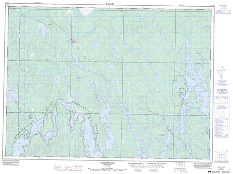
041O08 Biscotasing Canada topo map, 1:50,000 scale
041O08 Biscotasing NRCAN topographic map.
Includes UTM and GPS geographic coordinates (latitude and longitude). This 50k scale map is suitable for hiking, camping, and exploring, or you could frame it as a wall map.
Printed on-demand using high resolution, on heavy weight and acid free paper, or as an upgrade on a variety of synthetic materials.
Topos available on paper, Waterproof, Poly, or Tyvek. Usually shipping rolled, unless combined with other folded maps in one order.
- Product Number: NRCAN-041O08
- Parent Topo: TOPO-041O
- Map ID also known as: 041O08, 41O8, 41O08
- Unfolded Size: Approximately 26" high by 36" wide
- Weight (paper map): ca. 55 grams
- Map Type: POD NRCAN Topographic Map
- Map Scale: 1:50,000
- Geographical region: Ontario, Canada
Neighboring Maps:
All neighboring Canadian topo maps are available for sale online at 1:50,000 scale.
Purchase the smaller scale map covering this area: Topo-041O
Spatial coverage:
Topo map sheet 041O08 Biscotasing covers the following places:
- Cat Bay - Deschene Bay - East Arm - Flying Post Bay - Gowganda Bay - Grey Owl Bay - Longspur Bay - Metagama Bay - Northwest Arm - Norton Arm - Wind Point - Crooked Narrows - Straight Narrows - Spanish Chutes - 12 - 9 - Abney - Alcona - Arbutus - Biscotasi - Carew - Cavell - Ceylon - Edith - Elizabeth - Faust - Fingal - Hall - Hollinger - Hong Kong - Hubbard - Joffre - Lillie - Margaret - Smuts - Sudbury - Yeo - Dead Horse Island - Grey Owl Island - Grey Owl Island - Legace Island - Pansy Island - Abney Lake - Alcona Lake - Bardney Lake - Bear Lake - Biscotasi Lake - Biskotasi Lake - Boucher Lake - Carew Lake - Cat Lake - Cave Lake - Cavell Lake - First Lake - Fox Lake - Frechette Lake - Gandet Lake - Heart Lake - Houghton Lake - Joffre Lake - Kabetako Lake - Kane Lake - Keast Lake - Klemmer Lake - Kolosta Lake - Leblanc Lake - Little Cave Lake - Lost Lake - Lower Turnbull Lake - Macle Lake - Moonshine Lake - Moose Lake - Myre Lake - Ramsay Lake - Ramsey Lake - Roberts Lake - Scarp Lake - Shanacy Lake - Sheldon Lake - Spanish Lake - Syko Lake - Tassie Lake - Tower Lake - Turf Lake - Turnbull Lake - View Lake - White Pine Lake - Biscotasi Lake Provincial Park - Mississagi River Provincial Park - Spanish River Provincial Park - Alcona Creek - Bardney Creek - Biscotasi Creek - Biskotasi Creek - Cavell Creek - Hogsback Channel - Norton Creek - Ramsey Creek - Resinosa River - Spanish River - Tassie Creek - Turnbull Creek - Biscotasing - Bowen - Drefal - Ramsay - Ramsey - Roberts - Sheldon


