
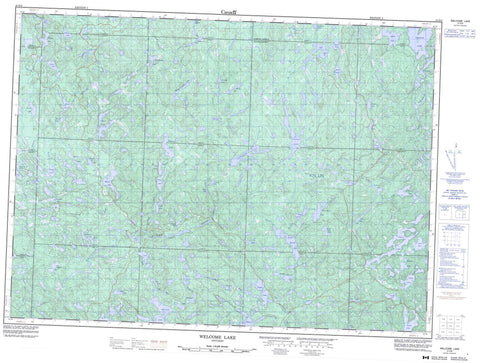
041O04 Welcome Lake Canada topo map, 1:50,000 scale
041O04 Welcome Lake NRCAN topographic map.
Includes UTM and GPS geographic coordinates (latitude and longitude). This 50k scale map is suitable for hiking, camping, and exploring, or you could frame it as a wall map.
Printed on-demand using high resolution, on heavy weight and acid free paper, or as an upgrade on a variety of synthetic materials.
Topos available on paper, Waterproof, Poly, or Tyvek. Usually shipping rolled, unless combined with other folded maps in one order.
- Product Number: NRCAN-041O04
- Parent Topo: TOPO-041O
- Map ID also known as: 041O04, 41O4, 41O04
- Unfolded Size: Approximately 26" high by 36" wide
- Weight (paper map): ca. 55 grams
- Map Type: POD NRCAN Topographic Map
- Map Scale: 1:50,000
- Geographical region: Ontario, Canada
Neighboring Maps:
All neighboring Canadian topo maps are available for sale online at 1:50,000 scale.
Purchase the smaller scale map covering this area: Topo-041O
Spatial coverage:
Topo map sheet 041O04 Welcome Lake covers the following places:
- 22,12 - 22,13 - 22,14 - 22,15 - 23,12 - 23,13 - 23,14 - 23,15 - 24,12 - 24,13 - 24,14 - 24,15 - 5G - 5H - 6G - 6H - 7G - 7H - 8G - 8H - Bracci - Butcher - Carton - Dablon - Desbiens - Ewen - Gapp - Gaudry - Handleman - Hoffman - Lunkie - McIlveen - Nahwegezhic - Pine - Running - Schembri - Scriven - Sherratt - Sudbury - Way-White - Wlasy - Affleck Lake - Alice Lake - Annibal Lake - Anvil Lake - Armour Lake - Boyle Lake - Browne Lake - Butter Tin Lake - Camel Lake - Chubb Lake - Coppens Lake - Cowie Lake - Dead Lake - Dismal Lake - Dixon Lake - Dude Lake - Dunkerley Lake - Dyson Lake - Eileen Lake - Ella Lake - Emerson Lake - Fifty Dollar Lake - Forester Lake - Fork Lake - Friendly Lake - Fyfe Lake - Galloway Lake - Gong Lake - Goulais Lake - Graham Lake - Gravel Lake - Gull Lake - Gut Lake - Halcrow Lake - Hanes Lake - Hodgson Lake - Horne Lake - Hound Lake - Irene Lake - Island Lake - Jet Lake - Lac Cherie - Lawer Lake - Limerick Lake - Little Horne Lake - Little Quinn Lake - Lodestone Lake - Loggers Lake - Mart Lake - Megisan Lake - Mirror Lake - Morrison Lake - Mystery Lake - Neundorf Lake - North Chubb Lake - North Emerson Lake - Otter Lake - Patter Lake - Patterson Lake - Point Lake - Private Lake - Quinn Lake - Ragged Lake - Red Pine Lake - Reedy Lake - Roar Lake - Saw Lake - Saymo Lake - Shadow Lake - Simms Lake - Snyder Lake - South Anvil Lake - South Branch Lake - South Teal Lake - Spook Lake - Tepee Lake - Torrance Lake - Tujak Lake - Vacher Lake - Watson Lake - Welcome Lake - Witchdoctor Lake - Algoma Headwaters Provincial Park - Aubinadong-Nushatogaini Rivers Provincial Park - Ranger North Conservation Reserve - Anvil Creek - Browne Creek - Cherie Creek - Chippewa River - Chubb Creek - Cowie Creek - Dead Creek - Dixon Creek - East Goulais River - Emerson Creek - Garden River - Gong Creek - Goulais River - Hanes Creek - Hodgson Creek - Little Quinn River - Morrison Creek - Patter Creek - Patterson Creek - Quinn River - South Branch Creek - Vacher Creek - Watson Creek - West Aubinadong River


