
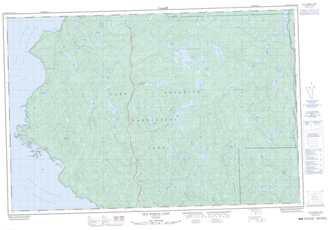
041N10 Old Woman Lake Canada topo map, 1:50,000 scale
041N10 Old Woman Lake NRCAN topographic map.
Includes UTM and GPS geographic coordinates (latitude and longitude). This 50k scale map is suitable for hiking, camping, and exploring, or you could frame it as a wall map.
Printed on-demand using high resolution, on heavy weight and acid free paper, or as an upgrade on a variety of synthetic materials.
Topos available on paper, Waterproof, Poly, or Tyvek. Usually shipping rolled, unless combined with other folded maps in one order.
- Product Number: NRCAN-041N10
- Parent Topo: TOPO-041N
- Map ID also known as: 041N10, 41N10
- Unfolded Size: Approximately 26" high by 36" wide
- Weight (paper map): ca. 55 grams
- Map Type: POD NRCAN Topographic Map
- Map Scale: 1:50,000
- Geographical region: Ontario, Canada
Neighboring Maps:
All neighboring Canadian topo maps are available for sale online at 1:50,000 scale.
Purchase the smaller scale map covering this area: Topo-041N
Spatial coverage:
Topo map sheet 041N10 Old Woman Lake covers the following places:
- Beatty Cove - Bushy Bay - Gargantua Bay - Gargantua Harbour - The North Arm - Warp Bay - Grindstone Point - Bushy Falls - Calwin Falls - 28,18 - 28,19 - 28,20 - 28,21 - 29,18 - 29,19 - 29,20 - 29,21 - 30,18 - 30,19 - 30,20 - 30,21 - 31,18 - 31,19 - 31,20 - 31,21 - Alarie - Algoma - Allouez - Asselin - Barager - Barnes - Bray - Brimacombe - Broome - Bullock - LaRonde - Peterson - Redsky - Restoule - Stone - Stoney - Tiernan - Burnt Island - Chalfant Island - Devils Warehouse Island - Devil's Warehouse Island - Dixon Island - Far Island - Fawcett Island - Gargantua Island - Peerless Island - Wilde Island - Acer Lake - Agawa Station Lake - Almonte Lake - Alpine Lake - Baby Lake - Backward Lake - Baillargeon Lake - Baldhead Lake - Bark Lake - Belanger Lake - Black Lake - Black Mandyn Lake - Broadtail Lake - Buckshot Lake - Bussineau Lake - Buzz Lake - Callahan Lake - Carol Lake - Castor Ponds - Chaillon Lake - Chalmers Lake - Colette Lake - Connell Lake - Coon Lake - Corner Lake - Dad Lake - Dark Lake - Dawn Lake - Dead Moose Lake - Dead Otter Lake - Desbois Lake - Dossier Lake - Dural Lake - Fife Lake - Fishbox Lake - Foam Lake - Found Lake - Gamitagama Lake - Gargantua Lake - Gibson Lake - Good Fortune Lake - Gravel Lake - Hardtime Lake - Jeff Lake - Joanne Lake - Jungle Lake - Kiigo Pond - Lac Supérieur - Lake Montgomery - Lake Superior - Lost Boy Lake - Lovely Lake - Luna Lake - Magnetite Lake - Maquon Lake - Mash Lake - Middle Wildcat Lake - Mijinemungshing Lake - Mirimoki Lake - Miron Lake - Mom Lake - Mud Lake - Murphy Lake - O'Connor Lake - Old Woman Lake - Peat Lake - Peller Lake - Perederka Lake - Picea Lake - Pilot Lake - Pinus Lake - Piquer Lake - Plato Lake - Poikkimaki Lake - Rabbit Blanket Lake - Radium Lake - Rathwell Lake - Red Rock Lake - Redwood Lake - Rotund Lake - Ruby Lake - Rustle Lake - Sand Lake - Sandy Mountain Lake - Slievert Lake - Snipe Lake - Sommers Lake - Stovepipe Lake - Sundstom Lake - Surf Lake - Till Lake - Upper Wildcat Lake - Ursa Major Lake - Ursa Minor Lake - Valentine Lake - Vesi Lake - Villian Lake - Viridian Lake - Wabigoon Lake - Whiskey Bottle Lake - White Spruce Lake - Wildcat Lake - Woodpecker Lake - Gargantua Hill - Grangousier Hill - Peat Mountain - Lake Superior Provincial Park - Agawa River - Anjigami River - Anjigomi River - Baldhead River - Buckshot Creek - Coldwater River - East Branch Baldhead River - Gargantua River - Kasubeck Creek - Maquon Creek - Mine Creek - Ogas Creek - Parch Creek - Red Rock River - Sand River - South Old Woman River - Agawa - Gargantua - O'Connor


