
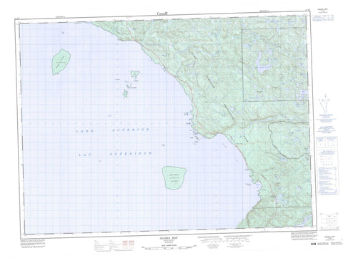
041N07 Agawa Bay Canada topo map, 1:50,000 scale
041N07 Agawa Bay NRCAN topographic map.
Includes UTM and GPS geographic coordinates (latitude and longitude). This 50k scale map is suitable for hiking, camping, and exploring, or you could frame it as a wall map.
Printed on-demand using high resolution, on heavy weight and acid free paper, or as an upgrade on a variety of synthetic materials.
Topos available on paper, Waterproof, Poly, or Tyvek. Usually shipping rolled, unless combined with other folded maps in one order.
- Product Number: NRCAN-041N07
- Parent Topo: TOPO-041N
- Map ID also known as: 041N07, 41N7, 41N07
- Unfolded Size: Approximately 26" high by 36" wide
- Weight (paper map): ca. 55 grams
- Map Type: POD NRCAN Topographic Map
- Map Scale: 1:50,000
- Geographical region: Ontario, Canada
Neighboring Maps:
All neighboring Canadian topo maps are available for sale online at 1:50,000 scale.
Purchase the smaller scale map covering this area: Topo-041N
Spatial coverage:
Topo map sheet 041N07 Agawa Bay covers the following places:
- Agawa Bay - Beatty Cove - Katherine Cove - MacGregor Cove - Robertson Cove - Sinclair Cove - Agawa Point - Bald Head - Rocky Point - Lady Evelyn Falls - 28,15 - 28,16 - 28,17 - 28,18 - 29,15 - 29,16 - 29,17 - 29,18 - 30,17 - 30,18 - Algoma - Brimacombe - Broome - Bullock - Giles - Goodwillie - Greenwood - Labelle - Labonte - Peever - Rix - Agawa Islands - Barrett Island - Ella Islet - Ganley Island - Leach Island - Lizard Islands - Montreal Island - Rock Island - Rowe Island - Sinclair Island - South Lizard Island - Vrooman Island - Vrooman Islands - Beaverhouse Lake - Black Beaver Lake - Boggy Pond - Castor Ponds - Charlie Lake - Crescent Lake - Crooked Cane Lake - Devlin Lake - Doc Greig Lake - Dottie Lake - Dugout Lake - Eber Pond - First Lake - Frater Lake - Greig Lake - Harrys Lake - Hotshot Lake - Howling Wolf Lake - Huckson Lake - Imprimis Lake - Kenny Lake - Kwagama Lake - Lac Supérieur - Lake Superior - Lost Lake - Mabel Pond - MacGregor Lake - McComb Lake - McDougal Lake - Menzie Lake - Mudhole Lake - Neomi Lake - Orphan Lake - Overland Lake - Pamplemouse Pond - Peyton Lake - Pontoon Lake - Royal Lake - Snyder Lake - Speckled Trout Lake - Stan Lake - Sweesey Lake - Sweezey Lake - Tame Rice Lake - Taylor Lake - Tee Bone Lake - The Duck Ponds - Tower Lake - Turtle Shell Lake - Wagon Wheel Lake - Wells Lake - Wizard Lake - Black Beaver Hill - Kwagama Hill - Montreal Hill - Sugarloaf Hill - Lake Superior Provincial Park - Agawa River - Baldhead River - Barrett River - Clay River - Coldwater River - Crazy Creek - Frater Creek - June Creek - Kwagama Creek - Laughing Brook - Montreal River - Sand River - Speckled Trout Creek - Wizard Creek - Agawa Rock - Barr Reef - Ganley Rock - Griffon Reef - Minnie Reef - Miron Bank - Sparrow Shoal - Telegraph Rock - Agawa Bay - Frater - Cliff Marsh


