
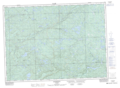
041N01 Batchewana Canada topo map, 1:50,000 scale
041N01 Batchewana NRCAN topographic map.
Includes UTM and GPS geographic coordinates (latitude and longitude). This 50k scale map is suitable for hiking, camping, and exploring, or you could frame it as a wall map.
Printed on-demand using high resolution, on heavy weight and acid free paper, or as an upgrade on a variety of synthetic materials.
Topos available on paper, Waterproof, Poly, or Tyvek. Usually shipping rolled, unless combined with other folded maps in one order.
- Product Number: NRCAN-041N01
- Parent Topo: TOPO-041N
- Map ID also known as: 041N01, 41N1, 41N01
- Unfolded Size: Approximately 26" high by 36" wide
- Weight (paper map): ca. 55 grams
- Map Type: POD NRCAN Topographic Map
- Map Scale: 1:50,000
- Geographical region: Ontario, Canada
Neighboring Maps:
All neighboring Canadian topo maps are available for sale online at 1:50,000 scale.
Purchase the smaller scale map covering this area: Topo-041N
Spatial coverage:
Topo map sheet 041N01 Batchewana covers the following places:
- 24,12 - 24,13 - 24,14 - 24,15 - 25,12 - 25,13 - 25,14 - 25,15 - 26,12 - 26,13 - 26,14 - 26,15 - 27,12 - 27,13 - 27,14 - 28,13 - 28,14 - 28,15 - Algoma - Brûlé - Dablon - Davieaux - Desbiens - Grenoble - Home - Nicolet - Norberg - Olsen - Palmer - Peever - Raaflaub - Runnalls - Running - Smilsky - Tolmonen - Tronsen - Vibert - Way-White - Wishart - Adelaide Lake - Algocen Lake - Alva Lake - Batchawana Lake - Big Pike Lake - Bone Lake - Boom Lake - Buker Lake - Butter Lake - Carpenter Lake - Chain Lakes - Croll Lake - Curry Lake - Dick Lake - Dill Lake - Drew Lake - East Lake - Elmer Lake - Fuller Lake - Gavor Lake - Griffin Lake - Guyatt Lake - Hailey Lake - Hion Lake - Horne Lake - Horseshoe Lake - Jules Lake - Lily Pad Lake - Little Drew Lake - Little Horne Lake - Little Turkey Lake - Logan Lake - Lower Griffin Lake - Lucas Lake - Lucky Lake - Lucky Lake - Marshy Lake - Martin Lake - Masten Lake - McCollough Lake - McGarry Lake - McGovern Lake - Meenach Lake - Mitchell Lake - Mongoose Lake - Negick Lake - North McKinnon Lake - Old Man Lake - Old Woman Lake - Olsen Lake - Pan Lake - Patterson Lake - Quintet Lakes - Rainbow Lake - Raine Lake - Rand Lake - Shoepack Lake - South McKinnon Lake - Spruce Lake - St. Clair Lake - Tamarac Lake - Tay Lake - Tilley Lakes - Toy Lake - Tribble Lake - Trim Lake - Trout Lake - Turkey Lake - Turtle Lake - Upper Algocen Lake - Wart Lake - Wishart Lake - Wonashin Lake - Yonder Lake - Batchawana Mountain - Batchawana River Provincial Park - Harmony Forest Conservation Reserve - O'Connor Conservation Reserve - Batchawana River - Big Pike Creek - Browne Creek - Chippewa River - Chippewa River - Drew Creek - East Branch Chippewa River - East Creek - Eldred Creek - Goulais River - Griffin Creek - Harmony River - Little Batchawana River - McDonald Creek - McKinnon Creek - Mongoose Creek - Norberg Creek - North Creek - O'Connor Creek - Quinn River - Quintet Creek - St. Clair Creek - Thompson Creek - Wart Creek - Alva - Batchawana - Batchewana - Mashkode - Mekatina - Pangis - Rand - Regent - Summit - Trout Lake


