
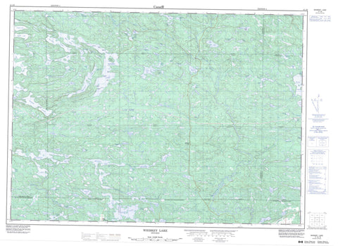
041J08 Whiskey Lake Canada topo map, 1:50,000 scale
041J08 Whiskey Lake NRCAN topographic map.
Includes UTM and GPS geographic coordinates (latitude and longitude). This 50k scale map is suitable for hiking, camping, and exploring, or you could frame it as a wall map.
Printed on-demand using high resolution, on heavy weight and acid free paper, or as an upgrade on a variety of synthetic materials.
Topos available on paper, Waterproof, Poly, or Tyvek. Usually shipping rolled, unless combined with other folded maps in one order.
- Product Number: NRCAN-041J08
- Parent Topo: TOPO-041J
- Map ID also known as: 041J08, 41J8, 41J08
- Unfolded Size: Approximately 26" high by 36" wide
- Weight (paper map): ca. 55 grams
- Map Type: POD NRCAN Topographic Map
- Map Scale: 1:50,000
- Geographical region: Ontario, Canada
Neighboring Maps:
All neighboring Canadian topo maps are available for sale online at 1:50,000 scale.
Purchase the smaller scale map covering this area: Topo-041J
Spatial coverage:
Topo map sheet 041J08 Whiskey Lake covers the following places:
- Arm of the Bear - Bellmore Bay - Dollar Bay - Haight Bay - MacDermott Bay - Ale Point - Anticline Point - Beer Point - Brandy Point - Cider Point - Cognac Point - Diabase Point - Gin Point - Paddy Point - Pine Point - Rum Point - Sandy Point - Shelter Point - Elliot Lake - Cameron Falls - Meareau Falls - 118 - 119 - 123 - 124 - 129 - 130 - 131 - 137 - 138 - 143 - 144 - Algoma - Boon - Buckles - Cadeau - Deagle - Gaiashk - Gerow - Gough - Joubin - Lehman - Lewis - Lockeyer - Mandamin - May - Proctor - Salter - Shedden - Shibananing - Sudbury - Tennyson - Victoria - Weeks - Barrow Island - Campbell Island - Alto Lake - Barrow Lake - Batty Lake - Bean Lake - Bear Lake - Beishlag Lake - Bellows Lake - Big Trout Lake - Birch Lake - Black Lake - Bock Lake - Bonamico Lake - Bouchard Lake - Bull Lake - Burnett Lake - Camera Lake - Canoe Lake - Caribou Lake - Clayton Lake - Closs Lake - Complin Lake - Conley Lake - Conway Lake - Corner Lake - Deresti Lake - Dinny Lake - Dyelle Lake - East Bull Lake - Folson Lake - Forestell Lake - Fryer Lake - Gabel Lake - Gaetano Lake - Geldart Lake - Goulding Lake - Gourd Lake - Grimard Lake - Hackford Lake - Haight Lake - Hanna Lake - Hone Lake - Horseshoe Lake - Hough Lake - Kecil Lake - Kindle Lake - Kitts Lake - Kriwoy Lake - Laitila Lake - Lang Lake - Larocque Lake - Little Bull Lake - Little Folson Lake - Little Serpent Lake - Little Trout Lake - Lizotte Lake - Lochness Lake - Louttit Lake - Macdermott Lake - MacDermott Lake - May Lake - May Lake - McCarthy Lake - McCool Lake - McGivney Lake - McKiggan Lake - McMinn Lake - Millen Lake - Moreland Lake - Moyle Lake - Mutcheguis Lake - Nazar Lake - Neumann Lake - Nook Lake - Novick Lake - Ortona Lake - Ouellette Lake - Paddy Lake - Parisien Lake - Pawson Lake - Pecors Lake - Pilon Lake - Quirke Lake - Rangers Lake - Renault Lake - Rioux Lake - Roney Lake - Salmay Lake - Savage Lake - Shaule Lake - Shawanda Lake - Shedden Lake - Shoe Lake - Smail Lake - Snapshot Lake - Sorley Lake - Speck Lake - St. Jules Lake - Stalker Lake - Stong Lake - Streich Lake - Tarsan Lake - Teasdale Lake - Tee Lake - Tees Lake - Tilt Lake - Tiplady Lake - Toria Lake - Trap Lake - Tweedle Lake - Vance Lake - Vanhorn Lake - Walton Lake - Weasel Lake - West Lake - Whiskey Lake - Whitefish Lake - Whitson Lake - Wickstrom Lake - Wiggly Lake - Wigmore Lake - Wing Lake - Sutherland Hill - Hallam - Sables-Spanish Rivers - Salter, May and Harrow - Shedden - The North Shore - The Spanish River - Victoria - Flat Creek Old Pine Conservation Reserve - Glenn N. Crombie Conservation Reserve - River Aux Sables Provincial Park - Batty Creek - Buff Creek - Cameron Creek - Cutler Creek - Flat Creek - Fleck Creek - Heffler Creek - Little Serpent River - Low Creek - Paddy Creek - River aux Sables - Serpent River - West River aux Sables - The Back Settlement


