
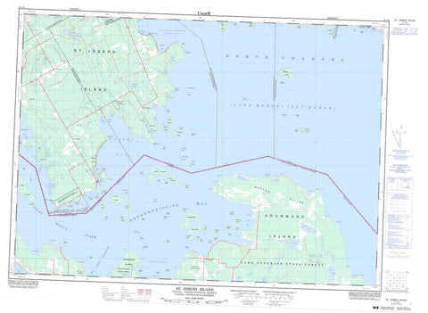
041J04 St Joseph Island Canada topo map, 1:50,000 scale
041J04 St Joseph Island NRCAN topographic map.
Includes UTM and GPS geographic coordinates (latitude and longitude). This 50k scale map is suitable for hiking, camping, and exploring, or you could frame it as a wall map.
Printed on-demand using high resolution, on heavy weight and acid free paper, or as an upgrade on a variety of synthetic materials.
Topos available on paper, Waterproof, Poly, or Tyvek. Usually shipping rolled, unless combined with other folded maps in one order.
- Product Number: NRCAN-041J04
- Parent Topo: TOPO-041J
- Map ID also known as: 041J04, 41J4, 41J04
- Unfolded Size: Approximately 26" high by 36" wide
- Weight (paper map): ca. 55 grams
- Map Type: POD NRCAN Topographic Map
- Map Scale: 1:50,000
- Geographical region: Ontario, Canada
Neighboring Maps:
All neighboring Canadian topo maps are available for sale online at 1:50,000 scale.
Purchase the smaller scale map covering this area: Topo-041J
Spatial coverage:
Topo map sheet 041J04 St Joseph Island covers the following places:
- Brickyard Bay - Brown's Bay - Garside Bay - Hamilton Bay - James Bay - Jocko Bay - Lyon Cove - McMenomy Bay - McMenomy Bay - Milford Haven - Moffat Bay - Mosquito Bay - Mosquito Bay - Potagannissing Bay - Richmond Bay - Sterling Bay - Tenby Bay - Whiskey Bay - Worsley Bay - Barton's Point - Big Point - Burnt Point - Caradoc Point - Collins Point - Elliot Point - Graveyard Point - Hay Point - Koshkawong Point - La Pointe - Old Fort St. Joe Point - Pecks Point - Rains Point - Recollet Point - Richmond Point - Sandy Point - Thessalon Point - Whiskey Point - Whitman Point - North Channel - St. Joseph Channel - Algoma - Hilton - Jocelyn - Plummer Additional - St. Joseph - Thessalon - Archibald Island - Beef Island - Birch Island - Calf Island - Cedar Island - Clinton Island - Colville Island - Duncan Island - Emily Island - Fox Island - Gull Island - Hog Island - Janden Island - Maggs Island - Milford Island - North Seine Island - O'Donnell Island - Outlaw Islands - Perrique Island - Pirate Island - Salt Island - Serpent Island - South Seine Island - St. Joseph Island - Sulphur Island - Thessalon Island - Wallace Island - Wawa Island - Caufield Lake - Deer Lake - Hans Lake - Hilton Lake - Lac Huron - Mountain Lake - Munuscong Lake - Rains Lake - Twin Lakes - Day and Bright Additional - Hilton - Huron Shores - Jocelyn - Plummer Additional - St. Joseph - Thessalon - Thompson - Fort St. Joseph National Historic Site of Canada - Hilton Township Wilderness Area - Lieu historique national du Canada du Fort-St. Joseph - Refuge d'oiseaux de l'Île St.-Joseph - St. Joseph's Island Bird Sanctuary - Brown's Creek - Gordon Creek - Koshkawong River - Milford Haven Creek - Rivière Ste-Marie - St. Mary River - St. Marys River - Sucker Creek - Watson Creek - Aurora Bank - Barrett Bank - Chippewa Bank - Dyment Rock - Fly Rock - Horne Rock - Ironsides Reef - Kangaroo Rock - Maggie Rock - O'Donnell Bank - Ontario Bank - Sam Smith Rock - Shepherd Reef - South Bank - West Rock - Thessalon - Beech Beach - Carterton - Milford Haven - Nesterville - Outlook - Tenby Bay - Hay Marsh - Hilton Beach


