
041J02 Algoma Canada topo map, 1:50,000 scale
041J02 Algoma NRCAN topographic map.
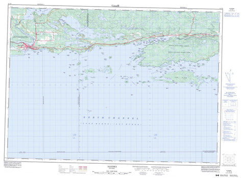
Includes UTM and GPS geographic coordinates (latitude and longitude). This 50k scale map is suitable for hiking, camping, and exploring, or you could frame it as a wall map.
Printed on-demand using high resolution, on heavy weight and acid free paper, or as an upgrade on a variety of synthetic materials.
Topos available on paper, Waterproof, Poly, or Tyvek. Usually shipping rolled, unless combined with other folded maps in one order.
- Product Number: NRCAN-041J02
- Parent Topo: TOPO-041J
- Map ID also known as: 041J02, 41J2, 41J02
- Unfolded Size: Approximately 26" high by 36" wide
- Weight (paper map): ca. 55 grams
- Map Type: POD NRCAN Topographic Map
- Map Scale: 1:50,000
- Geographical region: Ontario, Canada
Neighboring Maps:
All neighboring Canadian topo maps are available for sale online at 1:50,000 scale.
Purchase the smaller scale map covering this area: Topo-041J
Spatial coverage:
Topo map sheet 041J02 Algoma covers the following places:
- Algoma Bay - Allen Bay - Beardrop Harbour - Bickel's Bay - Bootleggers Bay - Colin Cove - Dorothy Inlet - East Bay - Fisherman's Bay - Gwynne Bay - Hoffman Bight - John Harbour - Lauzon Bay - Medicine Bay - Moiles Harbour - Mud Bay - Serpent Harbour - Spooner's Bay - Taschereau Bay - Wettlaufer Bay - Wicksteed Harbour - Bartlett Point - Battle Point - Bergeron Point - Big Sandy Point - Camp Point - Caribou Point - Comb Point - Davin Point - Emerald Point - Harriette Point - Herman Point - Hospital Point - Knight Point - Lally Point - Little Green Point - Little Sandy Point - Long Point - Mary Point - Narrow Point - Pregnant Point - Sandy Point - South Point - Table Rock - Waters Point - West Point - Wicksteed Point - East Entrance - Newport Channel - North Channel - North Entrance - North Passage - Scott Passage - South Passage - Spooner's Narrows - Turnbull Passage - Whalesback Channel - Algoma - Cobden - Lewis - Long - Manitoulin - Spragge - Striker - Mississagi River Indian Reserve 8 - Réserve indienne Mississagi River 8 - Réserve indienne Serpent River 7 - Serpent River 7 - Serpent River Indian Reserve 7 - Aikens Island - Alfred Island - Bassett Island - Beaufort Island - Bell's Island - Blueberry Island - Can Island - Caroline Island - Chicora Island - Clara Island - Cook Island - Cross Island - Dalrymple Island - Daly Islands - David Island - DeCelles Island - Dewdney Island - Dewdney Rock - Dixon Islands - Dot Island - Double Islands - Drew Island - Duffield Island - Edgar Island - Ely's Island - Fisher Island - Flood Island - Fournier Islands - Garibaldi Island - Gibson Island - Goalen Island - Godfrey Islands - Gowan Island - Greenway Island - Harbour Island - Henriette Island - Indian Island - John Island - Kimmy's Island - Klotz Island - LeSueur Island - Lett Island - Loughlin Island - Louis Island - Magazine Islands - McCallum Islands - McCracken Island - Mills Island - Mitchell Island - Morrison Islands - Mouse Island - Mulock Island - Navy Island - Nelles Island - Nicholas Island - Nobles Island - Norquay Island - O'Dwyer Island - Parsons Island - Peter Islands - Plumb Island - Prendergast Island - Rainboth Island - Ramsay Islands - Robin Island - Round Island - Sandford Island - Sanford Island - Sanford Island - Scott Island - Smith Island - Snider Island - Spotted Island - Spragge Island - Strong Island - Struthers Island - Sugar Island - Susanne Island - Sylvain Island - Tern Island - The Cousins - The Three Sisters - Turnbull Island - Vaux Island - Whitcher Island - White Island - Allen Lake - Bass Lake - Carson Lake - Hastie Lake - Lac Huron - Laderoute Lake - Lake Duborne - Lake of the Mountains - Lauzon Lake - Lillie Lake - Little Lake - Lizard Lake - Long Lake - Red Lake - Surprise Lake - Thurston Lake - Waugush Lake - Graveyard Hill - Old Baldy - Gordon - Howland - The North Shore - Black Creek - Blind River - Cobden River - Lauzon River - Lizard Creek - Marcellus Creek - Mississagi River - Potomac River - Serpent River - Spragge Creek - Acadia Rock - Amyot Rocks - Beaufort Reef - Belle Rock - Bergin Rock - Berrypicker Rock - Black Rock - Blind River Bank - Bradley Rock - Bruce Rock - Campana Shoal - Casey Shoal - Chapman Reef - Cherub Rock - Chrysler Rocks - Colmer Ground - Dalton Reef - Darby Rock - Davies Rock - Denison Rock - Deuce Rock - Dixie Rocks - Dog Point Shoal - Doucet Rock - Europa Reef - Fortin Rocks - Fraser Rocks - Gull Rock - Gunboat Shoal - Hamilton Rock - Huntly Reef - Isaac Rock - Jane Rock - Labelle Reef - LaFrance Rock - Maitland Patch - May Reef - Meteor Rock - Michels Ground - Minstrel Rock - Moodie Rock - Page Rocks - Pancake Rock - Pandora Rock - Ploughboy Rock - Rescue Rock - Restless Bank - Rob Roy Patch - Robb Rock - Robb Rocks - Shickluna Rock - Simon Rock - Southwest Patches - Spartan Rock - Tenspot Shoal - Tug Reef - Turtle Rock - Tyrwhitt Shoals - Weldon Shoal - Whalesback - Blind River - Northeastern Manitoulin and the Islands - Algoma - Algoma Mills - Blind River - McFerson - Moiles Mills - Newport - Pronto East - Serpent River - Sheppard - Spragge


