
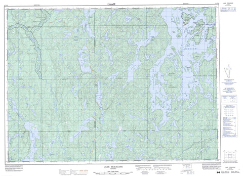
041I16 Lake Temagami Canada topo map, 1:50,000 scale
041I16 Lake Temagami NRCAN topographic map.
Includes UTM and GPS geographic coordinates (latitude and longitude). This 50k scale map is suitable for hiking, camping, and exploring, or you could frame it as a wall map.
Printed on-demand using high resolution, on heavy weight and acid free paper, or as an upgrade on a variety of synthetic materials.
Topos available on paper, Waterproof, Poly, or Tyvek. Usually shipping rolled, unless combined with other folded maps in one order.
- Product Number: NRCAN-041I16
- Parent Topo: TOPO-041I
- Map ID also known as: 041I16, 41I16
- Unfolded Size: Approximately 26" high by 36" wide
- Weight (paper map): ca. 55 grams
- Map Type: POD NRCAN Topographic Map
- Map Scale: 1:50,000
- Geographical region: Ontario, Canada
Neighboring Maps:
All neighboring Canadian topo maps are available for sale online at 1:50,000 scale.
Purchase the smaller scale map covering this area: Topo-041I
Spatial coverage:
Topo map sheet 041I16 Lake Temagami covers the following places:
- Austin Bay - Baie Jeanne - Cross Bay - Island Bay - Kokoko Bay - Loon Bay - Mule Bay - Outlet Bay - Portage Bay - Shiningwood Bay - South Arm - Southwest Arm - Spawning Bay - West Bay - Denedus Point - Matagama Point - McLean Peninsula - Pelican Point - Ranger Point - Lower Goose Falls - Upper Goose Falls - Afton - Armagh - Belfast - Briggs - Clary - Clement - Hobbs - Joan - Kelly - Macbeth - McCallum - McCarthy - McNish - Nipissing - Pardo - Phyllis - Scholes - Sheppard - Sudbury - Torrington - Vogt - Yates - Bear Island 1 - Bear Island Indian Reserve 1 - Réserve indienne Bear Island 1 - Alexander Island - Bear Island - Cattle Island - Denedus Island - Garden Island - High Rock Island - Kabekwabika Island - McMillan Island - Moore Island - Narrows Island - Ogama Island - Smoothrock Island - Temagami Island - Timagami Island - Turner Island - Wingfoot Island - Adobe Lake - Aileen Lake - Aleck Lake - Apple Lake - Arcand Lake - Banquet Lake - Barlow Lake - Barnes Lake - Boucher Lake - Brightwater Lake - Clem Lake - Colin Scott Lake - Crest Lake - Cross Lake - Cucumber Lake - Cummings Lake - David Lake - Dean Lake - Deschamps Lake - Dip Lake - Donald Lake - Eaglenest Lake - Eaglerock Lake - East Jones Lake - Echo Lake - Edna Lake - Eileen Lake - Emerald Lake - Gagnon Lake - Gamagowong Lake - Gawasi Lake - Greenrod Lake - Gull Lake - Harvey Lake - Herbert Lake - High Lake - Hybrid Lake - Indian Trail Lake - Iron Lake - Jewell Lake - Kearns Lake - Kelly Lake - Kibble Lake - Lac à Brochets - Lac Maskinongé - Lake Temagami - Lake Timagami - Little Cross Lake - Little Donald Lake - Little Rocky Lake - Little Weasel Lake - Longbow Lake - Lost Lake - Lower Bass Lake - Lower Matagamasi Lake - Lulu Lake - Manitou Lake - Marlow Lake - Maskinonge Lake - McNish Lake - Mickey Lake - Moses Lake - North Silver Lake - Obabika Lake - Ozhway Lake - Pat Lake - Pats Lake - Plum Lake - Pond Lake - Potvin Lake - Rachel Lake - Redbark Lake - Rice Lake - Rump Lake - Silver Lake - Sinton Lake - Skunk Lake - South Iron Lake - Stanley Lake - Tee Lake - Tip Lake - Triangle Lake - Turtleshell Lake - Wawiagama Lake - Wawiashkashi Lake - Weedy Lake - Weever Lake - West Adobe Lake - Woods Lake - Iron Mountain - Narrows Island Conservation Reserve - Obabika River Provincial Park - Sturgeon River Provincial Park - Temagami Island North Conservation Reserve - Temagami River Provincial Park - Chiniguchi River - Kibble Creek - Manitou River - McNish Creek - North Silver Creek - Obabika River - Plum Creek - Rivière Témagami - Sinton Creek - Sturgeon River - Temagami River - Timagami River - Wawiagama River - Yorston River - Temagami - Adanac - Bear Island - Camp Chimo - Camp Cochrane - Camp White Bear - Camp Wigwasati - Fridays - Kakeena Camp - La Salette - Wabi-Kon - Wabun Camp


