
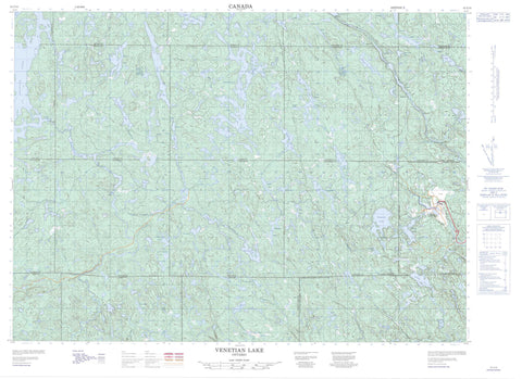
041I14 Venetian Lake Canada topo map, 1:50,000 scale
041I14 Venetian Lake NRCAN topographic map.
Includes UTM and GPS geographic coordinates (latitude and longitude). This 50k scale map is suitable for hiking, camping, and exploring, or you could frame it as a wall map.
Printed on-demand using high resolution, on heavy weight and acid free paper, or as an upgrade on a variety of synthetic materials.
Topos available on paper, Waterproof, Poly, or Tyvek. Usually shipping rolled, unless combined with other folded maps in one order.
- Product Number: NRCAN-041I14
- Parent Topo: TOPO-041I
- Map ID also known as: 041I14, 41I14
- Unfolded Size: Approximately 26" high by 36" wide
- Weight (paper map): ca. 55 grams
- Map Type: POD NRCAN Topographic Map
- Map Scale: 1:50,000
- Geographical region: Ontario, Canada
Neighboring Maps:
All neighboring Canadian topo maps are available for sale online at 1:50,000 scale.
Purchase the smaller scale map covering this area: Topo-041I
Spatial coverage:
Topo map sheet 041I14 Venetian Lake covers the following places:
- Copenhagen Bay - Green Bay - Turcotte Bay - Grand Sudbury - Greater Sudbury - Beaumont - Beresford - Botha - Bowell - Creelman - Dunbar - Emo - Fairbairn - Foy - Harty - Hess - Hutton - Kitchener - Leinster - Munster - Rhodes - Roberts - Sudbury - Sweeny - Tyrone - Wisner - Onaping Dam - Arm Lake - Ayotte Lake - Baseline Lake - Bay Lake - Beau Lake - Bennet Lake - Bessie Lake - Bigwood Lake - Blueberry Lake - Botha Lake - Burnish Lake - Camp Island Lake - Camp Lake - Copenhagen Lake - Decair Lake - Duck Lake - Fisher Lake - Foy Lake - Foyross Lake - Friday Lake - Frog Lake - Graveyard Lake - Hollow Lake - Hutton Lake - Ironside Lake - Joe Lake - Kasakawawia Lake - Kawawia Lake - Kitchener Lake - Kumska Lake - Leinster Lake - Little Lonely Lake - Little Michaud Lake - Little Sandcherry Lake - Lonely Lake - Loonfeather Lake - Lostend Lake - Madge Lake - McGrindle Lake - McLeod Lake - Michaud Lake - Minnow Lake - Morin Lake - Morton Lake - Mule Lake - North Lake - Onaping Lake - Osbourne Lake - Proudfoot Lake - Raffia Lake - Rand Lake - Raphoe Lake - Reed Lake - Rhodes Lake - Richardson Lake - Roberts Lake - Rome Lake - Sandcherry Lake - Sandfly Lake - Schkowona Lake - Scotia Lake - Shingwak Lake - Slide Lake - Smith Lake - South Lake - Towchain Lake - Tyrone Lake - Venetian Lake - Wanitanga Lake - Moose Mountain - Sudbury - Blezard - Capreol - Capreol and Hanmer - Garson - Hanmer - Neelon and Garson - Kawawia Lake Old Growth Conservation Reserve - Venetian Creek Old Pine Conservation Reserve - Beau Creek - Bee Creek - Bessie Creek - Botha Creek - Burnish Creek - Friday Creek - Frog Creek - Kumska Creek - Laforest Creek - Leinster Creek - Little Sandcherry Creek - Lonely Creek - McGrindle Creek - McLeod Creek - Michaud River - Morton Creek - Onaping River - Rand Creek - Rapid River - Reedy Creek - Rhodes Creek - Richardson Creek - Rivière Vermillion - Roberts River - Sandcherry Creek - Sandfly Creek - Shingwak Creek - Venetian Creek - Vermilion River - Wanitanga Creek - Wingekisinaw River - Anstice - Capreol - Dorchester Station - Raphoe - Sellwood - St. Clair Junction - Valley East


