
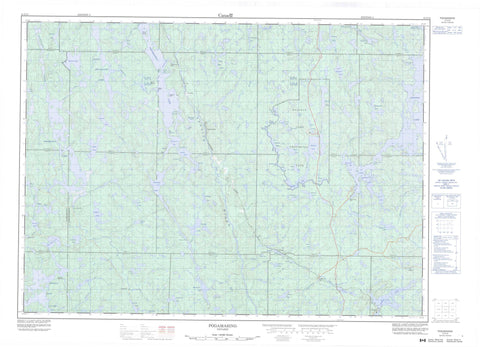
041I13 Pogamasing Canada topo map, 1:50,000 scale
041I13 Pogamasing NRCAN topographic map.
Includes UTM and GPS geographic coordinates (latitude and longitude). This 50k scale map is suitable for hiking, camping, and exploring, or you could frame it as a wall map.
Printed on-demand using high resolution, on heavy weight and acid free paper, or as an upgrade on a variety of synthetic materials.
Topos available on paper, Waterproof, Poly, or Tyvek. Usually shipping rolled, unless combined with other folded maps in one order.
- Product Number: NRCAN-041I13
- Parent Topo: TOPO-041I
- Map ID also known as: 041I13, 41I13
- Unfolded Size: Approximately 26" high by 36" wide
- Weight (paper map): ca. 55 grams
- Map Type: POD NRCAN Topographic Map
- Map Scale: 1:50,000
- Geographical region: Ontario, Canada
Neighboring Maps:
All neighboring Canadian topo maps are available for sale online at 1:50,000 scale.
Purchase the smaller scale map covering this area: Topo-041I
Spatial coverage:
Topo map sheet 041I13 Pogamasing covers the following places:
- Cunningham's Bay - Dead Horse Bay - Dunlop Bay - Green Bay - Macdonald Bay - Nut Bay - Paddy's Bay - Rubenstein's Bay - Stoney Bay - Big Narrows - Lost Channel - North Narrows - South Narrows - Three Mile Narrows - 115 - Algoma - Alton - Antrim - Athlone - B - C - Craig - D - Del Villano - Dennie - Emo - Fairbairn - Gilbert - Hess - Hotte - LaFleche - Moncrieff - Morse - Muldrew - Munster - Oshell - Ouellette - Stralak - Sudbury - Ulster - Bannerman Dam - Kingston's Island - McGinnis Island - Picnic Island - Abbott Lake - Antrim Lake - Bagpipe Lake - Bailey Lake - Bannerman Lake - Bass Lake - Benny Lake - Bittern Lake - Bluewater Lake - Burnt Ridge Lake - Capper Lake - Crystal Lake - Dennie Lake - Depot Lake - Dusty Lake - Franklin Lake - Geneva Lake - Gilbert Lake - Gilden Lake - Halfway Lake - Hamanegg Lake - Kennedy Lake - Landry Lake - Little Muldrew Lake - Little Pogamasing Lake - Lodge Lake - Loon Lake - Lost Lake - Lower Green Lake - Lower Onaping Lake - Lower Shakwa Lake - Macdonald Lake - Maltese Lake - Marguerite Lake - Marion Lake - McDougall Lake - Mile Lake - Moosemuck Lake - Muldrew Lake - Munster Lake - Nitro Lake - Onaping Lake - Otter Lake - Path Lake - Pejeke Lake - Pogamasing Lake - Pooch Lake - Present Lake - Raven Lake - Retort Lake - Sandys Lake - Shakwa Lake - Sideburn Lake - Sinaminda Lake - Smoke Lake - Smokefox Lake - Spider Lake - Spider Lake - Squirrel Lake - Stonesthrow Lake - Straight Lake - Sugarbush Lake - Tee Lake - Telephone Lake - Three Island Lake - Three Mile Lake - Tomasina Lake - Trapper Lake - Tremblay Lake - Two Narrows Lake - Ulster Lake - Upper Shakwa Lake - Wenn Lake - Wensley Lake - Moose Marsh - Halfway Lake Provincial Park - Spanish River Provincial Park - Bailey Creek - Bannerman Creek - Boundary Creek - Dennie Creek - Franklin Creek - Hough Creek - Little Sinaminda Creek - Macdonald Creek - Marion Creek - Mogo River - Moncrieff Creek - Muldrew Creek - Munster Creek - Nitro Creek - Path Creek - Pogamasing River - Rushbrook Creek - Shakwa River - Sinaminda Creek - Spanish River - Spider Lake Creek - Squaw Creek - Ulster Creek - Benny - Fluorite - Geneva - Nitro - Pogamasing - Pulp Siding - Sheahan - Stralak


