
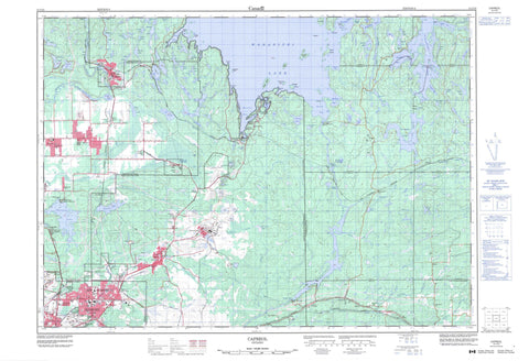
041I10 Capreol Canada topo map, 1:50,000 scale
041I10 Capreol NRCAN topographic map.
Includes UTM and GPS geographic coordinates (latitude and longitude). This 50k scale map is suitable for hiking, camping, and exploring, or you could frame it as a wall map.
Printed on-demand using high resolution, on heavy weight and acid free paper, or as an upgrade on a variety of synthetic materials.
Topos available on paper, Waterproof, Poly, or Tyvek. Usually shipping rolled, unless combined with other folded maps in one order.
- Product Number: NRCAN-041I10
- Parent Topo: TOPO-041I
- Map ID also known as: 041I10, 41I10
- Unfolded Size: Approximately 26" high by 36" wide
- Weight (paper map): ca. 55 grams
- Map Type: POD NRCAN Topographic Map
- Map Scale: 1:50,000
- Geographical region: Ontario, Canada
Neighboring Maps:
All neighboring Canadian topo maps are available for sale online at 1:50,000 scale.
Purchase the smaller scale map covering this area: Topo-041I
Spatial coverage:
Topo map sheet 041I10 Capreol covers the following places:
- Boland's Bay - Bowland Bay - Cochrane Bay - Fredsons Bay - Klondike Bay - Kolari Bay - Kolari Bay - Massey Bay - Outlet Bay - Outlet Bay - Portage Bay - Scadding Bay - Skead Bay - Southeast Bay - West Bay - Wright's Bay - Bissett's Point - Higgins Point - Kritz's Point - McClouds Point - Redrock Point - Skead Point - Crystal Narrows - Grand Sudbury - Greater Sudbury - Lambart Falls - Timmins Chute - Awrey - Blezard - Capreol - Davis - Dryden - Falconbridge - Garson - Hagar - Hanmer - Kelly - Loughrin - Maclennan - McKim - Neelon - Norman - Rathbun - Scadding - Street - Sudbury - Wisner - A Island - Blueberry Island - Bonanza Island - Burnt Island - Chambers Island - Chimney Island - Finley Island - High Island - Howie Island - Maclennan Island - Moore's Island - Oak Island - Rioux's Island - Seagull Island - Shaw Island - Sloan's Island - Wanapitei Island - Amy Lake - Ashigami Lake - Barnett Lake - Bass Lake - Bassfin Lake - Blue Lake - Boland's Lake - Bonanza Lake - Boot Lake - Boucher Lake - Bowland Lake - Bronson Lake - Bugg Lake - Bushy Lake - Capre Lake - Capreol Lake - Chaya Pond - Drill Lake - Eatlots Lake - Ella Lake - Falcon Gold Lake - Farm Lake - Fault Lake - Ford Lake - Fortune Lake - Frenchman Lake - Frost Lake - Garson Lake - Greens Lake - Hagarty Lake - Halfway Lake - Hanmer Lake - Headquarters Lake - Horseshoe Lake - Insect Lake - Jackson Lake - Joe Lake - Jones Lake - Kukagami Lake - Lac St. Jean - Lac Wanapitei - Little Amy Lake - Little Bonanza Lake - Little Moose Lake - Long Lake - Long Lake - MacDonald's Lake - Marshy Lake - Massey Lake - Matagamasi Lake - McCrea Lake - McLaren Lake - Minnow Lake - Moose Lake - Moose Lake - Moose Lake - Mud Lake - Newton's Pothole - North Lake - Norway Lake - Onwatin Lake - Paddy's Lake - Pike Lake - Pond Lake - Portage Lake - Pot Hole Lake - Rat Lake - Redrock Ponds - Rockcut Lake - Rocky Lake - Selwyn Lake - Skynner Lake - Spar Lake - Spider Lake - Suez Pit - Waddell Lake - Wanapitei Lake - Whitson Lake - Windy Lake - Sudbury - Blezard - Capreol - Capreol and Hanmer - Falconbridge - Garson - Hagar - Hanmer - Neelon and Garson - Neelon and Garson - Ratter and Dunnet - Garson Forest Conservation Reserve - MacLennan Esker Forest Conservation Reserve - Lambart Rapids - Moose Rapids - Carafel Creek - Coniston Creek - Emery Creek - Junction Creek - Kabikotitwia River - Leblanc Creek - Massey Creek - Massey Creek - McLaren Creek - North Veuve River - Rivière de Whitson - Rivière Vermillion - Rivière Veuve - Rivière Wanapitei - Speckled Trout Creek - Spring Creek - Tank Creek - Timmins Creek - Vermilion River - Veuve River - Wanapitei River - Whitson River - Ashigami Portage - Markstay-Warren - Algo - Bailey Corners - Barrydowne - Basin Mines - Boland's Bay - Bowlands Bay - Callum - Cambrian Heights - Capreol - Carr's Landing - Crerar - Cryderman Subdivision - Don Lita - Donovan - Elmview - Falconbridge - Flour Mill - Garlake - Garson - Garson Junction - Garson Mine - Guilletville - Hagarty - Hanmer - Hanmer - Happy Valley - Lebel - McCrea Heights - New Sudbury - Nickel Centre - Nickeldale - Parkwood - Sand Pit - Skead - Spaidal - Stinson - Sudbury - Sudbury - Sudbury Junction - Suez - The Donovan - Valley East


