
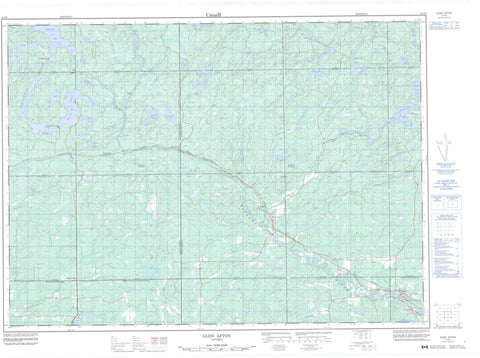
041I09 Glen Afton Canada topo map, 1:50,000 scale
041I09 Glen Afton NRCAN topographic map.
Includes UTM and GPS geographic coordinates (latitude and longitude). This 50k scale map is suitable for hiking, camping, and exploring, or you could frame it as a wall map.
Printed on-demand using high resolution, on heavy weight and acid free paper, or as an upgrade on a variety of synthetic materials.
Topos available on paper, Waterproof, Poly, or Tyvek. Usually shipping rolled, unless combined with other folded maps in one order.
- Product Number: NRCAN-041I09
- Parent Topo: TOPO-041I
- Map ID also known as: 041I09, 41I9, 41I09
- Unfolded Size: Approximately 26" high by 36" wide
- Weight (paper map): ca. 55 grams
- Map Type: POD NRCAN Topographic Map
- Map Scale: 1:50,000
- Geographical region: Ontario, Canada
Neighboring Maps:
All neighboring Canadian topo maps are available for sale online at 1:50,000 scale.
Purchase the smaller scale map covering this area: Topo-041I
Spatial coverage:
Topo map sheet 041I09 Glen Afton covers the following places:
- East Bay - West Bay - Nipissing Ouest - Ragged Chute - Badgerow - Bastedo - Crerar - Dana - Davis - Field - Gibbons - Hagar - Henry - Hobbs - Hugel - Janes - Kelly - Loughrin - McCallum - McNish - McWilliams - Nipissing - Pardo - Ratter - Sudbury - Thistle - Mossman Island - Azen Lake - Banshee Lake - Beavertooth Lake - Blanket Lake - Brownbear Lake - Carafel Lake - Clearview Lake - Dana Lake - Dwyer Lake - Ewart Lake - Ford Lake - Grandmaison Lake - Gwynfa Lake - Hand Lake - Hart Lake - Hen Lake - Henry Lake - Hobbs Lake - Jake Lake - Kennedy Lake - Knowles Lake - Lac des Cèdres - Lac des Îles - Lac Desjardins - Lac Grandmaison - Lac Maskinongé - Lac Murray - Lac Paradis - Lac Sargesson - Lac Thériault - Lac Washagami - Little Long Lake - Lost Lake - Loughrin Lake - Lower Murray Lake - Lynn Lake - Maskinonge Lake - Mud Lake - Murray Lake - Muskosung Lake - Namasang Lake - Pine Lake - Pud Lake - Ratter Lake - Red Cedar Lake - Rocky Lake - Sargesson Lake - Shallowpan Lake - Silver Lake - Sunset Lake - Theriault Lake - Thistle Lake - Washagami Lake - Weedy Lake - Oak Ridges - Caldwell - Field - Hagar - Ratter and Dunnet - Springer - Dana Township Jack Pine Forest Conservation Reserve - Temagami River Provincial Park - Floodwood Chutes - Lavergne Rapids - Azen Creek - Carafel Creek - Chiniguchi River - Chiniguchi River - Deer Creek - Hebert Creek - Henry Creek - Kabikotitwia River - Kiyask River - Lynn Creek - McArty Creek - McNedry Creek - McNish Creek - Murray Creek - Namasang Creek - North Veuve River - Pike River - Rivière Témagami - Silver Creek - Sinton Creek - Sturgeon River - Temagami River - Timagami River - The Elbow - Island Portage - Markstay-Warren - West Nipissing - Ashburton - Azen - Chudleigh - Désaulniers - Field - Glen Afton - River Valley - Rivière Veuve - Washagami


