
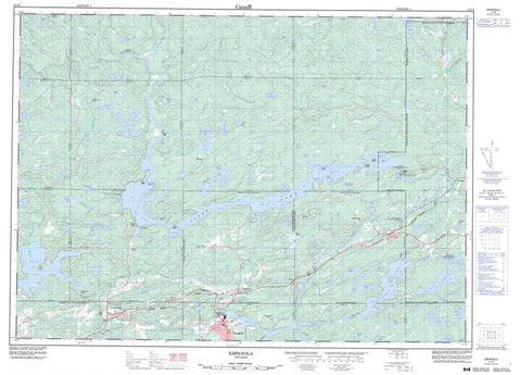
041I05 Espanola Canada topo map, 1:50,000 scale
041I05 Espanola NRCAN topographic map.
Includes UTM and GPS geographic coordinates (latitude and longitude). This 50k scale map is suitable for hiking, camping, and exploring, or you could frame it as a wall map.
Printed on-demand using high resolution, on heavy weight and acid free paper, or as an upgrade on a variety of synthetic materials.
Topos available on paper, Waterproof, Poly, or Tyvek. Usually shipping rolled, unless combined with other folded maps in one order.
- Product Number: NRCAN-041I05
- Parent Topo: TOPO-041I
- Map ID also known as: 041I05, 41I5, 41I05
- Unfolded Size: Approximately 26" high by 36" wide
- Weight (paper map): ca. 55 grams
- Map Type: POD NRCAN Topographic Map
- Map Scale: 1:50,000
- Geographical region: Ontario, Canada
Neighboring Maps:
All neighboring Canadian topo maps are available for sale online at 1:50,000 scale.
Purchase the smaller scale map covering this area: Topo-041I
Spatial coverage:
Topo map sheet 041I05 Espanola covers the following places:
- Bell's Bay - Camp 50 Bay - Espanola Bay - John Creek Bay - Long Bay - McDonald's Bay - Pickerel Bay - Robb's Bay - Sand Bay - Spellman's Cove - Stump Bay - Stumpy Bay - Winding Hill Bay - Picnic Point - Red Pine Point - Rocky Narrows - Wood's Channel - Grand Sudbury - Greater Sudbury - Gordon Chutes - High Falls - Lorne Falls - Nairn Falls - 118 - 119 - Baldwin - Bigelow - Drury - Dunlop - Foster - Gough - Hallam - Harwich - Hyman - Lorne - May - Merritt - Nairn - Porter - Shakespeare - Shibananing - Sudbury - Totten - Trill - Truman - Vernon - Weeks - Bear Island - Beaudoin Island - Coffee Island - East Blueberry Island - Hamilton Island - Hammond Island - High Falls Island - Rock Island - West Blueberry Islands - Agnew Lake - Augusta Lake - Beaver Lakes - Bell Lake - Big Swan Lake - Birch Lake - Boundary Lake - Brady Lake - Brazil Lake - Brunton Lake - Cameron Lake - Camp Eleven Lake - Charles Lake - Coreaux Lake - Ella Lake - Fish Lake - Gordon Lake - Gough Lake - Hammond Lake - Hock Lake - Hunter Lake - Jantti Lake - Jiggy Lake - Karstula Lake - Kerr Lake - Kusti Lake - Lake of the Mountains - Lake Panache - Lily Lake - Little Ella Lake - Little Hunter Lake - Little Swan Lake - Maville Lake - May Lake - McGuey Lake - McLander Lake - Mong Lake - Moon Lake - Nameless Lake - Nazar Lake - O'Brien Lake - Pistin Lake - Pomfrey Lake - Porter Lake - Rock Lake - Ross Lake - Savage Lake - Shiner Pond - Shoreaux Lake - Star Lake - Stony Lake - Streich Lake - Sutherland Lake - Swan Lake - Tenho Lake - Wabagishik Lake - Ward Lake - West Brady Lake - West Cameron Lake - Young's Lake - Headquarters Hill - Prospect Hill - The Haystack - Sudbury - Baldwin - Balfour - Dowling - Drury, Denison and Graham - Hallam - Nairn - Nairn and Hyman - Sables-Spanish Rivers - Salter, May and Harrow - The Spanish River - Victoria - Flat Creek Old Pine Conservation Reserve - Gough Outwash Forest Conservation Reserve - Shakespeare Forest Conservation Reserve - Spanish River Provincial Park - Boswell Rapids - Armstrong Creek - Beaudin Creek - Birch Creek - Blake Creek - Cameron Creek - Crazy Creek - Cutler Creek - Darkie Creek - Flat Creek - Fleck Creek - Gough Creek - Gough Creek - Hunter Creek - Jiggy Creek - John Creek - McLander Creek - Miller Creek - Ministic Creek - Porter Creek - Rivière Vermillion - Spanish River - Sutherland Creek - Vermilion River - Wakonassin River - Wood's Creek - Big Bend - Devil's Elbow - Great Bend - Eagle Rock - Target Rock - Espanola - Waters - Beaver Lake - Drury - High Falls - Lorne - McKerrow - Nairn - Nairn Centre - Prospect Hill - Turbine - Walden - Webbwood - Dixon Marsh - McGregor's Marsh


