
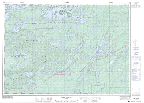
041I03 Lake Panache Canada topo map, 1:50,000 scale
041I03 Lake Panache NRCAN topographic map.
Includes UTM and GPS geographic coordinates (latitude and longitude). This 50k scale map is suitable for hiking, camping, and exploring, or you could frame it as a wall map.
Printed on-demand using high resolution, on heavy weight and acid free paper, or as an upgrade on a variety of synthetic materials.
Topos available on paper, Waterproof, Poly, or Tyvek. Usually shipping rolled, unless combined with other folded maps in one order.
- Product Number: NRCAN-041I03
- Parent Topo: TOPO-041I
- Map ID also known as: 041I03, 41I3, 41I03
- Unfolded Size: Approximately 26" high by 36" wide
- Weight (paper map): ca. 55 grams
- Map Type: POD NRCAN Topographic Map
- Map Scale: 1:50,000
- Geographical region: Ontario, Canada
Neighboring Maps:
All neighboring Canadian topo maps are available for sale online at 1:50,000 scale.
Purchase the smaller scale map covering this area: Topo-041I
Spatial coverage:
Topo map sheet 041I03 Lake Panache covers the following places:
- Archie Bay - Baie Fine - Bay Finn - Beaverstone Bay - Brown's Bay - Collins Inlet - East Bay - East Bay - Grassy Bay - Hunters Bay - Killarney Bay - Kimbell's Bay - Lamorandière Bay - Narrow Bay - Newton's Bay - Northeast Bay - Sawdust Bay - Sawmill Bay - Second Bay - Stony Bay - Taylor Bay - The Pool - Third Bay - Crean Point - Fox Point - Green Point - Potato Point - Burnt Narrows - Rocky Channel - Saginaw Channel - Tyson Channel - Grand Sudbury - Greater Sudbury - Attlee - Bevin - Caen - Carlyle - Dieppe - Goschen - Halifax - Hansen - Humboldt - Killarney - Kilpatrick - Manitoulin - Roosevelt - Rutherford - Sale - Stalin - Sudbury - Travers - Truman - Point Grondine Indian Reserve 3 - Réserve indienne Point Grondine 3 - Réserve indienne Whitefish Lake 6 - Whitefish Lake Indian Reserve 6 - Big Chief Island - Big Mary Island - Birch Island - Breaden's Island - Burnt Island - Chicken Island - Chief Island - Doris Island - Edward Island - Flat Island - Flatfish Island - Forbes Island - Frank Island - Lehman Island - Little Twin Sister Islands - McCalley's Island - Muskie Island - O'Brien's Island - One Tree Island - Philip Edward Island - Round Island - Sentinel Island - Sheep Island - Squaw Island - Sugar Island - West Squaw Island - Yoco Island - A.Y. Jackson Lake - Acid Lake - Amikogaming Lake - Annie Lake - Artist Lake - Attlee Lake - Balsam Lake - Bassoon Lake - Bear Lake - Beaverstone Lake - Beeftea Lake - Bejeau Lake - Bell Lake - Bell Lake - Betty Lake - Bevin Lake - Billy Lake - Bizhiw Lake - Bodina Lake - Boundary Lake - Broker Lake - Brush Camp Lake - Brushcamp Lake - Bunnyrabbit Lake - Burke Lake - Carlyle Lake - Cat Lake - Cat Lake - Cave Lake - Cedar Lake - Chain Lake - Clearsilver Lake - Crooked Lake - Cuckoo Lake - Dan Lake - David Lake - de Lamorandiere Lake - Deacon Lake - Deer Lake - Deer Lake - Duplex Lake - East Howry Lake - Fish Lake - Fox Lake - Frank Lake - Freeland Lake - Gabodin Lake - Gail Lake - Gem Lake - George Lake - Goose Lake - Goschen Lake - Great Mountain Lake - Green Lake - Grey Lake - Grow Lake - Halifax Lake - Harry Lake - Hemlock Lake - Hideaway Lake - High Lake - Horseshoe Lake - Howry Lake - Hunter Lake - Jackdaw Lake - Janes Lake - Johnnie Lake - Julian Lake - Kakakise Lake - Killarney Lake - Kirk Lake - Lake O.S.A. - Lake of the Woods - Lake Panache - Little Bear Lake - Little Bell Lake - Little Gabodin Lake - Little Mink Lake - Little Mountain Lake - Little Sheguiandah Lake - Little Superior Lake - Log Boom Lake - Lone Lake - Lower White Oak Lake - Lumsden Lake - Lyle Lake - Mahzenazing Lake - McDougall Lake - Mill Lake - Mink Lake - Missery Lake - Moose Lake - Muriel Lake - Ned Lake - Nellie Lake - Northeast Lake - Norway Lake - O.S.A. Lake - Otter Lake - Partridge Lake - Patten Lake - Pearl Lake - Peter Lake - Pig Lake - Pike Lake - Proulx Lake - Quartzite Lake - Reef Lake - Ringer Lake - Robinson Lake - Rock Lake - Rocky Lake - Roque Lake - Round Otter Lake - Ruth-Roy Lake - Sandy Lake - Scar Lake - Sealey's Lake - Shigaug Lake - Shingwak Lake - Sill Lake - Silver Lake - Slim Lake - Solomon Lake - Spark Lake - Spoon Lake - Strata Lake - Sturgeon Lake - Sugarbush Lake - Sunfish Lake - Teardrop Lake - Terry Lake - The Tri-Lakes - Three Mile Lake - Threenarrows Lake - Topaz Lake - Trout Lake - Turbid Lake - Turtleback Lake - Tyson Lake - Van Lake - Van Winkle Lake - Wagon Road Lake - Walker Lake - West Tanner Lake - Whiskeyjack Lake - Whitefish Lake - Whiterock Lake - York Lake - Blue Ridge - Cloche Mountains - Gulch Hill - Killarney Peak - Killarney Ridge - La Cloche Mountains - Leadingmark Hill - Northeast Hill - Silver Peak - South La Cloche Mountains - South La Cloche Range - Sudbury - Balfour - Dowling - Drury, Denison and Graham - Howland - Rutherford and George Island - Attlee Central Forest Conservation Reserve - Attlee Conservation Reserve - Killarney Lakelands and Headwaters Provincial Park - Killarney Provincial Park - Annie Creek - Artist Creek - Beaverstone River - Bevin Creek - Billy Creek - Chikanishing River - David Creek - Deacon Creek - Frying Pan Creek - Gabodin Creek - Halifax Creek - Howry Creek - Kakakise Creek - Kirk Creek - Little Beaverstone Creek - Little White Oak Creek - Lyle Creek - Mahzenazing River - North Howry Creek - Pickerel Channel - Scar Creek - Snake Channel - Stinky Creek - Strata Creek - West Mahzenazing River - White Oak Creek - Whitefish River - Wolf Creek - Wolf Creek - Cat Lake Portage - High Portage - Killarney - Northeastern Manitoulin and the Islands - Northeastern Manitoulin and the Islands - Waters - Beaverstone Bay - Collins Inlet - Walden - Cranberry Bog - Proulx Marsh


