
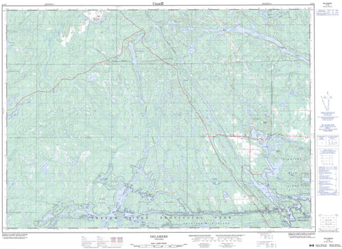
041I02 Delamere Canada topo map, 1:50,000 scale
041I02 Delamere NRCAN topographic map.
Includes UTM and GPS geographic coordinates (latitude and longitude). This 50k scale map is suitable for hiking, camping, and exploring, or you could frame it as a wall map.
Printed on-demand using high resolution, on heavy weight and acid free paper, or as an upgrade on a variety of synthetic materials.
Topos available on paper, Waterproof, Poly, or Tyvek. Usually shipping rolled, unless combined with other folded maps in one order.
- Product Number: NRCAN-041I02
- Parent Topo: TOPO-041I
- Map ID also known as: 041I02, 41I2, 41I02
- Unfolded Size: Approximately 26" high by 36" wide
- Weight (paper map): ca. 55 grams
- Map Type: POD NRCAN Topographic Map
- Map Scale: 1:50,000
- Geographical region: Ontario, Canada
Neighboring Maps:
All neighboring Canadian topo maps are available for sale online at 1:50,000 scale.
Purchase the smaller scale map covering this area: Topo-041I
Spatial coverage:
Topo map sheet 041I02 Delamere covers the following places:
- Bearsden Bay - Bigwood Bay - Bill's Bay - Cow Bay - Crombie Bay - David's Bay - Deer Bay - Dodd Bay - Dry Pine Bay - Eagles Nest - Eighteen Mile Bay - Flowerpot Bay - Fraser Bay - Hartley Bay - Little Moose Bay - Mary's Bay - Ox Bay - Pickerel Bay - Rangers Bay - Rock Bay - Smith Bay - Thompson Bay - Wanapitei Bay - Washpan Bay - X Bay - Crombie Bay Point - Desrochers Point - Canoe Bay Channel - Canoe Channel - Canoe Pass - French River Main Channel - Little Canoe Channel - Main Channel (French River) - McCullam's Narrows - North Channel (French River) - Tug Channel - Western Channel - Western Channel - Western Channel (French River) - Rivière des Français - The Elephants - Bear Chutes - Chute du Récollet - Chutes de Meshaw - Meshaw Falls - Michaud Falls - Recollet Falls - Sturgeon Chutes - Allen - Attlee - Bigwood - Cherriman - Cosby - Cox - Delamere - Halifax - Hoskin - Kilpatrick - Laura - Mason - Mowat - Parry Sound - Servos - Struthers - Sudbury - Travers - Waldie - French River Indian Reserve 13 - Réserve indienne French River 13 - Attwood Island - Bear Island - Big Island - Blueberry Island - Boom Island - Canal Island - Cantin Island - Dead Dog Island - Dispute Island - Duck Island - Eaglenest Island - Eighteen Mile Island - Fifteen Mile Island - Fourmile Island - Fourteen Mile Island - Green Island - Homestead Island - Île des Dix-Huit Milles - Kentucky Club Island - King's Island - Little Pig Island - McDougal Island - Merranger's Island - Nishoda Island - Ox Island - Pig Island - Potvin Island - Smith's Island - Ada Lake - Allen Lake - Attlee Lake - Badger Lake - Band Lake - Bayswater Lake - Beaver Lakes - Beeftea Lake - Big Rae Lake - Birch Lake - Bird Lake - Bouchard Lake - Broker Lake - Campsite Lake - Catfish Lake - Cemetery Lake - Commodore Lake - Courchesne's Lake - Crooked Lake - Daoust Lake - Delamere Lake - Dodd Lake - East Bouchard Lake - Edith Lake - Elbow Lake - Emma Lake - Frances Lake - Gainey Lake - Ham Lake - Hilltop Lake - Hunter Lake - Ink Lake - Judge Lake - Kakakiwaganda Lake - La Casse Lake - Lac à la Truite - Lac Barbotte - Lac Brochet - Lac Clair - Lac Faux-Pas - Lac LaChapelle - Lac Pomerleau - Len Lake - Little Rae Lake - Loon Lake - Lost Lake - Lost Lake - Lovering Lake - Lower Sturgeon Lake - Mears Lake - Naraka Lake - Neilly Lake - Pike Lake - Punch Bowl Lake - Pure Lake - Redgun Lakes - Rock Lake - Round Lake - Ruby Lake - Ruth Lake - Sawmill Lake - Sixbass Lake - Ted Lake - Threebass Lake - Threeway Lake - Trestle Gully Lake - Trout Lake - Twin Lake - Upper Sturgeon Lake - West Tanner Lake - Gibraltar Rock - Montagne Blanche - Cosby and Mason - Cosby, Mason and Martland - Martland - Rutherford and George Island - Attlee Conservation Reserve - Cherriman Township Conservation Reserve - Eighteen Mile Island Wilderness Area - French River Provincial Park - First Rapids - Little Flat Rapids - Little French Rapids - Ouellette Rapids - Petite rivière French - Stony Rapids - Band River - Beeftea Creek - Bird Lake Creek - Cosby Creek - Daoust Creek - Dodd Creek - Eastern Outlet (French River) - French River - French River (Main Outlet) - French River North Channel - Little Beaverstone Creek - Loon Creek - Main Outlet - Main Outlet (French River) - Millerd Creek - Moose Creek - Murdock River - Parent Creek - Pickerel River - Pillow River - Rivière des Français - Rivière Murdock - Rivière Wanapitei - Sucker Creek - Wanapitei River - White Oak Creek - Wolf Creek - Wolf Creek - Lost Child Bend - The Forks - Tinnerman's Rock - French River - Killarney - Northeastern Manitoulin and the Islands - Alban - Bayswater - Bigwood - Bon Air - Burwash - Delamere - Delamere - French River - Hartley Bay - Jamot - Ouellette - Paget - Pickerel River - Porlock - Rutter - Servos


