
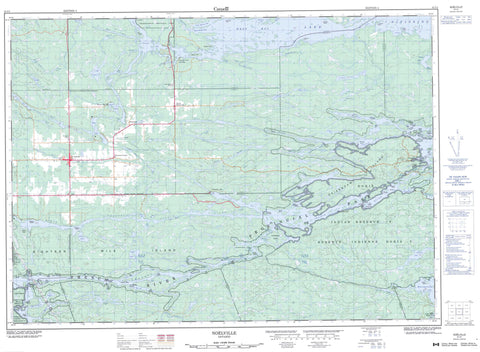
041I01 Noelville Canada topo map, 1:50,000 scale
041I01 Noelville NRCAN topographic map.
Includes UTM and GPS geographic coordinates (latitude and longitude). This 50k scale map is suitable for hiking, camping, and exploring, or you could frame it as a wall map.
Printed on-demand using high resolution, on heavy weight and acid free paper, or as an upgrade on a variety of synthetic materials.
Topos available on paper, Waterproof, Poly, or Tyvek. Usually shipping rolled, unless combined with other folded maps in one order.
- Product Number: NRCAN-041I01
- Parent Topo: TOPO-041I
- Map ID also known as: 041I01, 41I1, 41I01
- Unfolded Size: Approximately 26" high by 36" wide
- Weight (paper map): ca. 55 grams
- Map Type: POD NRCAN Topographic Map
- Map Scale: 1:50,000
- Geographical region: Ontario, Canada
Neighboring Maps:
All neighboring Canadian topo maps are available for sale online at 1:50,000 scale.
Purchase the smaller scale map covering this area: Topo-041I
Spatial coverage:
Topo map sheet 041I01 Noelville covers the following places:
- Ash Bay - Baie Daoust - Balmer Bay - Bark Bay - Bear Bay - Blind Bay - Clearwater Bay - Coté Bay - Daoust Bay - Deer Bay - Deer Bay - Dokis Bay - Five Mile Bay - Fivemile Bay - Grassy Bay - Hammerhead Bay - Horseshoe Bay - Keith's Bay - Lunge Bay - Merganser Bay - North Muskrat Bay - Pine Cove - Restoule Bay - Rogers Bay - Shanty Bay - South Bay - South Muskrat Bay - T Bay - Two Mile Bay - Warren Bay - West Arm - West Arm of Lake Nipissing - West Bay - Wolfe Cove - Wolseley Bay - Arthur Point - Bear Point - Dalton's Point - Deadhog Point - Green Point - Jennings Point - Keso Point - Lafleche Point - Owl Point - Playfair Point - Point Edward - Scott Point - The Elbow - Big Cut - Chaudière Channel - Free Flowing Channel - French River Main Channel - Hay Narrows - Little Chaudière Channel - Little Cut - Main Channel (French River) - North Channel (French River) - Obatiming Channel - Nipissing Ouest - Rivière des Français - Devil's Door - Blue Chute - Devil Chute - Bertram - Blair - Cherriman - Cosby - Falconer - Haddo - Hardy - Latchford - Loudon - Martland - Mason - McConkey - Mowat - Nipissing - Parry Sound - Scollard - Sudbury - Chaudière Dam - Little Chaudière Dam - Dokis 9 - Dokis Indian Reserve 9 - French River Indian Reserve 13 - Réserve indienne Dokis 9 - Réserve indienne French River 13 - Bark Islands - Big Bluff Island - Boom Island - Bosworth Island - Burnt Island - Cantin Island - Caulkins Island - Commanda Island - Concord Island - Coté Island - Cross Island - Deremo Island - Double Rapid Island - Double Rapids Island - Eighteen Mile Island - Elizabeth Island - Evergreen Island - Fire Island - George Island - Georgia Island - Green Island - Gull Island - Hale Island - Half Island - Hall Island - Haystack Islands - Huntington Island - Île des Dix-Huit Milles - Jeune Mariée Island - Kervins Island - Keso Island - Loftus Island - Martin Island - Miller Island - Okikendawt Island - Page Island - Parisien Island - Pine Island - Pineknot Island - Rainy Island - Rock Island - Shields Island - Squaw Island - The Ducks - Three Sisters Islands - Umbrella Island - Weldon Island - Wigwam Islands - Wright Island - Bark Lake - Bark Lake - Bear Lake - Byrne Lake - Doe Lake - Ethier Lake - Frank Lake - Haddo Lake - Island Lake - Jack Lake - Lac à la Truite - Lac Brulé - Lac Chauvin - Lac Menard - Lac Nipissing - Lac Viau - Lake Nipissing - Lower Haddo Lake - Lower Jack Lake - Marshall Lake - Memesagamesing Lake - Mercer Lake - Monet Lake - Number Four Lake - Number One Lake - Number Three Lake - Number Two Lake - Pike Lake - Pine Lake - Playfair Lake - Porcupine Lake - Portage Lake - Rabbit Lake - Redpine Lake - Trout Lake - Woodcock Lake - Caldwell - Casimir, Jennings and Appleby - Cosby and Mason - Cosby, Mason and Martland - Field - Martland - Springer - Cherriman Township Conservation Reserve - Eighteen Mile Island Wilderness Area - French River Provincial Park - Mashkinonje Provincial Park - Northern McConkey Conservation Reserve - Big Parisien Rapids - Big Parisien Rapids - Big Pine Rapids - Cedar Rapids - Crooked Rapids - Double Rapids - Five Finger Rapid - Five Finger Rapids - Five Mile Rapids - Fivemile Rapids - Little Parisien Rapids - Little Parisien Rapids - Little Pine Rapids - Lower Chaudiere Rapids - The Ladder - Upper Chaudiere Rapids - Amateewakea River - Birch Creek - Blaney Creek - Cosby Creek - French River North Channel - Haddo Creek - Hall River - Hardy Creek - Jack Creek - Little French River - Memesagamesing River - Muskrat Creek - Number One Creek - Number Two Creek - Pickerel River - Pine River - Porcupine Creek - Porcupine Creek - Redpine Creek - Restoule River - Sucker Creek - Wolf River - Wolseley River - French River - St.-Charles - West Nipissing - Chartrand Corner - Dokis - Dokis - Lunge Lodge - Monetville - Noelville - Noëlville - North Monetville - Ouellette - Shanty Bay - Sucker Creek Landing - West Arm - Wolseley Bay


