
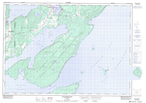
041H12 Manitowaning Canada topo map, 1:50,000 scale
041H12 Manitowaning NRCAN topographic map.
Includes UTM and GPS geographic coordinates (latitude and longitude). This 50k scale map is suitable for hiking, camping, and exploring, or you could frame it as a wall map.
Printed on-demand using high resolution, on heavy weight and acid free paper, or as an upgrade on a variety of synthetic materials.
Topos available on paper, Waterproof, Poly, or Tyvek. Usually shipping rolled, unless combined with other folded maps in one order.
- Product Number: NRCAN-041H12
- Parent Topo: TOPO-041H
- Map ID also known as: 041H12, 41H12
- Unfolded Size: Approximately 26" high by 36" wide
- Weight (paper map): ca. 55 grams
- Map Type: POD NRCAN Topographic Map
- Map Scale: 1:50,000
- Geographical region: Ontario, Canada
Neighboring Maps:
All neighboring Canadian topo maps are available for sale online at 1:50,000 scale.
Purchase the smaller scale map covering this area: Topo-041H
Spatial coverage:
Topo map sheet 041H12 Manitowaning covers the following places:
- Back Cove - Baie Georgienne - Charlton Bay - Club Harbour - Eagle's Nest Bay - Frood's Harbour - Froude Bay - Georgian Bay - James Bay - Leask Bay - Leason Bay - Leeson Bay - Long Gut - Manitowaning Bay - North Cove - Rattlesnake Harbour - Redcliff Bight - Roberts Bay - Sandfield Bay - Shallow Cove - Sims Bay - South Bay - Stephens Cove - Tamarack Cove - Tamarack Harbour - Thomas Bay - Turtle Creek Bay - Wanoshkang Bay - Kaboni Beach - Nabakwaneing - Wababikok - Beach Point - Benson Point - Brennan's Point - Clark's Point - Fishery Point - Harcus Point - Horsburgh Point - Hungerford Point - Leask Point - Maple Point - Narrow Point - Northeast Point - Pond Point - Rattlesnake Point - South Point - South Spit - Stony Point - Tamarack Point - Thomas Point - Erie Channel - Owen Channel - The Narrows - Clay Cliff - Gibraltar Cliff - Little Bluff - South Bluff - White Cliff - Assiginack - Manitoulin - Sandfield - Tehkummah - Réserve indienne Wikwemikong Unceded 26 - Wikwemikong Unceded 26 - Wikwemikong Unceded Indian Reserve 26 - Club Island - Erie Shingle - Fanny Island - Fitzwilliam Island - Little Island - Lonely Island - Manitoulin Island - Maple Island - Mayflower Island - Owen Island - Rabbit Island - Sims Island - Wall Island - Kadiginebik Lake - Lac Huron - Lake Huron - Lake Manitou - Mitigonaganing Lake - Quanja Lake - Redrock Lake - Sucker Lake - Burnt Summit - Church Hill - Copper Rock - Fossil Hill - Horsburgh Hill - The Rock - Assiginack - Carnarvon - Central Manitoulin - Howland - Sandfield - Tehkummah - Blue Jay Creek - Kaboni Creek - Manitou River - Rogers Creek - Wakwagami Creek - Acre Shoal - Beach Point Flat - Channel Rock - Club Island Ledge - Erie Bank - Glycerine Rock - Grantham Shoal - North Reef - Owen Island Bank - Pope Rock - Rabbit Island Bank - Ship Bank - Stewart Rock - The Ridge - The Wall - Todman Reef - Vigilant Rock - West Flat - Northeastern Manitoulin and the Islands - Clover Valley - Eagles Nest - Hilly Grove - Kaboni - Manitowaning - Sandfield - Squirrel Town - The Slash - Two O'Clock - Wikwemikongsing - Wikwemikonsing


