
041H10 Naiscoot River Canada topo map, 1:50,000 scale
041H10 Naiscoot River NRCAN topographic map.
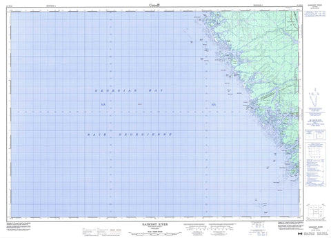
Includes UTM and GPS geographic coordinates (latitude and longitude). This 50k scale map is suitable for hiking, camping, and exploring, or you could frame it as a wall map.
Printed on-demand using high resolution, on heavy weight and acid free paper, or as an upgrade on a variety of synthetic materials.
Topos available on paper, Waterproof, Poly, or Tyvek. Usually shipping rolled, unless combined with other folded maps in one order.
- Product Number: NRCAN-041H10
- Parent Topo: TOPO-041H
- Map ID also known as: 041H10, 41H10
- Unfolded Size: Approximately 26" high by 36" wide
- Weight (paper map): ca. 55 grams
- Map Type: POD NRCAN Topographic Map
- Map Scale: 1:50,000
- Geographical region: Ontario, Canada
Neighboring Maps:
All neighboring Canadian topo maps are available for sale online at 1:50,000 scale.
Purchase the smaller scale map covering this area: Topo-041H
Spatial coverage:
Topo map sheet 041H10 Naiscoot River covers the following places:
- Alexander Inlet - Baie Georgienne - Bayfield Harbour - Bayfield Inlet - Bayfield Inlet - Burritts Bay - Charles Inlet - Georgian Bay - Kenerick Bay - Laura Bay - LeBlanc Bay - Nares Inlet - Nares Inlet - Norgate Inlet - Pointe au Baril Harbour - Prisque Bay - Gibraltar Point - Hangdog Point - Long Point - Lookout Point - MacKenzie Point - McReynolds Point - Nares Point - Oldham Point - Ragged Point - Thelma Point - Alexander Passage - Chicken Liver Channel - Whitefish Channel - Harrison - Parry Sound - Wallbridge - Magnetawan Indian Reserve 1 - Naiscoutaing Indian Reserve 17A - Réserve indienne Magnetawan 1 - Réserve indienne Naiscoutaing 17A - Bayfield Island - Bedwell Island - Bellebay Island - Big Burnt Island - Black Bill Islands - Black Island - Bon Ami Island - Bourchier Islands - Brooker Islands - Burritts Island - Bushy Island - Choctaw Island - Clontarf Island - Cow Island - Cratloe Island - Danny Island - Day Island - Dorothy Island - Duffy Island - Duquesne Island - Elm Tree Island - Fishery Island - Foster Island - Francis Island - Fredericksruhe Island - Gereaux Island - Gerry Island - Gibraltar Island - Gooch Island - Hangdog Island - Harbottle Island - Harbour Islands - Head Island - Inside Head Island - Irving Island - Isabel Island - Isle of Pines - Jarrad Island - Jean Island - Keneu Island - Lampey Island - Landing Island - Leith Island - Leland Island - Lisnacloon Island - Lookout Island - Marjorie Island - Meneilly Island - Minwabin Island - O'Brien Islands - Olga Island - Olwyn Island - Raft Island - Redleg Island - Risley Island - Rock Island - Tug Island - Umwah Island - Wasson Island - Woodlands Island - Big Lake - Giroux Lake - Lac Huron - Lake Huron - The Archipelago - Giroux River - Hangdog Channel - Mud Channel - Naiscoot River - Naiscoot River Middle Channel - Naiscoot River North Channel - Naiscoot River South Channel - Alberta Rock - Armstrong Rocks - Athabasca Rock - Augusta Rock - Baker Rocks - Black Rock - Burton Bank - Challenger Rock - Coghlan Reef - Corner Rock - Dart Rock - Doran Rock - Eagle Reef - Garnet Rock - Garnet Rocks - Hangdog Bank - Hangdog Reef - Harbour Reef - Haslewood Bank - Heart Bank - Imperial Bank - Kennedy Bank - Laird Rock - Laird Rocks - Lindsay Rock - Magnetawan Ledges - Magpie Rocks - McHugh Rock - McKenney Reef - Meaford Shoal - Mercier Rock - Morden Rock - Nares Ledge - Norgate Rock - Norgate Rocks - North Reef - Old Tower Rocks - Oliver Rock - Red Rock - Sarah Rock - Snap Rock - Sophia Rock - South Reef - Southeast Rock - Sylvia Rock - The Brothers - The Sisters - Tizard Rock - Triton Rock - Vail Rock - Wolsley Rock - Bayfield - Bayfield Inlet - Georgian Inlet - Pointe au Baril


