
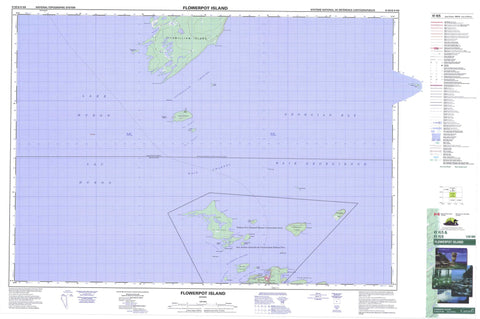
041H05 Flowerpot Island Canada topo map, 1:50,000 scale
041H05 Flowerpot Island NRCAN topographic map.
Includes UTM and GPS geographic coordinates (latitude and longitude). This 50k scale map is suitable for hiking, camping, and exploring, or you could frame it as a wall map.
Printed on-demand using high resolution, on heavy weight and acid free paper, or as an upgrade on a variety of synthetic materials.
Topos available on paper, Waterproof, Poly, or Tyvek. Usually shipping rolled, unless combined with other folded maps in one order.
- Product Number: NRCAN-041H05
- Parent Topo: TOPO-041H
- Map ID also known as: 041H05, 41H5, 41H05
- Unfolded Size: Approximately 26" high by 36" wide
- Weight (paper map): ca. 55 grams
- Map Type: POD NRCAN Topographic Map
- Map Scale: 1:50,000
- Geographical region: Ontario, Canada
Neighboring Maps:
All neighboring Canadian topo maps are available for sale online at 1:50,000 scale.
Purchase the smaller scale map covering this area: Topo-041H
Spatial coverage:
Topo map sheet 041H05 Flowerpot Island covers the following places:
- Baie Georgienne - Beachy Cove - Big Tub Harbour - Boat Harbour - China Cove - Cove Island Harbour - Dunks Bay - Eagle Cove - Georgian Bay - Laronde's Harbour - Little Cove - Little Dunks Bay - Little Tub - Little Tub Harbour - Shoal Bight - Southwest Arm - Tecumseh Cove - Tobermory Harbour - Wild Bight - Bruce Peninsula - Channel Point - Dunks Point - Eagle Point - Gat Point - Gig Point - Indian Harbour Point - Lighthouse Point - McCarthy Point - Middle Point - North Point - Northeast Point - Pavement Point - Phoebe Point - The Castle - The Knob - Wreck Point - Yeo Spit - Boat Passage - Cape Hurd Channel - Devil Island Channel - Fitzwilliam Channel - Lucas Channel - Macgregor Channel - Main Channel - North Channel - The Gut - Yeo Channel - Bruce - Manitoulin - Bears Rump Island - Cove Island - Devil Island - Doctor Island - Echo Island - Fitzwilliam Island - Flowerpot Island - Halfmoon Island - Harbour Island - James Island - Lucas Island - Middle Island - North Otter Island - Perseverance Island - Peters Island - Russel Island - Snake Island - South Otter Island - Turning Island - Williscroft Island - Yeo Island - Lac Huron - Lake Huron - Black Summit - Bruce - Eastnor - Howland - Lindsay - Northern Bruce Peninsula - St. Edmunds - Bruce Peninsula National Park of Canada - Cyprus Lake Provincial Park - Fathom Five National Marine Park of Canada - Fathom Five Provincial Park - Parc marin national du Canada Fathom Five - Parc national du Canada de la Péninsule-Bruce - Anderson Ledge - Bad Neighbour - Bad Neighbour Rock - Bears Rump Shoal - Brown Ledge - Confiance Rock - Cove Island Ground - East Sister - East Sister Patch - Emily Maxwell Reef - Fagan Ground - Flowerpots - Flummerfelt Patch - Gat Point Reef - Gourdeau Patch - Great Barrier - Greenfield Shoal - Indian Harbour Reef - James Reef - Kilroy Patch - Little Rock - Lucas Reef - Manitoba Ledge - McCarthy Point Ledge - McElhinney Ground - McLelan Rock - Middle Bank - Moorhouse Patch - Northwest Bank - O'Brien Patch - Rixon Rock - Russel Reef - Smith Rock - Snake Island Bank - Southwest Bank - Tilton Reef - West Sister - West Sister Patch - White Rock - White Shingle - Northeastern Manitoulin and the Islands - Tobermory


