
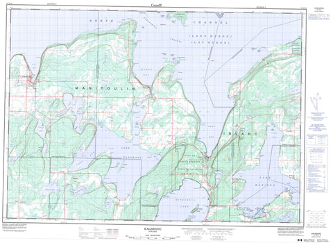
041G16 Kagawong Canada topo map, 1:50,000 scale
041G16 Kagawong NRCAN topographic map.
Includes UTM and GPS geographic coordinates (latitude and longitude). This 50k scale map is suitable for hiking, camping, and exploring, or you could frame it as a wall map.
Printed on-demand using high resolution, on heavy weight and acid free paper, or as an upgrade on a variety of synthetic materials.
Topos available on paper, Waterproof, Poly, or Tyvek. Usually shipping rolled, unless combined with other folded maps in one order.
- Product Number: NRCAN-041G16
- Parent Topo: TOPO-041G
- Map ID also known as: 041G16, 41G16
- Unfolded Size: Approximately 26" high by 36" wide
- Weight (paper map): ca. 55 grams
- Map Type: POD NRCAN Topographic Map
- Map Scale: 1:50,000
- Geographical region: Ontario, Canada
Neighboring Maps:
All neighboring Canadian topo maps are available for sale online at 1:50,000 scale.
Purchase the smaller scale map covering this area: Topo-041G
Spatial coverage:
Topo map sheet 041G16 Kagawong covers the following places:
- Bass Bay - Bass Creek Bay - Ben's Bay - Cannard's Bay - Corbier Cove - Donaldson's Bay - Ednie's Bay - Gibraltar Bay - Gore Bay - Green Bay - Honeymoon Harbour - Honora Bay - Horseshoe Bay - Jump's Bay - Kotcamp's Bay - Long Bay - Maggy's Bay - Martin's Bay - Moody Bay - Mud Bay - Mudge Bay - Newby's Bay - North East Harbour - Oakes Cove - Patterson's Bay - Priors Bay - Rushy Cove - Sandy Bay - Sandy Cove - Schut's Bay - Settler's Bay - Sidney Cox Bay - Silver Bay - Sounding Cove - Spring Bay - Timberlane Bay - Turner Cove - Twin Harbours - West Bay - West Bay - Birch Point - Brandow Point - Brandow's Point - Chisholm's Point - Collin's Point - Deer Point - Doc Smith's Point - Duff's Point - Dutchman Head - Ednie's Point - Francis Point - Freer Point - Gorrel Point - Grable's Point - Gramble's Point - Gray Point - Hartley's Point - Honora Point - Janet Head - Jeanna's Point - Jessie Point - Johnny's Point - Johnson Point - Kerr's Point - King's Point - Knoll's Point - Maple Point - Maple Point - Mary Ann Point - Mowat Point - Oakes Point - Panet Point - Pierce's Point - Sextant Point - South Spit - Tamarack Point - Tennents Point - Tennent's Point - The Ridge - Thompson's Point - Town Point - Trudeau Point - North Channel - The Narrows - Whitefish Channel - West Bluff - White Rock - Bridal Veil Falls - Allan - Assiginack - Bidwell - Billings - Campbell - Carnarvon - Gordon - Howland - Manitoulin - Mills - Sandfield - M'Chigeeng 22 - Réserve Indienne 22 M'Chigeeng - Réserve indienne Sucker Creek 23 - Réserve indienne West Bay 22 - Sucker Creek Indian Reserve 23 - West Bay Indian Reserve 22 - Bass Island - Bass Island - Battleship Island - Bear Island - Beverly Island - Burbidge Island - Clapperton Island - Gooseberry Island - Grass Island - Gull Island - Kakawaie Island - Little Grass Island - Little Island - Little Island - Lone Tree Island - Manitoulin Island - McCracken's Island - Meredith Island - Mowat Island - Roper Island - Seagull Island - Taché Island - The Tooth - Treasure Island - Trudeau Island - Wabos Island - Wabosons Island - Archie's Lake - Big Lake - Ice Lake - Kagawong Lake - Kiln Lake - Lake Kagawong - Lake Manitou - Lake Wolsey - Long Lake - Manitou Lake - Mindemoya Lake - Mud Lake - Nameless Lake - Oakes Lake - Otter Lake - Perch Lake - Saigeohn Lake - Saugigansing Lake - Stone's Lake - Tobacco Lake - Whitefish Lake - Badgerow Hill - Cathedral Rock - Cup and Saucer - East Bluff - High Hill - Jerusalem Hill - Maple Bluff - Assiginack - Billings - Burpee - Burpee and Mills - Carnarvon - Central Manitoulin - Gordon - Howland - Sandfield - Badgerow Creek - Barr's Creek - Bass Creek - Clapperton Channel - Kagawong River - Moody Creek - Mud Creek - Perch Creek - Robertson Creek - Scott's Creek - Boulder Bank - Burgess Reef - Doc Owen Shoal - Eleven Foot Rock - Foster Bank - James Foote Patch - Kittiwake Rock - Little IslandBank - Martin Reef - McInnes Bank - McRae Patch - Meredith Rock - Middle Bank - North Shoal - Red Rock - Roper's Shoal - Spring Shoal - Straubenzee Reef - Sunken Island - Sutherland Shoal - Taché Island Reef - Gore Bay - Northeastern Manitoulin and the Islands - Northeastern Manitoulin and the Islands - Advance - Advance - Bass Creek - Billings - Bowser's Corner - Cold Springs - Excelsior - Gibraltar - Green Bay - Honora - Ice Lake - Kagawong - Long Bay - Magawong Village - Perivale - Pleasant Valley - Poplar - Rockville - Tobacco Lake - West Bay - Blueberry Marsh - Cranberry Marsh


