
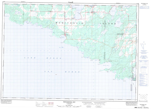
041G09 Providence Bay Canada topo map, 1:50,000 scale
041G09 Providence Bay NRCAN topographic map.
Includes UTM and GPS geographic coordinates (latitude and longitude). This 50k scale map is suitable for hiking, camping, and exploring, or you could frame it as a wall map.
Printed on-demand using high resolution, on heavy weight and acid free paper, or as an upgrade on a variety of synthetic materials.
Topos available on paper, Waterproof, Poly, or Tyvek. Usually shipping rolled, unless combined with other folded maps in one order.
- Product Number: NRCAN-041G09
- Parent Topo: TOPO-041G
- Map ID also known as: 041G09, 41G9, 41G09
- Unfolded Size: Approximately 26" high by 36" wide
- Weight (paper map): ca. 55 grams
- Map Type: POD NRCAN Topographic Map
- Map Scale: 1:50,000
- Geographical region: Ontario, Canada
Neighboring Maps:
All neighboring Canadian topo maps are available for sale online at 1:50,000 scale.
Purchase the smaller scale map covering this area: Topo-041G
Spatial coverage:
Topo map sheet 041G09 Providence Bay covers the following places:
- Big Bay - Carter Bay - Dean Bay - Dean Bay - Deans Bay - Dominion Bay - Hughson Bay - Jenkins Bay - Little Deans Bay - Lonely Bay - Lougheed Bay - Lougheeds Bay - Love's Cove - McKim Bay - Melville Bay - Michael Bay - Michael's Bay - Monkhouse Bay - Pirate's Cove - Providence Bay - Rathbun Bay - Sand Bluffs Bay - Shrigley Bay - South Bay - Spring Bay - Square Bay - Srigley Bay - Timber Bay - Birch Point - Black Rock - Dean Spit - Dominion Point - Galbraith Point - Hammond Point - Hare's Creek Point - Jenkins Point - Lonely Point - Lougheed Point - Lougheeds Point - McGaw Point - Melville Point - Michael Point - Michael's Point - Milton Point - Mutchmor Point - Mutchmore Point - Providence Point - Rathbun Point - Simcoe Point - Tracy's Point - Volunteer Spit - Walker Point - West Melville Point - Assiginack - Campbell - Carnarvon - Manitoulin - Mills - Sandfield - Tehkummah - Réserve indienne Wikwemikong Unceded 26 - Wikwemikong Unceded Indian Reserve 26 - Maiden Island - Manitoulin Island - Big Lake - Clam Ponds - Dace Lake - Deer Lake - Douglas Lake - Lac Huron - Lake Huron - Long Lake - Marsh Lake - Martin Lake - Mindemoya Lake - Owl Lake - Pine Lake - Poole Lake - Rock Lake - Sand Lakes - Smoky Hollow Lake - Snow Lake - South Pine Lake - White's Lake - Windfall Lake - The Sand Bluffs - Assiginack - Burpee - Burpee and Mills - Carnarvon - Central Manitoulin - Howland - Sandfield - Tehkummah - Blue Jay Creek Provincial Park - Black Creek - Blue Jay Creek - Dewar's Creek - Grimsthorpe Creek - Hare's Creek - Hughson Creek - Jenkins Creek - Manitou River - Mindemoya River - Scott's Creek - Shrigley Creek - Timber Bay Creek - Advance Reef - Buckeye Shoal - Chisholm Shoal - Everett Reefs - Genesta Bank - Inkster Rock - Lougheed Reef - Milton Reef - Red Dan Reef - Red Dan Rock - Scotchie Reef - Simcoe Bank - Timber Bay Shoal - Wallace Rock - Northeastern Manitoulin and the Islands - Northeastern Manitoulin and the Islands - Big Lake - Britainville - Dryden's Corner - Grimsthorpe - Michael Bay - Michael's Bay - Mindemoya - Monument Corner - Old Spring Bay - Providence Bay - Snowville - South Baymouth - Spring Bay - Tehkummah


