
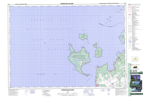
041A16 Christian Island Canada topo map, 1:50,000 scale
041A16 Christian Island NRCAN topographic map.
Includes UTM and GPS geographic coordinates (latitude and longitude). This 50k scale map is suitable for hiking, camping, and exploring, or you could frame it as a wall map.
Printed on-demand using high resolution, on heavy weight and acid free paper, or as an upgrade on a variety of synthetic materials.
Topos available on paper, Waterproof, Poly, or Tyvek. Usually shipping rolled, unless combined with other folded maps in one order.
- Product Number: NRCAN-041A16
- Parent Topo: TOPO-041A
- Map ID also known as: 041A16, 41A16
- Unfolded Size: Approximately 26" high by 36" wide
- Weight (paper map): ca. 55 grams
- Map Type: POD NRCAN Topographic Map
- Map Scale: 1:50,000
- Geographical region: Ontario, Canada
Neighboring Maps:
All neighboring Canadian topo maps are available for sale online at 1:50,000 scale.
Purchase the smaller scale map covering this area: Topo-041A
Spatial coverage:
Topo map sheet 041A16 Christian Island covers the following places:
- Baie de Sable - Baie du Tonnerre - Baie Georgienne - Big Sand Bay - Georgian Bay - Kettle's Bay - Little Sand Bay - Methodist Bay - Nottawasaga Bay - Salt Cove - Salt Harbour - Sandy Bay - Sandy Bay - Sandy Cove - South Bay - Southwest Harbour - Thunder Bay - West Sand Bay - Whitefish Bay - Bar Point - Bayly Point - Black Rock Point - Blue Point - Cedar Point - Charity Point - Daly Point - Faith Point - Hardhead Point - Hayter Point - Hoar Point - Lighthouse Point - Little Beckwith - Marks Point - Mayne Point - Menague Point - Methodist Point - Monague Point - Motton Point - Parker Point - Pointe Méthodiste - Shoal Point - South Point - Stoney Point - Thunder Point - Todd Point - Variation Point - Ways Point - Whitefish Point - Christian Channel - Hope Channel - Sand Cliff - Muskoka - Simcoe - Tiny - Christian Island 30 - Christian Island 30A - Christian Island Indian Reserve 30 - Christian Island Indian Reserve 30A - Réserve indienne Christian Island 30 - Réserve indienne Christian Island 30A - Beckwith Island - Christian Island - Giants Tomb Island - Gray Island - Hope Island - Île au Géant - Île aux Chrétiens - Île Ronde - Île Travers - Little Christian Island - Little Island - North Watcher Island - Pine Islands - South Watcher Island - Southeast Wooded Pine Island - Stoney Island - Stoney Islands - The Watchers - Douglas Lake - Jerry's Lake - Lac Huron - Lake Huron - Macey Lake - The Tomb - Muskoka - Simcoe - Georgian Bay - Tiny - Awenda Provincial Park - Anchor Rock - Bennet Bank - Campana Shoal - Fawkes Rock - Grace Bank - Grieve Rock - Lottie Wolf Rock - Quai des Roches - Single Rock - Spain Rock - Table Rocks - Watcher Reef - Baie-du-Tonnerre - Cedar Point - Christian Island - Georgian Highlands - Kingswood Acres - Lafontaine - Laurin - Pointe-aux-Cèdres - Randolph - Sand Castle Beach - Silver Birch Beach - Thunder Beach


