
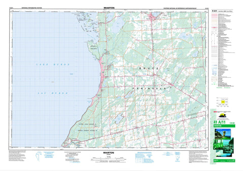
041A11 Wiarton Canada topo map, 1:50,000 scale
041A11 Wiarton NRCAN topographic map.
Includes UTM and GPS geographic coordinates (latitude and longitude). This 50k scale map is suitable for hiking, camping, and exploring, or you could frame it as a wall map.
Printed on-demand using high resolution, on heavy weight and acid free paper, or as an upgrade on a variety of synthetic materials.
Topos available on paper, Waterproof, Poly, or Tyvek. Usually shipping rolled, unless combined with other folded maps in one order.
- Product Number: NRCAN-041A11
- Parent Topo: TOPO-041A
- Map ID also known as: 041A11, 41A11
- Unfolded Size: Approximately 26" high by 36" wide
- Weight (paper map): ca. 55 grams
- Map Type: POD NRCAN Topographic Map
- Map Scale: 1:50,000
- Geographical region: Ontario, Canada
Neighboring Maps:
All neighboring Canadian topo maps are available for sale online at 1:50,000 scale.
Purchase the smaller scale map covering this area: Topo-041A
Spatial coverage:
Topo map sheet 041A11 Wiarton covers the following places:
- Chiefs Point Bay - Colpoy Bay - Colpoys Bay - Colpoy's Bay - Frenchman Bay - Jordan Bay - Regatta Bay - Sauble Beach - Bruce Peninsula - Chiefs Point - Frenchman Point - Hawks Nest Point - Preacher's Point - Rutherford Point - Sylvan Point - Smokehouse Channel - Sauble Falls - Amabel - Arran - Bruce - Derby - Grey - Keppel - Saugeen - Chief's Point 28 - Chief's Point Indian Reserve 28 - Réserve indienne Chief's Point 28 - Réserve indienne Saugeen 29 - Réserve indienne Saugeen and Cape Croker Fishing Islands 1 - Saugeen 29 - Saugeen and Cape Croker Fishing Islands Indian Reserve 1 - Saugeen Indian Reserve 29 - Bowes Island - Cigar Island - Cranberry Island - Cranberry Island - Cranberry Island - Cranberry Island - Fishing Islands - Frog Island - Indian Island - Indian Island - Jack Island - Kid Island - Lonely Island - Main Station Island - Montrose Island - Oar Island - Rabbit Island - Rock Haven Island - Rock Island - Rowan's Island - Rowdy Island - Rownes Island - Scotch Bonnet Island - Smokehouse Island - Sunset Island - The Jacks - Twin Island - Vimy Island - Whiskey Island - Whisky Island - Whitefish Island - Wildman's Island - Arran Lake - Bass Lake - Boat Lake - Carson Lake - Chesley Lake - Francis Lake - Gould Lake - Lac Huron - Lake Huron - Manchester Lake - Mary Lake - Maryville Lake - McNab Lake - McNab Ponds - Mountain Lake - Mud Lake - Scale Lake - Shallow Lake - Shepherd Lake - Silver Lake - Spry Lake - Town Line Lake - Bruce - Grey - Albemarle - Amabel - Arran - Arran-Elderslie - Derby - Elderslie - Georgian Bluffs - Keppel - Sarawak - Saugeen - Sauble Falls Provincial Park - Arkwright Creek - Cashore Creek - Clavering Creek - Davidson Creek - Gleason Brook - Hepworth Creek - Indian Channel - Main Station Channel - Park Head Creek - Pottawatomi River - Rankin River - Sable River - Sauble River - Saugeen River - Spring Creek - Stoney Creek - Chantry Shoal - Lambert Shoal - Lee Bank - Saugeen Shores - South Bruce Peninsula - Allenford - Alvanley - Chippawa Hill - Clavering - Copperkettle - Cruickshank - Elsinore - Hepworth - Jackson - Kilsyth - Oliphant - Park Head - Sauble Beach - Sauble Beach North - Sauble Beach South - Sauble Falls - Scotch Settlement - Shallow Lake - Shouldice - Skipness - Southampton - Tolmie - Wiarton - Wolseley - Zion - Playford Flats - Skinner's Marsh - The Long Swamp


