
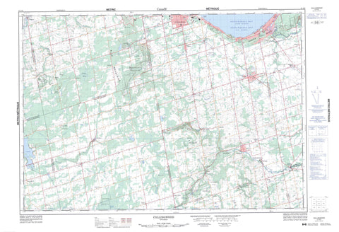
041A08 Collingwood Canada topo map, 1:50,000 scale
041A08 Collingwood NRCAN topographic map.
Includes UTM and GPS geographic coordinates (latitude and longitude). This 50k scale map is suitable for hiking, camping, and exploring, or you could frame it as a wall map.
Printed on-demand using high resolution, on heavy weight and acid free paper, or as an upgrade on a variety of synthetic materials.
Topos available on paper, Waterproof, Poly, or Tyvek. Usually shipping rolled, unless combined with other folded maps in one order.
- Product Number: NRCAN-041A08
- Parent Topo: TOPO-041A
- Map ID also known as: 041A08, 41A8, 41A08
- Unfolded Size: Approximately 26" high by 36" wide
- Weight (paper map): ca. 55 grams
- Map Type: POD NRCAN Topographic Map
- Map Scale: 1:50,000
- Geographical region: Ontario, Canada
Neighboring Maps:
All neighboring Canadian topo maps are available for sale online at 1:50,000 scale.
Purchase the smaller scale map covering this area: Topo-041A
Spatial coverage:
Topo map sheet 041A08 Collingwood covers the following places:
- Back Bay - Baie Georgienne - Georgian Bay - Nottawasaga Bay - Wasaga Beach - The Caves - Lavender Falls - Artemesia - Collingwood - Dufferin - Euphrasia - Grey - Melancthon - Mulmur - Nottawasaga - Osprey - Simcoe - Sunnidale - Tosorontio - One Tree Island - Brewster Lake - Brewster's Lake - Davidson's Lake - Dey's Pond - Duncan Lake - Edward Lake - Eugenia Lake - Glen Huron Pond - Jack Lake - Jacks Lake - Lake Huron - Perry's Pond - Beacon's Rock - Black Bank Hill - Blue Mountains - Corn Hill - Lavender Hill - McKinney's Hill - Mitchell's Hill - Mulmur Hills - Osler Bluff - Ten Hill - Dufferin - Grey - Simcoe - Adjala-Tosorontio - Artemesia - Clearview - Collingwood - Euphrasia - Grey Highlands - Melancthon - Mulmur - Nottawasaga - Osprey - Sunnidale - Devil's Glen Provincial Park - Duncan Escarpment Provincial Nature Reserve - Noisy River Provincial Nature Reserve - Nottawasaga Lookout Provincial Nature Reserve - Pretty River Valley Provincial Park - Wasaga Beach Provincial Park - Batteaux Creek - Batteaux River - Beaver River - Black Ash Creek - Black's Creek - Coates Creek - Flesherton Creek - Indian Brook - Kolapore Creek - Kolapore Creek - Lamont Creek - Leys Burn - Lisle Creek - Little Beaver River - Mad River - McIntyre Creek - Mill Creek - Mitchell Creek - Mitchell Creek - Mitchell's Creek - Mitchell's Creek - Mud Creek - Noisy River - Nottawasaga River - Pretty River - Priddle Creek - Saugeen River - Silver Creek - Walker's Creek - Warrington Creek - The Oxbow - Metcalfe Rock - Pine Rock - Blue Mountains - Collingwood - Wasaga Beach - Airlie - Avening - Badjeros - Banda - Banks - Batteaux - Bowers Beach - Brocks Beach - Cashtown - Cashtown Corners - Castle Glen Estates - Creemore - Duncan - Dunedin - Duntroon - Feversham - Gibraltar - Glen Huron - Glencairn - Hatherton - Heathcote - Jack Lake - Kolapore - Lady Bank - Lavender - Little Germany - Mair Mills - Maple Valley - Maxwell - McIntyre - McMurchy Settlement - Nottawa - Oakview Beach - Oxbow Park - Port Law - Pretty River Valley - Randwick - Ravenna - Red Wing - Rob Roy - Rock Mills - Singhampton - Smithdale - Springhurst Beach - Stayner - Sunnidale Corners - Wareham - Websterville - Beaver Valley - Devils Glen - Pretty River Valley - The Wildcat - Kolapore Swamp - Rob Roy Swamp - The Marsh - The Traps


