
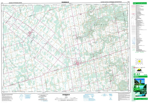
041A01 Dundalk Canada topo map, 1:50,000 scale
041A01 Dundalk NRCAN topographic map.
Includes UTM and GPS geographic coordinates (latitude and longitude). This 50k scale map is suitable for hiking, camping, and exploring, or you could frame it as a wall map.
Printed on-demand using high resolution, on heavy weight and acid free paper, or as an upgrade on a variety of synthetic materials.
Topos available on paper, Waterproof, Poly, or Tyvek. Usually shipping rolled, unless combined with other folded maps in one order.
- Product Number: NRCAN-041A01
- Parent Topo: TOPO-041A
- Map ID also known as: 041A01, 41A1, 41A01
- Unfolded Size: Approximately 26" high by 36" wide
- Weight (paper map): ca. 55 grams
- Map Type: POD NRCAN Topographic Map
- Map Scale: 1:50,000
- Geographical region: Ontario, Canada
Neighboring Maps:
All neighboring Canadian topo maps are available for sale online at 1:50,000 scale.
Purchase the smaller scale map covering this area: Topo-041A
Spatial coverage:
Topo map sheet 041A01 Dundalk covers the following places:
- Amaranth - Artemesia - Dufferin - East Luther - Grey - Luther - Melancthon - Mono - Mulmur - Osprey - Proton - Simcoe - Tosorontio - Wellington - West Luther - Lake Inistioge - McCarston's Lake - Springwater Lakes - Black Bank Hill - Mill Hill - Mono Hills - Mulmur Hills - Oak Ridges - Sheldon Hill - Violet Hill - Dufferin - Grey - Simcoe - Wellington - Adjala-Tosorontio - Amaranth - Amaranth - Artemesia - Arthur - East Luther Grand Valley - Egremont - Euphrasia - Grey Highlands - Luther - Mapleton - Melancthon - Melancthon - Mount Forest/Arthur/West Luther/Arthur - Mulmur - Osprey - Proton - Southgate - Wellington North - West Garafraxa - West Luther - Boyne Valley Provincial Park - Hockley Valley Provincial Nature Reserve - Luther Marsh Conservation Area - Mono Cliffs Provincial Park - Noisy River Provincial Nature Reserve - Boyne River - Grand River - Lisle Creek - Noisy River - Nottawasaga River - Pine River - Saugeen River - Sheldon Creek - South Saugeen River - Walker's Creek - Willow Brook - Mono - Shelburne - Black Bank - Blacks Corners - Camilla - Conover - Corbetton - Crombie - Crombies - Dundalk - Earnscliffe - Elba - Elder - Granger - Honeywood - Horning's Mills - Jessopville - Keldon - Kilgorie - Kingscote - Mansfield - Maple Grove - Melancthon - Mono Centre - Mulmur - Perm - Primrose - Proton Station - Redickville - Relessey - Riverview - Ruskview - Shrigley - Signet - Springwater Lakes - Stanton - Terra Nova - Ventry - Violet Hill - Wareham - Wesley - Whitfield - Hockley Valley - Luther Marsh - Shelbourne


