
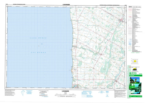
040P13 Lucknow Canada topo map, 1:50,000 scale
040P13 Lucknow NRCAN topographic map.
Includes UTM and GPS geographic coordinates (latitude and longitude). This 50k scale map is suitable for hiking, camping, and exploring, or you could frame it as a wall map.
Printed on-demand using high resolution, on heavy weight and acid free paper, or as an upgrade on a variety of synthetic materials.
Topos available on paper, Waterproof, Poly, or Tyvek. Usually shipping rolled, unless combined with other folded maps in one order.
- Product Number: NRCAN-040P13
- Parent Topo: TOPO-040P
- Map ID also known as: 040P13, 40P13
- Unfolded Size: Approximately 26" high by 36" wide
- Weight (paper map): ca. 55 grams
- Map Type: POD NRCAN Topographic Map
- Map Scale: 1:50,000
- Geographical region: Ontario, Canada
Neighboring Maps:
All neighboring Canadian topo maps are available for sale online at 1:50,000 scale.
Purchase the smaller scale map covering this area: Topo-040P
Spatial coverage:
Topo map sheet 040P13 Lucknow covers the following places:
- Quaid's Bay - Kintail Beach - Martin's Point - Wright Point - Ashfield - Bruce - Colborne - East Wawanosh - Goderich - Hullett - Huron - Huron - Kinloss - Wawanosh - West Wawanosh - Ackert Drain - Henderson Drain - Kirk Drain - Young Drain - Ship Island - Lac Huron - Lake Huron - Mud Lake - Bruce - Huron - Ashfield - Ashfield-Colborne-Wawanosh - Central Huron - Colborne - East Wawanosh - Goderich - Hullett - Huron - Huron-Kinloss - Kinloss - North Huron - West Wawanosh - Point Farms Provincial Park - Allans Creek - Blyth Brook - Boundary Creek - Dickeys Creek - Dickies Creek - Griffins Creek - Kerrys Creek - Lucknow River - Maitland River - Nine Mile River - Sharp Creek - Sharpes Creek - St. Augustine Creek - St. Helens Creek - Goderich - Auburn - Belfast - Bogies Beach - Carlow - Crewe - Dungannon - Dunlop - Kingsbridge - Kintail - Lanes - Lothian - Loyal - Lucknow - Mafeking - Manchester - Meneset - Nile - Port Albert - Prosperity - Saltford - Saratoga - Sheppardton - St. Augustine - St. Helens - Sunset Beach - Zion - Saratoga Swamp


