
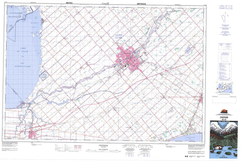
040J08 Chatham Canada topo map, 1:50,000 scale
040J08 Chatham NRCAN topographic map.
Includes UTM and GPS geographic coordinates (latitude and longitude). This 50k scale map is suitable for hiking, camping, and exploring, or you could frame it as a wall map.
Printed on-demand using high resolution, on heavy weight and acid free paper, or as an upgrade on a variety of synthetic materials.
Topos available on paper, Waterproof, Poly, or Tyvek. Usually shipping rolled, unless combined with other folded maps in one order.
- Product Number: NRCAN-040J08
- Parent Topo: TOPO-040J
- Map ID also known as: 040J08, 40J8, 40J08
- Unfolded Size: Approximately 26" high by 36" wide
- Weight (paper map): ca. 55 grams
- Map Type: POD NRCAN Topographic Map
- Map Scale: 1:50,000
- Geographical region: Ontario, Canada
Neighboring Maps:
All neighboring Canadian topo maps are available for sale online at 1:50,000 scale.
Purchase the smaller scale map covering this area: Topo-040J
Spatial coverage:
Topo map sheet 040J08 Chatham covers the following places:
- Cul de Sac - Johnston Bay - Mitchell Bay - Mitchell's Bay - Mud Bay - Patricks Cove - St. Lukes Bay - Mitchell Point - Mitchell's Point - Ticky Tacky Point - Johnston Channel - Travellers Gap - Chatham-Kent - Chatham - Dover - Harwich - Howard - Kent - Lambton - Raleigh - Sombra - Tilbury East - Tilbury North - Tilbury West - Boyle Drain - Brown Drain - Dolson Drain - Ferguson Drain - Lock Drain - McFarlane Relief Drain - Proctor Drain - Réserve indienne Walpole Island 46 - Walpole Island Indian Reserve 46 - Grassy Bend Islands - Martin Island - St. Anne Island - Walpole Island - Club House Pond - Goose Lake - Lac Érié - Lac Sainte-Claire - Lake Erie - Lake St. Clair - South Pond - Cedar Springs Range - Champ de tir Cedar Springs - Essex - Kent - Lambton - Camden - Chatham - Dover - Harwich - Howard - Maidstone - Orford - Raleigh - Rochester - Romney - Tilbury East - Tilbury North - Tilbury West - Zone - Réserve nationale de faune de Sainte-Claire - St. Clair National Wildlife Area - Arnold Creek - Baptiste Creek - Big Creek - Big Creek - Cheff Creek - Chenail Ecarté (The Snye) - Chenal Ecarté - Dolson Creek - Dolson Creek - Dolson Creek - Grand Crique - Indian Creek - Jeannettes Creek - McGregor Creek - Paincourt Creek - Rankin Creek - Rivière Thames - Thames River - Tilbury Creek - Wolfe Creek - Lakeshore - Arkwood - Bagnall - Baldoon - Bear Line - Big Point - Blenheim - Blenheim Junction - Bradley - Buxton - Cedar Springs - Charing Cross - Chatham - Darrell - Dealtown - Dover Centre - Doyles - Dubuque - Erie Beach - Fargo - Fletcher - Grande Pointe - Hoffman Corners - Huffman Corners - Jeanette - Jeannette - Jeannettes Creek - Kent Centre - Louisville - Mitchell Bay - Mitchell's Bay - North Buxton - Northwood - Oriole Parkway - Oungah - Pain Court - Paincourt - Pinehurst - Prairie Siding - Rhodes - Richardson - Ringold - Riverside Trailer Park - Sandison - South Buxton - Tilbury - Tilbury Station - Valetta - Van Horne - Vosburg - Wilsonwood - Bradley's Marsh - Tilbury Centre


