
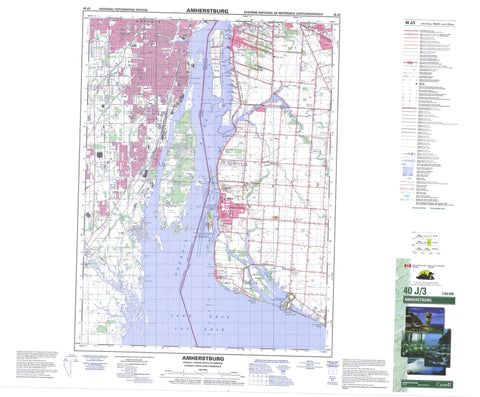
040J03 Amherstburg Canada topo map, 1:50,000 scale
040J03 Amherstburg NRCAN topographic map.
Includes UTM and GPS geographic coordinates (latitude and longitude). This 50k scale map is suitable for hiking, camping, and exploring, or you could frame it as a wall map.
Printed on-demand using high resolution, on heavy weight and acid free paper, or as an upgrade on a variety of synthetic materials.
Topos available on paper, Waterproof, Poly, or Tyvek. Usually shipping rolled, unless combined with other folded maps in one order.
- Product Number: NRCAN-040J03
- Parent Topo: TOPO-040J
- Map ID also known as: 040J03, 40J3, 40J03
- Unfolded Size: Approximately 26" high by 36" wide
- Weight (paper map): ca. 55 grams
- Map Type: POD NRCAN Topographic Map
- Map Scale: 1:50,000
- Geographical region: Ontario, Canada
Neighboring Maps:
All neighboring Canadian topo maps are available for sale online at 1:50,000 scale.
Purchase the smaller scale map covering this area: Topo-040J
Spatial coverage:
Topo map sheet 040J03 Amherstburg covers the following places:
- Amherstburg Harbour - Crystal Bay - Bailey's Beach - White Sands - Amherst Pointe - Bar Point - Livingstone Channel - Colchester - Essex - Malden - Sandwich - Sandwich East - Sandwich South - Sandwich West - Cahill Drain - Maranette Drain - Bird Island - Bois Blanc Island - Fighting Island - Grassy Island - Île aux Bois Blancs - Knapps Island - Turkey Island - International Lake - Lac Érié - Lake Erie - Essex - Anderdon - Malden - Sandwich - Sandwich - Sandwich East - Sandwich South - Sandwich West - Bois Blanc Island Lighthouse and Blockhouse National Historic Site of Canada - Bois Blanc Island Lighthouse National Historic Site of Canada - Fort Malden National Historic Site of Canada - Lieu historique national du Canada du Fort-Malden - Lieu historique national du Canada du Phare-de-l'Île-Bois Blanc - Lieu historique national du Canada du Phare-et-du-Blockhaus-de-l'Île-Bois-Blanc - Ontario - Amherstburg Channel - Big Creek - Canard River - Detroit River - Fighting Channel - Rivière aux Canards - Rivière Détroit - Turkey Creek - Amherstburg - LaSalle - Tecumseh - Amherst Pointe - Amherstburg - Auld - Bar Point - Busy Bee Corners - Delisle's Corners - Edgewater Beach - Glen Eden - Gordon - La Salle - Lake Erie Country Club - Lakewood Beach - Levergood Beach - Lukerville - Malden Centre - North Malden - Oliver - Quarries - River Canard - Rivière-aux-Canards - South Windsor - Southwick - Splitlog - Sunset Beach - Tecumseh - The Meadows - Willow Beach - Willowood


