
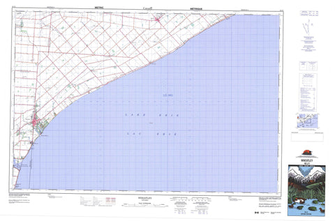
040J01 Wheatley Canada topo map, 1:50,000 scale
040J01 Wheatley NRCAN topographic map.
Includes UTM and GPS geographic coordinates (latitude and longitude). This 50k scale map is suitable for hiking, camping, and exploring, or you could frame it as a wall map.
Printed on-demand using high resolution, on heavy weight and acid free paper, or as an upgrade on a variety of synthetic materials.
Topos available on paper, Waterproof, Poly, or Tyvek. Usually shipping rolled, unless combined with other folded maps in one order.
- Product Number: NRCAN-040J01
- Parent Topo: TOPO-040J
- Map ID also known as: 040J01, 40J1, 40J01
- Unfolded Size: Approximately 26" high by 36" wide
- Weight (paper map): ca. 55 grams
- Map Type: POD NRCAN Topographic Map
- Map Scale: 1:50,000
- Geographical region: Ontario, Canada
Neighboring Maps:
All neighboring Canadian topo maps are available for sale online at 1:50,000 scale.
Purchase the smaller scale map covering this area: Topo-040J
Spatial coverage:
Topo map sheet 040J01 Wheatley covers the following places:
- Wheatley Harbour - Marentette Beach - Chatham-Kent - Essex - Kent - Mersea - Raleigh - Romney - Tilbury East - Tilbury North - Tilbury West - Coatsworth-Robinson Drain - Henry Robinson Drain - Tunnel Drain - Lac Érié - Lake Erie - Essex - Kent - Camden - Chatham - Dover - Harwich - Howard - Maidstone - Mersea - Orford - Raleigh - Rochester - Romney - Tilbury East - Tilbury North - Tilbury West - Zone - Wheatley Provincial Park - Baptiste Creek - Big Creek - East Two Creeks - Grand Crique - Hillman Creek - Muddy Creek - Tilbury Creek - West Two Creeks - Yellow Creek - Lakeshore - Leamington - Coatsworth - Coatsworth Station - Dealtown - Elmdale - Glenwood - Holiday Harbour - Marentette Beach - Merlin - Ouvry - Port Alma - Port Crewe - Quinn - Renwick - Romney - Stevenson - Stewart - Valetta - Wheatley - Windfall - Hillman Marsh


