
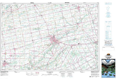
040I15 Tillsonburg Canada topo map, 1:50,000 scale
040I15 Tillsonburg NRCAN topographic map.
Includes UTM and GPS geographic coordinates (latitude and longitude). This 50k scale map is suitable for hiking, camping, and exploring, or you could frame it as a wall map.
Printed on-demand using high resolution, on heavy weight and acid free paper, or as an upgrade on a variety of synthetic materials.
Topos available on paper, Waterproof, Poly, or Tyvek. Usually shipping rolled, unless combined with other folded maps in one order.
- Product Number: NRCAN-040I15
- Parent Topo: TOPO-040I
- Map ID also known as: 040I15, 40I15
- Unfolded Size: Approximately 26" high by 36" wide
- Weight (paper map): ca. 55 grams
- Map Type: POD NRCAN Topographic Map
- Map Scale: 1:50,000
- Geographical region: Ontario, Canada
Neighboring Maps:
All neighboring Canadian topo maps are available for sale online at 1:50,000 scale.
Purchase the smaller scale map covering this area: Topo-040I
Spatial coverage:
Topo map sheet 040I15 Tillsonburg covers the following places:
- Brant - Brant-on-the-Grand - Nanticoke - Norfolk - Norfolk County - Bayham - Brant - Burford - Charlotteville - Delhi - Dereham - Dorchester - Elgin - Malahide - Middlesex - Middleton - North Dorchester - North Norwich - North Walsingham - Norwich - Oxford - South Dorchester - South Norwich - South Walsingham - Walsingham - Windham - Zorra - Argyle Drain - Bear Creek Drain - Centre Branch Drain - Collver Drain - Condie Drain - Cowan Drain - Cranberry Marsh Drain - Currie Drain - Fewster Drain - Fitzpatrick Drain - Fuller Drain - Garnum Drain - Gracey Drain - Hastings Drain - Laidlaw Drain - Mud Lake Drain - Newall Drain - Newark Drain - North Branch Drain - Quinton Drain - Rosehart Drain - Shivley-Ness Drain - Singer Drain - Stirton Drain - Swance Drain - Teskey Drain - Lake Lisgar - Lake Whittaker - Mill Pond - Mud Lake - Spring Lake - St. Josephs Lake - Whittaker Lake - Springer's Hill - Brant - Elgin - Haldimand-Norfolk - Middlesex - Oxford - Bayham - Brantford - Burford - Charlotteville - Delhi - Dereham - Dereham - Dorchester - Dorchester - Dumfries - East Oxford - Houghton - Malahide - Malahide - Middleton - Middleton - Nissouri - Norfolk - North Dorchester - North Norwich - North Walsingham - Norwich - Oakland - Onondaga - South Dorchester - South Dumfries - South Norwich - South Walsingham - South-West Oxford - Thames Centre - Townsend - Walsingham - West Nissouri - West Oxford - Windham - Woodhouse - Zorra - Aylmer Provincial Wildlife Management Area - Brown Conservation Area - Croton Conservation Area - Croton Conservation Area - Dereham Wetlands Conservation Area - Ivan Steen Conservation Area - Lake Whittaker Conservation Area - Lehman Conservation Area - Middleton Wetlands Conservation Area - Norwich Conservation Area - Oatman Conservation Area - Rock Mill Conservation Area - Tillsonburg Conservation Area - Ward McKenna Conservation Area - Watson Dam Conservation Area - Big Creek - Big Otter Creek - Bradley Creek - Bradleys Creek - Branch Creek - Catfish Creek - Cranberry Creek - Deer Creek - Deer Creek - East Catfish Creek - Kettle Creek - Little Jerry Creek - Little Otter Creek - Middle Thames River - Moores Creek - North Creek - Otter Creek - Piney Creek - Plumb Creek - Reynolds Creek - Rivière Thames - Silver Creek - South Creek - South Creek - Spittler Creek - Stony Creek - Stony Creek - Sweets Creek - Thames River - Venison Creek - West Catfish Creek - Aylmer - Tillsonburg - Tilsonburg - Westminster - Andy's Corners - Arthur's Corners - Avon - Aylmer Station - Aylmer West - Bayham - Bookton - Bradburn Subdivision - Brown's Corners - Brownsville - Brownsville Station - Corinth - Cornell - Courtland - Crampton - Culloden - Delhi - Delmer - Dereham Centre - Eden - Glencolin - Glenridge - Guysborough - Harrietsville - Hawtrey - Hink's Corners - La Salette - Little Aylmer - Lynedoch - Lyons - Mabee - Mabee's Corners - Middletown Line - Mile Corner - Milldale - Mount Burnham - Mount Elgin - Mount Vernon - Newark - North Bayham - North Hall - Norwich - Norwich Gore - Norwich Junction - Ostrander - Otterville - Putnam - Ranelagh - Rhineland - Richmond - Rock's Mills - Ronson - Rosanna - Salford - Seville - South Middleton - Springfield - Springford - Straffordville - Summers Corners - Summerville - The Gore - The Junction - Tillsonburg Junction - Verschoyle - Westmount - Wyecombe - Zenda - Dorchester Swamp


