
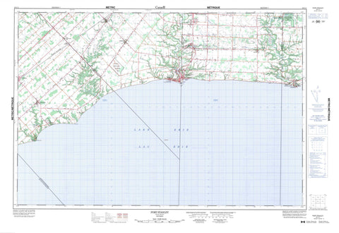
040I11 Port Stanley Canada topo map, 1:50,000 scale
040I11 Port Stanley NRCAN topographic map.
Includes UTM and GPS geographic coordinates (latitude and longitude). This 50k scale map is suitable for hiking, camping, and exploring, or you could frame it as a wall map.
Printed on-demand using high resolution, on heavy weight and acid free paper, or as an upgrade on a variety of synthetic materials.
Topos available on paper, Waterproof, Poly, or Tyvek. Usually shipping rolled, unless combined with other folded maps in one order.
- Product Number: NRCAN-040I11
- Parent Topo: TOPO-040I
- Map ID also known as: 040I11, 40I11
- Unfolded Size: Approximately 26" high by 36" wide
- Weight (paper map): ca. 55 grams
- Map Type: POD NRCAN Topographic Map
- Map Scale: 1:50,000
- Geographical region: Ontario, Canada
Neighboring Maps:
All neighboring Canadian topo maps are available for sale online at 1:50,000 scale.
Purchase the smaller scale map covering this area: Topo-040I
Spatial coverage:
Topo map sheet 040I11 Port Stanley covers the following places:
- Little Beach - Patrick Point - Plum Point - Hawk Cliff - Aldborough - Dunwich - Elgin - Malahide - Southwold - Yarmouth - Millman Drain - Bell's Pond - Lac Érié - Lake Erie - Sanders Pond - Saunders Pond - Springwater Pond - Union Pond - White's Pond - Elgin - Central Elgin - Dorchester - Dunwich - Dutton/Dunwich - Malahide - South Dorchester - Southwold - Southwold - West Elgin - Yarmouth - John E. Pearce Provincial Park - Lieu historique national du Canada des Remblais-de-Southwold - Port Bruce Provincial Park - Southwold Earthworks National Historic Site of Canada - Springwater Conservation Area - Pineo's Flats - Beaver Creek - Bradley Creek - Bradleys Creek - Catfish Creek - Kettle Creek - Little Creek - Mill Creek - Talbot Creek - Cowal - Dexter - Dutton - Duttona Beach - Erie Rest - Fingal - Grimmonds Beach - Invererie Heights - Iona - Iona Station - Jaffa - Lawton's Corners - Lyndale - Mitchell Heights - Norman - North Ward - Orchard Beach - Ormond Beach - Port Bruce - Port Stanley - Port Talbot - Shedden - Sparta - Tyrconnell - Union - Wallacetown - Waneeta Beach - Whites - Barnum Gully - Barnum's Gully - Grand Canyon


