
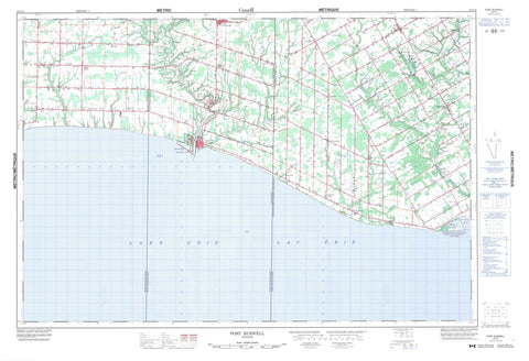
040I10 Port Burwell Canada topo map, 1:50,000 scale
040I10 Port Burwell NRCAN topographic map.
Includes UTM and GPS geographic coordinates (latitude and longitude). This 50k scale map is suitable for hiking, camping, and exploring, or you could frame it as a wall map.
Printed on-demand using high resolution, on heavy weight and acid free paper, or as an upgrade on a variety of synthetic materials.
Topos available on paper, Waterproof, Poly, or Tyvek. Usually shipping rolled, unless combined with other folded maps in one order.
- Product Number: NRCAN-040I10
- Parent Topo: TOPO-040I
- Map ID also known as: 040I10, 40I10
- Unfolded Size: Approximately 26" high by 36" wide
- Weight (paper map): ca. 55 grams
- Map Type: POD NRCAN Topographic Map
- Map Scale: 1:50,000
- Geographical region: Ontario, Canada
Neighboring Maps:
All neighboring Canadian topo maps are available for sale online at 1:50,000 scale.
Purchase the smaller scale map covering this area: Topo-040I
Spatial coverage:
Topo map sheet 040I10 Port Burwell covers the following places:
- Nanticoke - Norfolk - Norfolk County - Bayham - Elgin - Houghton - Malahide - North Walsingham - South Walsingham - Walsingham - Fernley Drain - Hahn Ditch - Hankinson Drain - Harmon Drain - Mooseberger Drain - Scanlon Drain - Sinclair Drain - Tate Drain - Timpany Drain - Lac Érié - Lake Erie - Silver Lake - The Sand Hills - Elgin - Haldimand-Norfolk - Bayham - Charlotteville - Delhi - Dorchester - Houghton - Malahide - Middleton - Norfolk - North Walsingham - South Dorchester - South Walsingham - Townsend - Walsingham - Windham - Woodhouse - Port Burwell Provincial Park - Réserve nationale de faune du ruisseau Big Creek - Big Creek - Big Otter Creek - Bradley Creek - Bradleys Creek - Clear Creek - Deer Creek - Hemlock Creek - Little Otter Creek - Long Point Creek - Moores Creek - Pirrie Creek - Silver Creek - South Otter Creek - Venison Creek - Calton - Candyville - Carholme - Clear Creek - Copenhagen - Cultus - Dunboyne - Erie View - Fairground - Fairview - Froggetts Corners - Frogmore - Glen Meyer - Griffin Corners - Grovesend - Hemlock - Houghton - Houghton Centre - Jacksonburg - Kinglake - Kinglake Station - Lakeview - Langton - Luton - Malahide - Marston - Mount Salem - Port Burwell - Rowan Mills - Spring Arbour - Straffordville - Vienna - Walsingham - Stalter's Gully - Hahn Marsh - Lee Brown Marsh


