
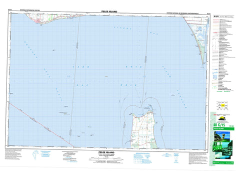
040G15 Pelee Island Canada topo map, 1:50,000 scale
040G15 Pelee Island NRCAN topographic map.
Includes UTM and GPS geographic coordinates (latitude and longitude). This 50k scale map is suitable for hiking, camping, and exploring, or you could frame it as a wall map.
Printed on-demand using high resolution, on heavy weight and acid free paper, or as an upgrade on a variety of synthetic materials.
Topos available on paper, Waterproof, Poly, or Tyvek. Usually shipping rolled, unless combined with other folded maps in one order.
- Product Number: NRCAN-040G15
- Parent Topo: TOPO-040G
- Map ID also known as: 040G15, 40G15
- Unfolded Size: Approximately 26" high by 36" wide
- Weight (paper map): ca. 55 grams
- Map Type: POD NRCAN Topographic Map
- Map Scale: 1:50,000
- Geographical region: Ontario, Canada
Neighboring Maps:
All neighboring Canadian topo maps are available for sale online at 1:50,000 scale.
Purchase the smaller scale map covering this area: Topo-040G
Spatial coverage:
Topo map sheet 040G15 Pelee Island covers the following places:
- North Bay - Pigeon Bay - Black Willow Beach - East Beach - East Point Beach - Marentette Beach - Northwest Beach - West Beach - Lighthouse Point - Littles Point - Lizard Point - Middle Point - Mill Point - Pelee Point - Point Pelee - Sheridan Point - Pelee Passage - Colchester - Essex - Gosfield - Mersea - Pelee - Big Chicken Island - Chick Island - East Sister Island - Hen Island - Little Chicken Island - Middle Sister Island - North Harbour Island - Pelee Island - Big Pond - Bush Pond - East Cranberry Pond - Girardin Pond - Lac Érié - Lake Erie - Lake Henry - Lake Pond - Redhead Pond - Round Pond - Sanctuary Pond - West Cranberry Pond - Essex - Colchester - Colchester North - Colchester South - Gosfield - Gosfield North - Gosfield South - Mersea - Pelee - Pelée - East Sister Island Provincial Nature Reserve - Lighthouse Point Provincial Nature Reserve - Parc national du Canada de la Pointe-Pelée - Point Pelee National Park of Canada - Ontario - Dolson's Creek - Fox Creek - Colchester Reef - East Sister Shoal - Grecian Shoal - Grubb Reef - Hen Island Shoal - Hulda's Rock - Middle Ground - North Harbour Island Reef - Western Erie Basin - Essex - Kingsville - Leamington - Colchester - Grove Avenue - Klie's Beach - Marentette Beach - Oxley - Pelee Island - Point Pelee - Point Pelee Park - Scudder


