
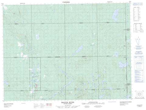
032D05 Magusi River Canada topo map, 1:50,000 scale
032D05 Magusi River NRCAN topographic map.
Includes UTM and GPS geographic coordinates (latitude and longitude). This 50k scale map is suitable for hiking, camping, and exploring, or you could frame it as a wall map.
Printed on-demand using high resolution, on heavy weight and acid free paper, or as an upgrade on a variety of synthetic materials.
Topos available on paper, Waterproof, Poly, or Tyvek. Usually shipping rolled, unless combined with other folded maps in one order.
- Product Number: NRCAN-032D05
- Parent Topo: TOPO-032D
- Map ID also known as: 032D05, 32D5, 32D05
- Unfolded Size: Approximately 26" high by 36" wide
- Weight (paper map): ca. 55 grams
- Map Type: POD NRCAN Topographic Map
- Map Scale: 1:50,000
- Geographical region: Ontario, Canada
Neighboring Maps:
All neighboring Canadian topo maps are available for sale online at 1:50,000 scale.
Purchase the smaller scale map covering this area: Topo-032D
Spatial coverage:
Topo map sheet 032D05 Magusi River covers the following places:
- Arnold - Ben Nevis - Bisley - Clifford - Dasserat - Dokis - Elliott - Garrison - Harker - Hébécourt - Holloway - Katrine - Marriott - Montbray - Morrisette - Ossian - Pontiac - Tannahill - Thackeray - Timiskaming - Alfie Lake - Allan Lake - Anrev Lake - Armitage Lake - Audette Lake - Bea Lake - Bolan Lake - Bourassa Lake - Bourke Lake - Boyer Lake - Brinnie Lake - Campbell Lake - Captain Lake - Car Lake - Checklin Lake - Cherniuk Lake - Clarice Lake - Clermont Lake - Clifford Lake - Cochenour Lake - Columbus Lake - Corner Lake - Daughter Lake - Death Lake - Dew Lake - Dickson Lake - Dokis Lake - Driscoll Lake - Dunbrack Lake - Duralia Lake - Esker Lakes - Farnes Lake - Fennah Lake - Forsyth Lake - Frances Lake - Gaf Lake - Gareau Lake - Ghost Lake - Giunta Lake - Gourlay Lake - Griffey Lake - Grover Lake - Harker Lake - Hazel Lake - Horlock Lake - Howard Lake - Imperial Lake - Jones Lake - Jump Lake - Keith Lake - Kelso Lake - Kennedy Lake - Labyrinth Lake - Lac à la Truite - Lac Clarice - Lac Delmas - Lac des Îles - Lac Després - Lac du Serpent - Lac Floyd - Lac Labyrinthe - Lac Opwataongajing - Lac Skunk - Laf Lake - Lahaie Lake - Lallan Lake - Langley Lake - Lauramay Lake - Lavery Lake - Little Boy Lake - Little Esker Lake - Little Misema Lake - Lulu Lake - Lydon Lake - Mall Lake - Marten Lake - Mary Lake - McCurdy Lake - McDiarmid Lake - McKinley Lake - Merritt Lake - Merson Lake - Mist Lake - Motherwell Lake - Mutch Lake - Nickila Lake - Old Man Lake - Ore Car Lake - Pack Can Lake - Pall Lake - Panagapka Lake - Parysek Lake - Petit Lake - Pinaws Lake - Pontiac Lake - Pothole Lakes - Primeau Lake - Purdy Lake - Pushkin Lake - Ramey Lake - Ranger Lake - Rat Lake - Roach Lake - Row Lake - Rozon Lake - Sausage Lake - Seahorse Lake - Shubat Lake - Side Lake - Skelly Lake - Stever Lake - Stuart Lake - Sullivan Lake - Sunrise Lake - Sweeney Lake - Sylvia Lake - Thackeray Lake - Thrasher Lake - Todd Lakes - Tracy Lake - Tuke Lake - Van Alstyne Lake - Vanalstyne Lake - Vannier Lake - Verna Lake - Vinkle Lake - Webber Lake - Webster Lake - Wicklan Lake - Wynn Lake - Boundary Hill - Colline Boundary - Cordelia Hill - Lawson Hill - Mount Blewett - Pushkin Hills - Ross Hill - Traverse Hill - Workman Hills - Esker Lakes Provincial Park - Pushkin Hills Provincial Nature Reserve - Thackeray Provincial Nature Reserve - Alfie Creek - Bisley Creek - Black River - Cochenour Creek - Dokis Creek - Garrison Creek - Ghost River - Gourlay Creek - Little Misema River - Magusi River - Mattawasaga River - McDiarmid Creek - Misema River - Mist Creek - Pontiac Creek - Rivière Dasserat - Rivière Magusi - Ruisseau Clarice - Ruisseau Marriott - Ruisseau Marriott - Ruisseau McDiarmid - Ruisseau Pontiac - Ruisseau Sunrise - Sunrise Creek - Thackeray Creek - Webster Creek - Kirkland Lake - The Canyon


