
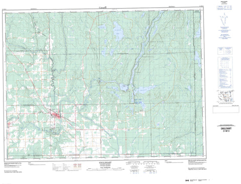
031M13 Englehart Canada topo map, 1:50,000 scale
031M13 Englehart NRCAN topographic map.
Includes UTM and GPS geographic coordinates (latitude and longitude). This 50k scale map is suitable for hiking, camping, and exploring, or you could frame it as a wall map.
Printed on-demand using high resolution, on heavy weight and acid free paper, or as an upgrade on a variety of synthetic materials.
Topos available on paper, Waterproof, Poly, or Tyvek. Usually shipping rolled, unless combined with other folded maps in one order.
- Product Number: NRCAN-031M13
- Parent Topo: TOPO-031M
- Map ID also known as: 031M13, 31M13
- Unfolded Size: Approximately 26" high by 36" wide
- Weight (paper map): ca. 55 grams
- Map Type: POD NRCAN Topographic Map
- Map Scale: 1:50,000
- Geographical region: Ontario, Canada
Neighboring Maps:
All neighboring Canadian topo maps are available for sale online at 1:50,000 scale.
Purchase the smaller scale map covering this area: Topo-031M
Spatial coverage:
Topo map sheet 031M13 Englehart covers the following places:
- Swift Water - Eighty Foot Falls - First Falls - Fourth Falls - High Falls - Horseshoe Falls - Sunday Creek Falls - Teddy's Falls - Wendigo Falls - Armstrong - Bayly - Beauchamp - Brethour - Catharine - Chamberlain - Dack - Dufay - Evanturel - Hilliard - Ingram - Marter - Montreuil - Mulligan - Pacaud - Pense - Pontleroy - Rattray - Skead - Timiskaming - Weekes Island - Beaver Lake - Benson Lake - Big Moose Lake - Clear Lake - Costello Lake - Crystal Lake - Dawson Lake - Ginn Lake - Gravenor Lake - Hamel's Pond - Icefish Lake - Iron Lake - Kearney Lake - Lac Laberge - Lac Pontleroy - Little Moose Lake - Long Lake - Mageau Lake - Mallard Lake - Margaret Lake - Marion Lake - McLean Pond - Miller Lake - Miron Lake - Montague Lake - Mud Lake - Mulligan Lake - Old Moose Pond - Pense Lake - Rattray Lake - Shepherd Lake - Skead Lake - Skeleton Lake - Skeletonpup Lake - Skidoo Lake - St. Anthony Lake - Turtle Lake - Ward Lake - Wendigo Lake - Dunbar Rock - McConnell Rock - Sand Ridge - Trestle Hill - Armstrong - Brethour - Chamberlain - Charlton and Dack - Dack - Evanturel - Larder Lake - East Larder River Bedrock Conifer Conservation Reserve - Hilliardton Marsh Conservation Reserve - Kap-Kig-Iwan Provincial Park - Larder River Waterway Provincial Park - Court Rapids - Flat Rapids - Garnett's Rapids - Hell's Gate - Nuisance Rapids - Stuart's Rapids - Aidie Creek - Alligator Creek - Armstrong Creek - Benson Creek - Blanche River - Boston Creek - Crocodile Creek - Elkhorn Creek - Englehart River - Englehart River - Evanturel Creek - Flanagan Creek - Grahams Creek - Ingram Creek - Julian Creek - Larder River - Little Otterskin Creek - Little Skeleton Creek - Misema River - Moosehorn Creek - Pontleroy Creek - Rivière Laberge - Rivière Laberge - Ruisseau Armstrong - Ruisseau Julian - Ruisseau Pontleroy - Skeleton Creek - Smith Creek - Spring Creek - St. Jean Baptiste Creek - Sunday Creek - Taylor Creek - Ash's Rock - Englehart - Brentha - Chamberlain - Charlton - Charlton Station - Dack - Englehart North - Errettsville - Gerlach - Heaslip - Kadman - Krugerdorf - Marshall's Corners - Marter - Mindoka - South Mindoka - Tomstown - Wawbewawa - Wendigo Lake - Hilliardton Swamp - Margaret Swamp


