
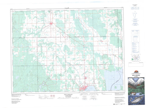
031M12 New Liskeard Canada topo map, 1:50,000 scale
031M12 New Liskeard NRCAN topographic map.
Includes UTM and GPS geographic coordinates (latitude and longitude). This 50k scale map is suitable for hiking, camping, and exploring, or you could frame it as a wall map.
Printed on-demand using high resolution, on heavy weight and acid free paper, or as an upgrade on a variety of synthetic materials.
Topos available on paper, Waterproof, Poly, or Tyvek. Usually shipping rolled, unless combined with other folded maps in one order.
- Product Number: NRCAN-031M12
- Parent Topo: TOPO-031M
- Map ID also known as: 031M12, 31M12
- Unfolded Size: Approximately 26" high by 36" wide
- Weight (paper map): ca. 55 grams
- Map Type: POD NRCAN Topographic Map
- Map Scale: 1:50,000
- Geographical region: Ontario, Canada
Neighboring Maps:
All neighboring Canadian topo maps are available for sale online at 1:50,000 scale.
Purchase the smaller scale map covering this area: Topo-031M
Spatial coverage:
Topo map sheet 031M12 New Liskeard covers the following places:
- Baie Paulson - Black Bay - Burnt Bay - Gilchrist Bay - Sucker Gut Bay - Sutton Bay - The Boot Leg - Wabi Bay - Windy Arm - Booming Out Point - Burnt Point - Jumbo Point - You-go I-go Point - Chenal du Diable - Chenal du Diable - The Narrows - Temiskaming Shores - Côte à Lemieux - Redpine Chutes - Armstrong - Beauchamp - Brethour - Casey - Dymond - Harley - Harris - Henwood - Hilliard - Hudson - Kerns - Lundy - Montreuil - Nédelec - Nédélec - Timiskaming - Réserve indienne Timiskaming 19 - Timiskaming - Timiskaming Indian Reserve 19 - Dynamite Island - Île du Chef - Île Rempnouix - Rempnouix Island - Rousselet Island - Snake Island - Sugarloaf Island - Aleck's Pond - Bailey Lake - Bartle Lake - Blanche Lake - Blueberry Lake - Callicut Lake - Collacutt Lake - Cyril Lake - Divide Lake - Echo Lake - Elk Pit - Frere Lake - Hammond Lake - Head Lake - Henwood Lake - Hidden Lake - High Falls Lake - Hudfir Lake - Ice Chisel Lake - Lac LeMoyne - Lac René - Lac Témiscamingue - Lac Témiscamingue - Lake Timiskaming - Larabie Lake - Le Moyne Lake - Little Black Lake - Little Blueberry Lake - Little Gillies Lake - Little Grassy Lake - Little Sharp Lake - Little Spring Lake - Long Lake - Lost Lake - Lundy Lake - Maggie Lake - Mary Ann Lake - Mayfair Pond - McChesney Lake - Pacey Lake - Pike Lake - Professor Pond - Second Justin Lake - Spring Lake - Taylor Lake - Twin Lakes - Wabi Lake - Woodpecker Lake - Casey Mountain - Edison Mountain - Fisher's Rock - Hooper's Rock - McConnell Rock - Montagne Casey - Armstrong - Brethour - Casey - Dymond - Harley - Harris - Hilliard - Hudson - Kerns - Henwood Township Forest and Wetland Conservation Reserve - Hilliardton Marsh Conservation Reserve - Blanche River - Burwash Creek - Calamity Creek - Cours d'eau de la Ligne Interprovinciale - Cours d'eau Laferrière - Cours d'eau Lambert - Cours d'eau McLean-Rivard - Evanturel Creek - Gilchrist Creek - Grahams Creek - Hound Chute Creek - Hudfir Creek - Hudson Creek - Ingram Creek - Julian Creek - Kelvin Creek - Leacock Creek - Lepha Creek - Little Otterskin Creek - McLaren Creek - Moffatt Creek - Moose Creek - Ottawa River - Pike Creek - Pontleroy Creek - Rivière des Outaouais - Rivière des Outaouais - Rivière Wabi - Ruisseau Burwash - Ruisseau Julian - Ruisseau Wright - Ruisseau Wright Ouest - South Wabi Creek - St. Jean Baptiste Creek - Sucker Gut Creek - Sutton Creek - Wabi Creek - Wadi's Creek - Wright Creek - Hudson Rock - Belle Vallée - Brethour - Couttsville - Dymond - Earlton - Elk Pit - Hanbury - Highland - Hilliardton - Hillview - Judge - Kenabeek - Maybrook - McCool - Milberta - New Liskeard - Pearson - Sutton Bay - Thorncrest Village - Thwaites - Uno Park - Village à Breault - Whitewood Grove - Calamity Gulch - Edison Marsh - Hilliardton Swamp - Thornloe


