
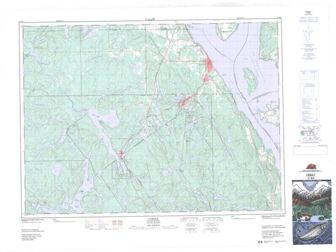
031M05 Cobalt Canada topo map, 1:50,000 scale
031M05 Cobalt NRCAN topographic map.
Includes UTM and GPS geographic coordinates (latitude and longitude). This 50k scale map is suitable for hiking, camping, and exploring, or you could frame it as a wall map.
Printed on-demand using high resolution, on heavy weight and acid free paper, or as an upgrade on a variety of synthetic materials.
Topos available on paper, Waterproof, Poly, or Tyvek. Usually shipping rolled, unless combined with other folded maps in one order.
- Product Number: NRCAN-031M05
- Parent Topo: TOPO-031M
- Map ID also known as: 031M05, 31M5, 31M05
- Unfolded Size: Approximately 26" high by 36" wide
- Weight (paper map): ca. 55 grams
- Map Type: POD NRCAN Topographic Map
- Map Scale: 1:50,000
- Geographical region: Ontario, Canada
Neighboring Maps:
All neighboring Canadian topo maps are available for sale online at 1:50,000 scale.
Purchase the smaller scale map covering this area: Topo-031M
Spatial coverage:
Topo map sheet 031M05 Cobalt covers the following places:
- Baie des Ties - Baie du Nord - Black Bay - Brigstocke Bay - Burnt Bay - Contact Bay - Crowrock Bay - Gilchrist Bay - Marsh Bay - Martineau Bay - Paradis Bay - Portage Bay - Sucker Gut Bay - The Boot Leg - Wabi Bay - Windy Arm - Booming Out Point - Burnt Point - Dawson Point - Diabase Point - Jumbo Point - Pointe Brown - Pointe Piché - Redpine Point - You-go I-go Point - Second Narrows - The Narrows - Temiskaming Shores - Devil Rock - Silver Cliff - Fountain Falls - High Falls - Hound Chute - Ragged Chute - Redpine Chutes - Watson Falls - Barr - Brigstocke - Bucke - Coleman - Dymond - Firstbrook - Gillies Limit - Harris - Hudson - Kittson - Lorrain - Lundy - Timiskaming - Latchford Dam - Mattawapika Dam - Corkill Island - Dynamite Island - Farr Island - Fiddler's Island - Greenstone Island - Île Brisseau - Île Brûlée - Île Bryson - Île du Collège - Île du Finlandais - Île Mann - Île Oster - Snake Island - Sugarloaf Island - Twin Islands - Aleck's Pond - Anderson Lake - Anima Nipissing Lake - Barth Lake - Bartle Lake - Bass Lake - Bay Lake - Belle Isle Lake - Best Lake - Blanche Lake - Blueberry Lake - Borden Lake - Botha Lake - Bouck Lake - Bowers Lake - Brady Lake - Brief Lake - Brigstocke Lake - Bryan Lake - Cart Lake - Cassidy Lake - Charlotte Lake - Chopin Lake - Chown Lake - Clear Lake - Cobalt Lake - Coleman Lake - Columbus Lake - Conglomerate Lake - Constance Lake - Crosswise Lake - Cyril Lake - Darwin Lake - Divide Lake - Edison Lake - Edwards Lake - Eisen Lake - Expanse Lake - First Justin Lake - Firstbrook Lake - Fraleck's Pond - Frog Lake - George Lake - Gillies Lake - Giroux Lake - Gleeson Lake - Glen Lake - Goodwin Lake - Graham Lake - Grassy Lake - Green Lake - Gullrock Lake - Hammond Lake - Harris Lake - Head Lake - Hearst Lake - Hermann Pond - Hidden Lake - High Falls Lake - Hound Chute Lake - Hudfir Lake - Ibsen Pond - Ice Chisel Lake - Island Lake - Isobar Lake - Joachim Lake - Johnson Lake - Justin Lake - Kelvin Lake - Kerr Lake - Kirk Lake - Kitt Lake - Kittson Lake - Lac Gillies - Lac LeMoyne - Lac Témiscamingue - Lac Témiscamingue - Lake Timiskaming - Larabie Lake - Latour Lake - Le Heup Lake - Le Moyne Lake - Leconte Lake - Little Black Lake - Little Blueberry Lake - Little Gillies Lake - Little Grassy Lake - Little Sharp Lake - Long Lake - Longfellow Lake - Loon Lake - Maggie Lake - Mahon Lake - Malcolm Lake - Mary Ann Lake - Mayfair Pond - McLaren Lake - McLennon Lake - Moffat Lake - Moose Lake - Mowat Lake - Mud Lake - New Lake - Nicol Lake - North Beaver Lake - North Pickerel Lake - Number Six Lake - Pan Lake - Peterson Lake - Pike Lake - Pine Lake - Pretty Lake - Professor Pond - Prud'homme Lake - Raede Lake - Reid Lake - Rib Lake - Roosevelt Lake - Rousseau Lake - Saltlick Lake - Sasaginaga Lake - Schumann Lake - Second Justin Lake - Sharp Lake - Short Lake - Silver Lake - Slate Lake - Sonny Lake - South Beaver Lake - South Coleman Lake - South Pickerel Lake - Spring Lake - Starr's Pond - Stewart Lake - Straight Lake - Suddie Lake - Summit Lake - Taylor Lake - Third Justin Lake - Twin Lakes - Warner Pond - Wilgar Lake - Woodpecker Lake - Habitat floristique de l'Île-Brisseau - Diabase Mountain - Edison Mountain - Greywacke Mountain - Bucke - Coleman - Dymond - Cliff Lake Conservation Reserve - Domaine Moses-Brown - W.J.B. Greenwood Provincial Park - Pork Rapids - Red Pine Rapids - Bowers Creek - Dickson Creek - Edwards Creek - Farr Creek - Gilchrist Creek - Gillies Creek - Giroux Creek - Hound Chute Creek - Hudfir Creek - Kelvin Creek - Kitt Creek - Lady Evelyn River - Latour Creek - Loon Creek - McLaren Creek - Montreal River - Moore Creek - New Lake Creek - Ottawa River - Pike Creek - Rivière des Outaouais - Rivière des Outaouais - Sasaginaga Creek - Slate Creek - South Wabi Creek - Spring Creek - Sucker Gut Creek - Wadi's Creek - Cobalt - Latchford - Bigelow - Button's Corners - Cassidy - Coleman - Fleming Corners - Fountain Falls - Gillies - Gillies Depot - Haileybury - Johnson - Kerr Lake - L'Île-du-Collège - Lorrain - Lorrain Valley - Mowat Landing - New Liskeard - North Cobalt - O'Brien - Paradis Bay - Pointe-Piché - Royaume-des-Cèdres - Sharp Landing - Edison Marsh


