
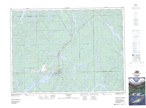
031M04 Temagami Canada topo map, 1:50,000 scale
031M04 Temagami NRCAN topographic map.
Includes UTM and GPS geographic coordinates (latitude and longitude). This 50k scale map is suitable for hiking, camping, and exploring, or you could frame it as a wall map.
Printed on-demand using high resolution, on heavy weight and acid free paper, or as an upgrade on a variety of synthetic materials.
Topos available on paper, Waterproof, Poly, or Tyvek. Usually shipping rolled, unless combined with other folded maps in one order.
- Product Number: NRCAN-031M04
- Parent Topo: TOPO-031M
- Map ID also known as: 031M04, 31M4, 31M04
- Unfolded Size: Approximately 26" high by 36" wide
- Weight (paper map): ca. 55 grams
- Map Type: POD NRCAN Topographic Map
- Map Scale: 1:50,000
- Geographical region: Ontario, Canada
Neighboring Maps:
All neighboring Canadian topo maps are available for sale online at 1:50,000 scale.
Purchase the smaller scale map covering this area: Topo-031M
Spatial coverage:
Topo map sheet 031M04 Temagami covers the following places:
- Boot Bay - Breeches Bay - Dart's Bay - Inlet Bay - Kingston's Bay - Mannajigama Bay - Muddy Water Bay - Murphy's Bay - Northeast Arm - Northeast Bay - Northwest Bay - Outlet Bay - Outlet Bay - Portage Bay - Snare Bay - Southeast Bay - Spawning Bay - Ferguson Point - Axe Narrows - Rabbit Chute - Banting - Best - Briggs - Brigstocke - Cassels - Chambers - Eldridge - Gillies Limit - Hebert - Lorrain - Nipissing - Riddell - South Lorrain - Strathcona - Strathy - Timiskaming - Babcock Island - Bell Island - Broom Island - Caldwell Island - Campfire Island (39) - Ferguson Island - Forestry Island - Horr Island - Newcomb Island - O'Connor Island - Sans Souci Island - Alfreda Lake - Anima Nipissing Lake - Arsenic Lake - Bernice Lake - Best Lake - Black Duck Lake - Blueberry Lake - Bogie Lake - Boulton Lake - Breeches Lake - Broom Lake - Bryan Lake - Business Lake - Caribou Lake - Carrying Lake - Cassels Lake - Caswell Lake - Chambers Lake - Charley Lake - Cliff Lake - Collins Lake - Command Lake - Contact Lake - Cooke Lake - Cooper Lake - Copper Lake - Crash Lake - Doris Lake - Duncan Lake - Fat Lake - Ferguson Lake - Foley Lake - Fourbass Lake - Fourclaim Lake - Francis Lake - Friday Lake - Geoffrey Lake - Gilbert Lake - Glasford Lake - Goethe Lake - Golden Lake - Gorrie Lake - Gosselin Lake - Goward Lake - Granite Lake - Guppy Lake - Hansen Lake - Hardwood Lake - Hay Lake - Hermit Lake - Hidden Lake - Hook Lake - Iceland Lake - Ingersoll Lake - Iron Lake - Jackpine Lake - James Lake - Jamieson Lake - Jessie Lake - Kanichee Lake - Karol Lake - Lake Temagami - Lake Timagami - Latour Lake - Lenore Lake - Leroy Lake - Link Lake - Little Hardwood Lake - Little Mountain Lake - Little Mud Lake - Little Trout Lake - Lorrain Lake - Lowell Lake - Lundy Lake - Maille Lake - Mannajigama Lake - Maureen Lake - McLaren Lake - McLean Lake - McNab Lake - Monty Lake - Mountain Lake - Mud Lake - Myth Lake - Nellem Lake - Net Lake - Obashkong Lake - O'Connor Lake - Owaissa Lake - Petraut Lake - Pigot Lake - Pike Lake - Pineview Lake - Pingue Lake - Pishabo Lake - Pleasant Lake - Price's Lake - Prud'homme Lake - Rabbit Lake - Rib Lake - Roosevelt Lake - Rory Lake - Sauvé Lake - Slim Lake - Snake Island Lake - Snare Lake - Spawning Lake - Spruce Lake - Stewart Lake - Summit Lakes - Sunrise Lake - Sutton Lake - Tasse Lake - Tetapaga Lake - The Three Sisters - Thieving Bear Lake - Tooth Lake - Turtle Lake - Tyndall Lake - Upper Twin Lake - Vermilion Lake - Wagkich Lake - Watson's Lake - Whitewater Lake - Whitney Lake - Wilson Lake - Windy Lake - Young Lake - Cliff Lake Conservation Reserve - Finlayson Point Provincial Park - Rabbit Lake West Conservation Reserve - White Bear Forest Conservation Reserve - Paugan Rapids - Alfreda Creek - Anima Nipissing River - Friday Creek - Guppy Creek - Herridge Creek - Jessie Creek - Johnny Creek - Lorrain Creek - Matabitchuan River - McDonald Creek - Montreal River - Net Creek - Sandstone Creek - Snare Creek - South Tetapaga River - Sucker Gut Creek - Tetapaga River - Many Portage - Temagami - Freeman - Goward - Owaissa - Rib Lake - Roxboro - Silver Centre - Temagami - Temagami North - Timagami


