
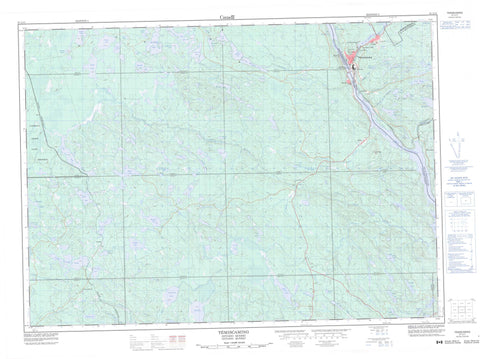
031L11 Temiscaming Canada topo map, 1:50,000 scale
031L11 Temiscaming NRCAN topographic map.
Includes UTM and GPS geographic coordinates (latitude and longitude). This 50k scale map is suitable for hiking, camping, and exploring, or you could frame it as a wall map.
Printed on-demand using high resolution, on heavy weight and acid free paper, or as an upgrade on a variety of synthetic materials.
Topos available on paper, Waterproof, Poly, or Tyvek. Usually shipping rolled, unless combined with other folded maps in one order.
- Product Number: NRCAN-031L11
- Parent Topo: TOPO-031L
- Map ID also known as: 031L11, 31L11
- Unfolded Size: Approximately 26" high by 36" wide
- Weight (paper map): ca. 55 grams
- Map Type: POD NRCAN Topographic Map
- Map Scale: 1:50,000
- Geographical region: Ontario, Canada
Neighboring Maps:
All neighboring Canadian topo maps are available for sale online at 1:50,000 scale.
Purchase the smaller scale map covering this area: Topo-031L
Spatial coverage:
Topo map sheet 031L11 Temiscaming covers the following places:
- Colton Narrows - Témiscaming - Antoine - Butler - Campeau - Clarkson - Eddy - French - Garrow - Gendreau - Jocko - La Salle - Lockhart - McAuslan - Merrick - Mulock - Nipissing - Notre-Dame-du-Lac - Osborne - Poitras - Sainte-Thérèse - Stewart - Wyse - Barrage du Lac-Témiscamingue - Anderson Lake - Banana Lake - Beaudry Lake - Biber Lake - Big McDougal Lake - Blue Lake - Boland Lake - Brûlé Lake - Burke Lake - Butler Lake - Campbell Lake - Charlie Lake - Crocan Lake - Dymond Lake - Ferguson Lake - Fournier Lake - Garrow Lake - Gros lac Keeler - Halfmile Lake - Halfmoon Lake - Island Lake - Jimmie Lake - Jocko Lake - Koko Lake - La Salle Lakes - Lac à l'Eau Claire - Lac Arc-en-Ciel - Lac aux Brochets - Lac aux Castors - Lac Beauchêne - Lac Bob-Cat - Lac des Sept Lieues - Lac England - Lac Foley - Lac Jadot - Lac la Cave - Lac la Cave - Lac Long - Lac Obashing - Lac Orignal - Lac Rock Dam - Lac Seven League - Lac Taggart - Lac Tank - Lac Témiscamingue - Lac Témiscamingue - Lake Timiskaming - Langevin Lake - Little Jocko Lake - Little McDougal Lake - Little Rock Lake - Little Sucker Lake - Little Tomiko Lake - Malone Lake - McConnell Lake - McDougal Lake - Miners Lake - Mitchell Lake - Moose Lake - Mug Lake - Mulock Lake - Notman Lake - Perchfin Lake - Petit lac Groulx - Petit lac Keeler - Pine Lake - Pinewater Lake - Pole Lake - Reynolds Lake - Sabourin Lake - Salt Lake - Salter Lake - Serene Lake - Seven League Lake - Smoky Lake - Sparks Lake - Spring Lake - Sturgeon Lake - Sucker Lake - Susy Lake - Threetrails Lake - Timber Lake - Tower Lake - Tremblay Lake - Twin Lakes - Valin Lake - White Lake - Wyse Lake - Pembroke - Blue Lake End Moraine Conservation Reserve - Jocko Rivers Provincial Park - Crooked Rapids - Devils Eddy - Flat Rapids - Foot of Rapids - Fournier Rapids - Long Sault Rapids - Anderson Creek - Black Duck Creek - Fournier Creek - Fournier River - Francis Creek - Hanson Creek - Jocko River - Little Fournier Creek - Little Fournier River - Little Jocko River - Little Pinewater Creek - Little Tomiko River - McDougal Creek - Ottawa River - Pinewater Creek - Pinewater Creek - Rivière Beauchêne - Rivière des Outaouais - Rivière des Outaouais - Rivière Ottawa - Ruisseau du Lac Rock Dam - Ruisseau Gordon - Ruisseau Keeler - Ruisseau Tank - Sucker Creek - Tuque Creek - Valin Creek - Beauchêne - Eldee - Gendreau - Grimmer - Jocko - Jocko River - Ketchen - Le Petit-Canada - Letang - Lumsden's Mill - Osborne - Tee Lake - Témiscaming - Thorne - Tomiko - Wyse - Kipawa - Letang


