
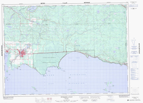
031L05 Sturgeon Falls Canada topo map, 1:50,000 scale
031L05 Sturgeon Falls NRCAN topographic map.
Includes UTM and GPS geographic coordinates (latitude and longitude). This 50k scale map is suitable for hiking, camping, and exploring, or you could frame it as a wall map.
Printed on-demand using high resolution, on heavy weight and acid free paper, or as an upgrade on a variety of synthetic materials.
Topos available on paper, Waterproof, Poly, or Tyvek. Usually shipping rolled, unless combined with other folded maps in one order.
- Product Number: NRCAN-031L05
- Parent Topo: TOPO-031L
- Map ID also known as: 031L05, 31L5, 31L05
- Unfolded Size: Approximately 26" high by 36" wide
- Weight (paper map): ca. 55 grams
- Map Type: POD NRCAN Topographic Map
- Map Scale: 1:50,000
- Geographical region: Ontario, Canada
Neighboring Maps:
All neighboring Canadian topo maps are available for sale online at 1:50,000 scale.
Purchase the smaller scale map covering this area: Topo-031L
Spatial coverage:
Topo map sheet 031L05 Sturgeon Falls covers the following places:
- Cache Bay - Dutrisac's Bay - Great North Bay - McLeod Bay - Minnehaha Bay - Moose Bay - Beaucage Point - Dokis Point - Dukis Point - Ferris Point - Goulais Island Point - Goulard's Point - Jocko Point - Mousseau Point - One Mile Point - Pointe à Beaucage - Pointe à Goulais - Yellek Point - Nipissing Ouest - Côte à Bellefeuille - Chutes à Sandy - Crystal Falls - Duchesnay Falls - Sandy Falls - Sturgeon Falls - Beaucage - Bertram - Blyth - Charlton - Commanda - Field - Grant - Merrick - Nipissing - Pedley - Springer - Widdifield - Nipissing 10 - Nipissing Indian Reserve 10 - Réserve indienne Nipissing 10 - Burritt Island - Calder Island - Cockburn Island - Dalaire's Island - Duck Island - Garden Island - Goose Islands - Great Manitou Island - Île de Fer - Île Pine - Îles Manitou - Iron Island - Jocko Point Islands - Little Iron Island - Little Manitou Island - Manitou Islands - Newman Island - Pine Island - Rankin Island - Toba's Little Islands - Blyth Lake - Booth Lake - Burnt Lake - Burt Lake - Cameron Lake - Chebogomog Lake - Coburn Lake - Cockburn Lake - Lac Brûlé - Lac Caché - Lac Cameron - Lac Chebogan - Lac Nipissing - Lake Nipissing - Lost Lake - McFarlane Lake - McInnis Lake - Moss Lake - Mudcat Lake - Springer Lake - Bellefeuille Hill - Caldwell - Field - Springer - Manitou Islands Provincial Nature Reserve - Mudcat Lake Forest Conservation Reserve - Smoky River Headwaters Conservation Reserve - Brule Creek - Brûlé Creek - Duchesnay Creek - Duchesnay River - First Creek - Laronde Creek - Little Cache River - Little Sturgeon River - Moose Creek - Mosquito Creek - Mud Creek - Mudcat Creek - Rivière Tomiko - Smoke River - Smoky River - Sturgeon River - Tomiko River - Delorme's Rock - West Nipissing - Beaucage - Cache Bay - Crystal Falls - Duchesnay - Evansville - Garden Village - Harfred - Indian Reserve - Meadowside - Sturgeon Falls - Yellek - Cranberry Marsh


